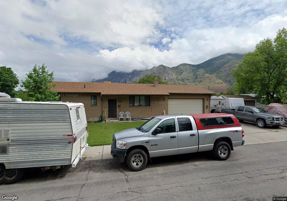
777 Chase Ln Springville, UT 84663
Estimated Value: $435,000 - $486,432
4
Beds
2
Baths
2,288
Sq Ft
$205/Sq Ft
Est. Value
About This Home
This home is located at 777 Chase Ln, Springville, UT 84663 and is currently estimated at $469,358, approximately $205 per square foot. 777 Chase Ln is a home located in Utah County with nearby schools including Brookside School, Springville Junior High School, and Springville High School.
Ownership History
Date
Name
Owned For
Owner Type
Purchase Details
Closed on
May 2, 2019
Sold by
Mcbroom Elaine
Bought by
Mcbroom Elaine and Sundblom Marilyn
Current Estimated Value
Purchase Details
Closed on
Oct 21, 2016
Sold by
Llxc Elaine Mcbroom
Bought by
Mcbroom Elaine
Purchase Details
Closed on
May 21, 2016
Sold by
Mcbroom Elaine
Bought by
Mcbroom Elain and Hempel Steven W
Purchase Details
Closed on
Apr 1, 2014
Sold by
Hunter Janice H
Bought by
Hunter Janice Ann
Purchase Details
Closed on
Apr 26, 2007
Sold by
Mcbroom Elaine
Bought by
Chase Lane Trust and Of One Heart Llc
Purchase Details
Closed on
Aug 11, 2006
Sold by
Chamberlain Daniel C and Chamberlain Michelle M
Bought by
Mcbroom Elaine
Home Financials for this Owner
Home Financials are based on the most recent Mortgage that was taken out on this home.
Original Mortgage
$157,750
Interest Rate
6.76%
Mortgage Type
Purchase Money Mortgage
Create a Home Valuation Report for This Property
The Home Valuation Report is an in-depth analysis detailing your home's value as well as a comparison with similar homes in the area
Home Values in the Area
Average Home Value in this Area
Purchase History
| Date | Buyer | Sale Price | Title Company |
|---|---|---|---|
| Mcbroom Elaine | -- | None Available | |
| Mcbroom Elaine | -- | Accommodation | |
| Mcbroom Elain | -- | None Available | |
| Hunter Janice Ann | -- | None Available | |
| Chase Lane Trust | -- | None Available | |
| Mcbroom Elaine | -- | Meridian Title Company |
Source: Public Records
Mortgage History
| Date | Status | Borrower | Loan Amount |
|---|---|---|---|
| Previous Owner | Mcbroom Elaine | $157,750 |
Source: Public Records
Tax History Compared to Growth
Tax History
| Year | Tax Paid | Tax Assessment Tax Assessment Total Assessment is a certain percentage of the fair market value that is determined by local assessors to be the total taxable value of land and additions on the property. | Land | Improvement |
|---|---|---|---|---|
| 2025 | $2,307 | $459,400 | $138,500 | $320,900 |
| 2024 | $2,307 | $236,335 | $0 | $0 |
| 2023 | $2,291 | $234,960 | $0 | $0 |
| 2022 | $2,201 | $221,650 | $0 | $0 |
| 2021 | $1,953 | $306,100 | $99,600 | $206,500 |
| 2020 | $1,778 | $270,300 | $73,800 | $196,500 |
| 2019 | $1,667 | $258,000 | $61,500 | $196,500 |
| 2018 | $1,599 | $236,100 | $57,200 | $178,900 |
| 2017 | $1,516 | $118,855 | $0 | $0 |
| 2016 | $1,445 | $111,045 | $0 | $0 |
| 2015 | $1,344 | $105,655 | $0 | $0 |
| 2014 | $1,291 | $100,760 | $0 | $0 |
Source: Public Records
Map
Nearby Homes
- 802 S Brookside Dr
- 639 E 100 S
- 1062 E 350 S
- 649 Swenson Ave Unit 4
- 639 Swenson Ave Unit 4
- 509 Brookside Dr
- 1185 Hillcrest Dr
- 2554 E 350 S Unit 4
- 177 S Canyon Ave
- 115 N 750 E
- 445 Swenson Ave
- 511 S 300 E Unit 2
- 393 E Center St
- 633 E 800 St S
- 337 E 600 S
- 615 E 800 St S
- 170 S 1300 E
- 581 E 800 St S
- 630 E 800 St S
- 211 N 650 E