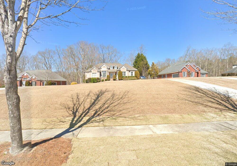
777 Hayes Ct Unit 6 Atlanta, GA 30349
Estimated Value: $406,000 - $523,000
4
Beds
3
Baths
2,508
Sq Ft
$178/Sq Ft
Est. Value
About This Home
This home is located at 777 Hayes Ct Unit 6, Atlanta, GA 30349 and is currently estimated at $447,308, approximately $178 per square foot. 777 Hayes Ct Unit 6 is a home located in Fulton County with nearby schools including Cliftondale Elementary School, Renaissance Middle School, and Langston Hughes High School.
Ownership History
Date
Name
Owned For
Owner Type
Purchase Details
Closed on
Dec 16, 2003
Sold by
Nesbitt Lord & Co
Bought by
Goza Lora W and Goza Gwen
Current Estimated Value
Home Financials for this Owner
Home Financials are based on the most recent Mortgage that was taken out on this home.
Original Mortgage
$259,920
Outstanding Balance
$119,937
Interest Rate
5.82%
Mortgage Type
New Conventional
Estimated Equity
$327,371
Create a Home Valuation Report for This Property
The Home Valuation Report is an in-depth analysis detailing your home's value as well as a comparison with similar homes in the area
Home Values in the Area
Average Home Value in this Area
Purchase History
| Date | Buyer | Sale Price | Title Company |
|---|---|---|---|
| Goza Lora W | $324,900 | -- |
Source: Public Records
Mortgage History
| Date | Status | Borrower | Loan Amount |
|---|---|---|---|
| Open | Goza Lora W | $259,920 |
Source: Public Records
Tax History Compared to Growth
Tax History
| Year | Tax Paid | Tax Assessment Tax Assessment Total Assessment is a certain percentage of the fair market value that is determined by local assessors to be the total taxable value of land and additions on the property. | Land | Improvement |
|---|---|---|---|---|
| 2025 | $2,987 | $164,840 | $45,280 | $119,560 |
| 2023 | $4,653 | $164,840 | $45,280 | $119,560 |
| 2022 | $2,887 | $125,080 | $24,040 | $101,040 |
| 2021 | $2,854 | $121,480 | $23,360 | $98,120 |
| 2020 | $2,869 | $120,040 | $23,080 | $96,960 |
| 2019 | $3,236 | $117,440 | $27,080 | $90,360 |
| 2018 | $3,408 | $102,920 | $16,800 | $86,120 |
| 2017 | $2,310 | $73,760 | $15,400 | $58,360 |
| 2016 | $2,309 | $73,760 | $15,400 | $58,360 |
| 2015 | $2,316 | $73,760 | $15,400 | $58,360 |
| 2014 | $2,162 | $67,880 | $15,240 | $52,640 |
Source: Public Records
Map
Nearby Homes
- 7425 Thoreau Cir
- 775 Ambrose Ln
- 640 Fitzgerald Place
- 2980 Oxford Rd
- 0 W Stubbs Rd Unit (11.4 ACRES)
- 0 W Stubbs Rd Unit 7487198
- 2970 Oxford Rd
- 7656 Cole Ln
- 7648 Cole Ln Unit 1C
- 7250 Old Chapel
- 260 Redding Ridge
- 450 Pinevale Ct
- 440 Pinevale Ct
- 7847 Wrotham Cir
- 275 Redding Ridge
- 7198 Glaspie Way
- 3198 Redwood Run
- 733 Miller Run
- 781 Hayes Ct Unit 6
- 773 Hayes Ct Unit 6
- 0 Hayes Ct Unit 7034079
- 0 Hayes Ct Unit 7278957
- 0 Hayes Ct Unit 3257407
- 0 Hayes Ct Unit 8430713
- 0 Hayes Ct Unit 8226005
- 0 Hayes Ct
- 785 Hayes Ct
- 769 Hayes Ct Unit 6
- 769 Hayes Ct
- 780 Hayes Ct Unit 6
- 3422 Concord Loop
- 789 Hayes Ct
- 3418 Concord Loop Unit 6
- 784 Hayes Ct
- 765 Hayes Ct
- 3414 Concord Loop Unit 6
- 3414 Concord Loop
- 795 Hayes Ct