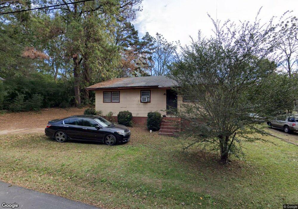
777 Wayne St Elberton, GA 30635
Estimated Value: $51,548 - $55,000
--
Bed
1
Bath
945
Sq Ft
$57/Sq Ft
Est. Value
About This Home
This home is located at 777 Wayne St, Elberton, GA 30635 and is currently estimated at $53,637, approximately $56 per square foot. 777 Wayne St is a home located in Elbert County with nearby schools including Elbert County Elementary School, Elbert County Primary School, and Elbert County Middle School.
Ownership History
Date
Name
Owned For
Owner Type
Purchase Details
Closed on
Mar 28, 2024
Sold by
Fleming Antwone
Bought by
Benard Thelma E
Current Estimated Value
Home Financials for this Owner
Home Financials are based on the most recent Mortgage that was taken out on this home.
Original Mortgage
$44,000
Interest Rate
6.79%
Mortgage Type
New Conventional
Purchase Details
Closed on
Nov 1, 1978
Purchase Details
Closed on
Aug 1, 1975
Purchase Details
Closed on
Jan 1, 1962
Purchase Details
Closed on
Jan 1, 1959
Create a Home Valuation Report for This Property
The Home Valuation Report is an in-depth analysis detailing your home's value as well as a comparison with similar homes in the area
Home Values in the Area
Average Home Value in this Area
Purchase History
| Date | Buyer | Sale Price | Title Company |
|---|---|---|---|
| Benard Thelma E | $44,000 | -- | |
| -- | $14,500 | -- | |
| -- | -- | -- | |
| -- | -- | -- | |
| -- | $300 | -- |
Source: Public Records
Mortgage History
| Date | Status | Borrower | Loan Amount |
|---|---|---|---|
| Previous Owner | Benard Thelma E | $44,000 |
Source: Public Records
Tax History Compared to Growth
Tax History
| Year | Tax Paid | Tax Assessment Tax Assessment Total Assessment is a certain percentage of the fair market value that is determined by local assessors to be the total taxable value of land and additions on the property. | Land | Improvement |
|---|---|---|---|---|
| 2024 | $360 | $14,617 | $2,020 | $12,597 |
| 2023 | $421 | $14,617 | $2,020 | $12,597 |
| 2022 | $429 | $17,456 | $2,020 | $15,436 |
| 2021 | $433 | $17,456 | $2,020 | $15,436 |
| 2020 | $363 | $13,145 | $2,020 | $11,125 |
| 2019 | $374 | $13,145 | $2,020 | $11,125 |
| 2018 | $382 | $13,145 | $2,020 | $11,125 |
| 2017 | $317 | $10,082 | $2,020 | $8,062 |
| 2016 | $296 | $10,082 | $2,020 | $8,062 |
| 2015 | -- | $10,081 | $2,020 | $8,062 |
| 2014 | -- | $10,081 | $2,020 | $8,062 |
| 2013 | -- | $10,081 | $2,020 | $8,062 |
Source: Public Records
Map
Nearby Homes
- 381 College Ave
- 0 Pulliam St Unit 7659662
- 0 Pulliam St Unit 10616872
- 243 W Tate St
- 136 Forest Ave
- 170 Lake Forest Dr
- 89 College Ave
- 270 Dogwood Ln
- 143 Lake Forest Cir
- 108 Brookhaven Cir
- 62 Oak St
- 118 Oak Dr
- 1133 Kathwood Dr
- 0 Oak Dr Unit 7643600
- 0 Oak Dr Unit 10598083
- 345 N Oliver St
- 1020 Hickory Dr
- 968 Ext Elbert St
- 346 N Oliver St
- 00 Athens Hwy
- 775 Wayne St
- 779 Wayne St
- 610 Pulliam St
- 608 Pulliam St
- 771 Wayne St
- 614 Pulliam St
- 355 College Ave
- 609 Pulliam St
- 611 Pulliam St
- 351 College Ave
- 634 Mclendon St
- 628 Pulliam St
- 815 Mercer Dr
- 343 College Ave
- 0 Mcginty Unit 7368315
- 630 Pulliam St
- 623 Pulliam St
- 341,343+ College Ave
- 341,343,+ College Ave
- 636 Mclendon St