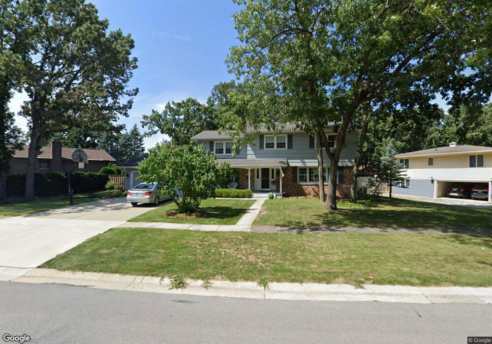
777 Williams Dr Crown Point, IN 46307
Estimated Value: $327,104 - $349,000
4
Beds
3
Baths
2,379
Sq Ft
$144/Sq Ft
Est. Value
About This Home
This home is located at 777 Williams Dr, Crown Point, IN 46307 and is currently estimated at $342,276, approximately $143 per square foot. 777 Williams Dr is a home located in Lake County with nearby schools including Solon Robinson Elementary School, Robert Taft Middle School, and Crown Point High School.
Ownership History
Date
Name
Owned For
Owner Type
Purchase Details
Closed on
Sep 18, 2020
Sold by
Morrison Michael H and Morrison Debora A
Bought by
Morrison Michael H and Morrison Debra A
Current Estimated Value
Create a Home Valuation Report for This Property
The Home Valuation Report is an in-depth analysis detailing your home's value as well as a comparison with similar homes in the area
Home Values in the Area
Average Home Value in this Area
Purchase History
| Date | Buyer | Sale Price | Title Company |
|---|---|---|---|
| Morrison Michael H | -- | None Available |
Source: Public Records
Tax History
| Year | Tax Paid | Tax Assessment Tax Assessment Total Assessment is a certain percentage of the fair market value that is determined by local assessors to be the total taxable value of land and additions on the property. | Land | Improvement |
|---|---|---|---|---|
| 2025 | $2,800 | $281,900 | $34,600 | $247,300 |
| 2024 | $6,882 | $267,900 | $34,600 | $233,300 |
| 2023 | $2,784 | $250,400 | $34,600 | $215,800 |
| 2022 | $2,784 | $250,900 | $34,600 | $216,300 |
| 2021 | $2,834 | $255,300 | $23,200 | $232,100 |
| 2020 | $2,687 | $242,400 | $23,200 | $219,200 |
| 2019 | $2,732 | $242,400 | $23,200 | $219,200 |
| 2018 | $3,068 | $232,100 | $23,200 | $208,900 |
| 2017 | $3,028 | $227,500 | $23,200 | $204,300 |
| 2016 | $2,917 | $217,900 | $23,200 | $194,700 |
| 2014 | $2,521 | $205,700 | $23,200 | $182,500 |
| 2013 | $2,437 | $198,700 | $23,200 | $175,500 |
Source: Public Records
Map
Nearby Homes
- 780 Williams Ct
- 217 Crestview Ln
- 903 S Main St
- 221 E Elizabeth Dr
- 109 Elmwood Place
- 741 Pettibone St
- 254 E Greenwood Ave
- 802 Hayfield Dr
- 1002 Gordon Ct
- 319 Michele Ave
- 815 Hayfield Dr
- 437 Fairview Ave
- 430 S East St
- 622 E Brookside Dr
- 412 W South St
- 804 Shannon Dr
- 964 Ryan Ct
- 629 W South St
- 3709 W 121st Ave
- 943 Pawnee Dr
- 767 Williams Dr
- 785 Williams Dr
- 774 S Court St
- 784 Williams Dr
- 766 S Court St
- 765 Williams Dr
- 789 Williams Dr
- 766 Williams Dr
- 788 Williams Dr
- 792 Williams Dr
- 761 Williams Dr
- 796 Williams Dr
- 760 Williams Dr
- 756 Williams Dr
- 750 S Court St
- 770 Williams Ct
- 798 Williams Dr
- 750 Williams Dr
- 205 Grace Ct
- 236 Grace Ct
Your Personal Tour Guide
Ask me questions while you tour the home.