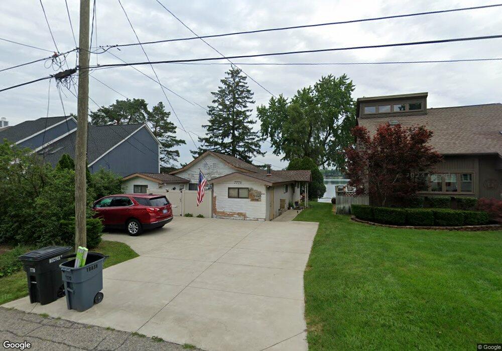
7770 Detroit Blvd West Bloomfield, MI 48323
Estimated Value: $302,000 - $412,000
1
Bed
1
Bath
1,319
Sq Ft
$269/Sq Ft
Est. Value
About This Home
This home is located at 7770 Detroit Blvd, West Bloomfield, MI 48323 and is currently estimated at $354,667, approximately $268 per square foot. 7770 Detroit Blvd is a home located in Oakland County with nearby schools including Clifford H. Smart Middle School, Walled Lake Northern High School, and St. Matthew Lutheran School.
Ownership History
Date
Name
Owned For
Owner Type
Purchase Details
Closed on
Apr 3, 2025
Sold by
Northey Thomas A and White Barbara M
Bought by
Revocable Living Trust Of Northey/White
Current Estimated Value
Purchase Details
Closed on
Nov 13, 2021
Sold by
Northey Thomas A
Bought by
Northey Thomas A and White Barbara M
Purchase Details
Closed on
Jun 3, 1998
Sold by
Northey Thomas Arthur
Bought by
Northey Thomas Arthur
Create a Home Valuation Report for This Property
The Home Valuation Report is an in-depth analysis detailing your home's value as well as a comparison with similar homes in the area
Home Values in the Area
Average Home Value in this Area
Purchase History
| Date | Buyer | Sale Price | Title Company |
|---|---|---|---|
| Revocable Living Trust Of Northey/White | -- | None Listed On Document | |
| Revocable Living Trust Of Northey/White | -- | None Listed On Document | |
| Northey Thomas A | -- | None Listed On Document | |
| Northey Thomas Arthur | -- | -- |
Source: Public Records
Tax History Compared to Growth
Tax History
| Year | Tax Paid | Tax Assessment Tax Assessment Total Assessment is a certain percentage of the fair market value that is determined by local assessors to be the total taxable value of land and additions on the property. | Land | Improvement |
|---|---|---|---|---|
| 2024 | $2,143 | $155,580 | $0 | $0 |
| 2022 | $2,020 | $140,010 | $97,610 | $42,400 |
| 2021 | $3,473 | $136,640 | $0 | $0 |
| 2020 | $1,997 | $134,690 | $97,610 | $37,080 |
| 2018 | $3,358 | $125,400 | $88,730 | $36,670 |
| 2015 | -- | $97,780 | $0 | $0 |
| 2014 | -- | $89,910 | $0 | $0 |
| 2011 | -- | $85,210 | $0 | $0 |
Source: Public Records
Map
Nearby Homes
- 7969 Richardson Rd
- 7369 Sweetbriar
- 7381 Crestmore St
- 7337 Richardson Rd
- 4212 Greendale Ave
- 4245 Bunker Ave
- 0000 Dickert St
- 4335 Crestdale Ave
- 7146 Arrowood Dr
- 3291 Melmoor St
- 3280 Chambourne St
- 6978 Colony Dr
- 8330 Dickert St
- 7359 Woodlore Dr
- 8223 Arlis St
- 3115 Westacres Dr
- 6903 Dandison Blvd
- Richfield Plan at Rosewood - Detached Ranch Condos
- 8304 Arlis St
- 7543 Greenway Ln
- 7776 Detroit Blvd
- 7760 Detroit Blvd
- 7750 Detroit Blvd
- 7790 Detroit Blvd
- 0 Detroit Blvd S Unit 4972681
- 0 Detroit Blvd S Unit 4662945
- 000 Detroit Blvd S
- 0 Detroit Blvd S Unit G31211062
- 0 Detroit Blvd S Unit R214093382
- 7755 Detroit Blvd
- 7730 Detroit Blvd
- 7763 Detroit Blvd
- 7800 Detroit Blvd
- 7771 Detroit Blvd
- 7781 Detroit Blvd
- 7806 Detroit Blvd
- 7821 Detroit Blvd
- 7727 Detroit Blvd
- 7720 Detroit Blvd
- 3925 Beach Terrace