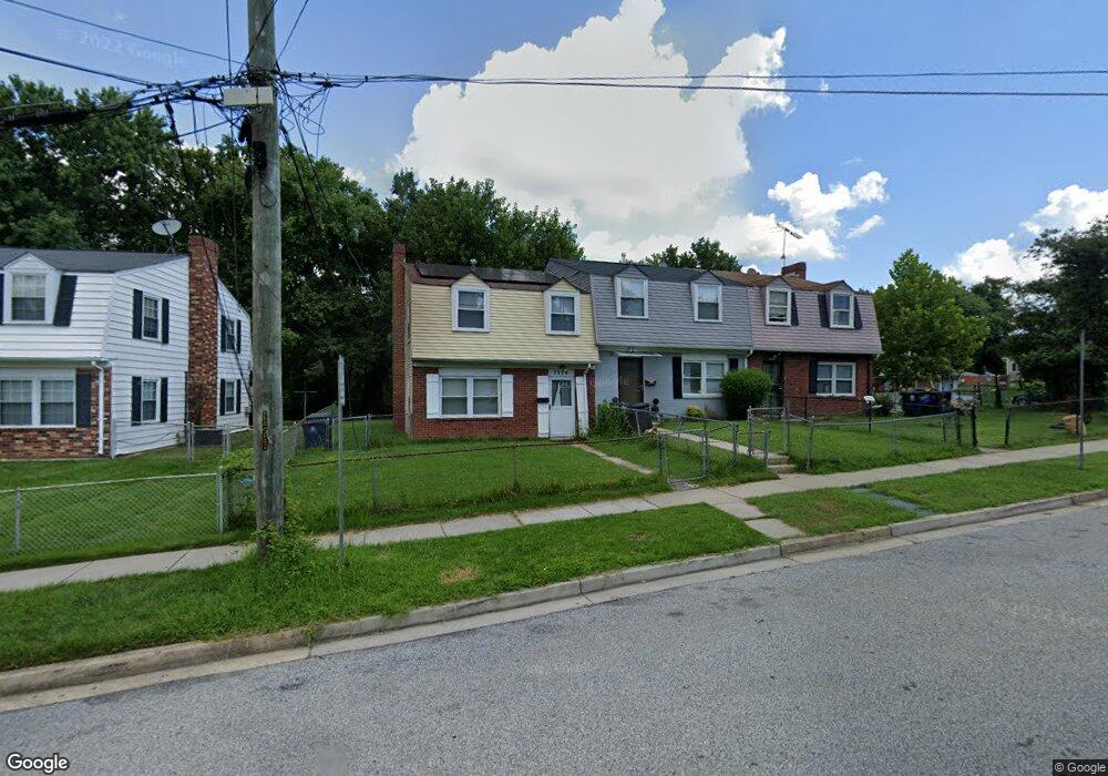
7774 Burnside Rd Hyattsville, MD 20785
Greater Landover NeighborhoodEstimated Value: $207,000 - $360,000
--
Bed
2
Baths
1,320
Sq Ft
$218/Sq Ft
Est. Value
About This Home
This home is located at 7774 Burnside Rd, Hyattsville, MD 20785 and is currently estimated at $287,345, approximately $217 per square foot. 7774 Burnside Rd is a home located in Prince George's County with nearby schools including William Paca Elementary School, Kenmoor Middle School, and Charles Herbert Flowers High School.
Ownership History
Date
Name
Owned For
Owner Type
Purchase Details
Closed on
Sep 26, 2005
Sold by
Norvell Cynthia M
Bought by
Hassan David
Current Estimated Value
Home Financials for this Owner
Home Financials are based on the most recent Mortgage that was taken out on this home.
Original Mortgage
$104,000
Outstanding Balance
$55,605
Interest Rate
5.84%
Mortgage Type
New Conventional
Estimated Equity
$231,740
Purchase Details
Closed on
Apr 20, 1993
Sold by
Moore Morris R
Bought by
Norvell Cynthia M
Purchase Details
Closed on
Apr 9, 1991
Sold by
Russell Rudy H
Bought by
Moore Morris R
Create a Home Valuation Report for This Property
The Home Valuation Report is an in-depth analysis detailing your home's value as well as a comparison with similar homes in the area
Home Values in the Area
Average Home Value in this Area
Purchase History
| Date | Buyer | Sale Price | Title Company |
|---|---|---|---|
| Hassan David | $130,000 | -- | |
| Norvell Cynthia M | $78,000 | -- | |
| Moore Morris R | $39,500 | -- |
Source: Public Records
Mortgage History
| Date | Status | Borrower | Loan Amount |
|---|---|---|---|
| Open | Hassan David | $104,000 | |
| Closed | Hassan David | $26,000 |
Source: Public Records
Tax History Compared to Growth
Tax History
| Year | Tax Paid | Tax Assessment Tax Assessment Total Assessment is a certain percentage of the fair market value that is determined by local assessors to be the total taxable value of land and additions on the property. | Land | Improvement |
|---|---|---|---|---|
| 2025 | $3,852 | $245,833 | -- | -- |
| 2024 | $3,852 | $232,967 | $0 | $0 |
| 2023 | $3,660 | $220,100 | $45,000 | $175,100 |
| 2022 | $3,490 | $208,667 | $0 | $0 |
| 2021 | $3,320 | $197,233 | $0 | $0 |
| 2020 | $3,150 | $185,800 | $45,000 | $140,800 |
| 2019 | $2,842 | $165,067 | $0 | $0 |
| 2018 | $2,534 | $144,333 | $0 | $0 |
| 2017 | $2,226 | $123,600 | $0 | $0 |
| 2016 | -- | $119,700 | $0 | $0 |
| 2015 | $3,165 | $115,800 | $0 | $0 |
| 2014 | $3,165 | $111,900 | $0 | $0 |
Source: Public Records
Map
Nearby Homes
- 1909 Palmer Park Rd
- 7850 Burnside Rd
- 7708 Bender Rd
- 2010 Ray Leonard Rd
- 1710 Allendale Place
- 8001 Barlowe Rd
- 1911 Ray Leonard Rd
- 7905 Greenleaf Rd
- 1859 Dutch Village Dr Unit J-287
- 1748 Dutch Village Dr Unit O-377
- 1842 Dutch Village Dr Unit R-264
- 7722 Penbrook Place
- 1760 Dutch Village Dr
- 8135 Allendale Dr
- 7600 Normandy Rd
- 1925 Dutch Village Dr Unit I-242
- 1909 Dutch Village Dr Unit I-234
- 1926 Dutch Village Dr Unit T-229
- 1780 Village Green Dr Unit C-68
- 1852 Village Green Dr Unit E-122
- 7776 Burnside Rd
- 7772 Burnside Rd
- 7770 Burnside Rd
- 7778 Burnside Rd
- 1910 Palmer Park Rd
- 7768 Burnside Rd
- 1908 Palmer Park Rd
- 7766 Burnside Rd
- 1822 Palmer Park Rd
- 7764 Burnside Rd
- 1912 Palmer Park Rd
- 7762 Burnside Rd
- 1820 Palmer Park Rd
- 7771 Burnside Rd
- 1903 Palmer Park Rd
- 7769 Burnside Rd
- 7760 Burnside Rd
- 1818 Palmer Park Rd
- 1914 Palmer Park Rd
- 7767 Burnside Rd