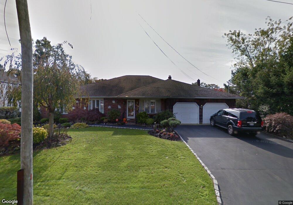
778 Carlton Rd West Babylon, NY 11704
Estimated Value: $693,417 - $861,000
--
Bed
--
Bath
2,578
Sq Ft
$297/Sq Ft
Est. Value
About This Home
This home is located at 778 Carlton Rd, West Babylon, NY 11704 and is currently estimated at $766,104, approximately $297 per square foot. 778 Carlton Rd is a home located in Suffolk County.
Ownership History
Date
Name
Owned For
Owner Type
Purchase Details
Closed on
Aug 10, 2007
Sold by
Kolman Robert
Bought by
Fulton Theodore T
Current Estimated Value
Purchase Details
Closed on
Mar 19, 2004
Sold by
Pititto Thomas R
Bought by
Kolman Robert and Kolman Dianna
Home Financials for this Owner
Home Financials are based on the most recent Mortgage that was taken out on this home.
Original Mortgage
$328,000
Interest Rate
5.4%
Mortgage Type
Purchase Money Mortgage
Create a Home Valuation Report for This Property
The Home Valuation Report is an in-depth analysis detailing your home's value as well as a comparison with similar homes in the area
Home Values in the Area
Average Home Value in this Area
Purchase History
| Date | Buyer | Sale Price | Title Company |
|---|---|---|---|
| Fulton Theodore T | $540,000 | Richard H Schaffer | |
| Kolman Robert | $410,000 | Fidelity National Title Insu |
Source: Public Records
Mortgage History
| Date | Status | Borrower | Loan Amount |
|---|---|---|---|
| Previous Owner | Kolman Robert | $328,000 |
Source: Public Records
Tax History Compared to Growth
Tax History
| Year | Tax Paid | Tax Assessment Tax Assessment Total Assessment is a certain percentage of the fair market value that is determined by local assessors to be the total taxable value of land and additions on the property. | Land | Improvement |
|---|---|---|---|---|
| 2024 | $15,753 | $4,290 | $400 | $3,890 |
| 2023 | $15,753 | $4,290 | $400 | $3,890 |
| 2022 | $12,471 | $4,290 | $400 | $3,890 |
| 2021 | $12,471 | $4,290 | $400 | $3,890 |
| 2020 | $14,107 | $4,290 | $400 | $3,890 |
| 2019 | $14,107 | $0 | $0 | $0 |
| 2018 | $12,367 | $4,290 | $400 | $3,890 |
| 2017 | $12,367 | $4,290 | $400 | $3,890 |
| 2016 | $12,342 | $4,290 | $400 | $3,890 |
| 2015 | -- | $4,290 | $400 | $3,890 |
| 2014 | -- | $4,290 | $400 | $3,890 |
Source: Public Records
Map
Nearby Homes
- 792 Glendale Rd
- 248 Arnold Ave
- 825 Weber Ave
- 404 N Putnam Ave
- 323 Grand Ave
- 1 Puritan Place
- 436 N Ontario Ave
- 475 N Putnam Ave
- 842 Brook St
- 417 N Monroe Ave
- 16 Della Dr
- 34 Karen St
- 457 N Monroe Ave
- 465 N Monroe Ave
- 669 East Dr
- 6 Glenda Dr
- 166 & 170 Woodrow Pkwy
- 115 Old Farmingdale Rd
- 557 N Kings Ave
- 27 E Neck Ct