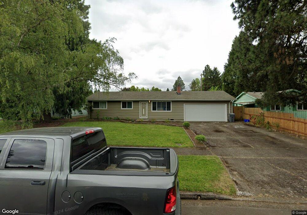
778 Hatton Ave Eugene, OR 97404
River Road NeighborhoodEstimated Value: $369,000 - $419,000
3
Beds
2
Baths
1,438
Sq Ft
$274/Sq Ft
Est. Value
About This Home
This home is located at 778 Hatton Ave, Eugene, OR 97404 and is currently estimated at $394,480, approximately $274 per square foot. 778 Hatton Ave is a home located in Lane County with nearby schools including Howard Elementary School, Kelly Middle School, and North Eugene High School.
Ownership History
Date
Name
Owned For
Owner Type
Purchase Details
Closed on
Oct 7, 2016
Sold by
Snow Mountain Resources Llc
Bought by
Ayers Alan J and Ayers Arthur J
Current Estimated Value
Home Financials for this Owner
Home Financials are based on the most recent Mortgage that was taken out on this home.
Original Mortgage
$234,081
Outstanding Balance
$186,103
Interest Rate
3.37%
Mortgage Type
FHA
Estimated Equity
$208,377
Purchase Details
Closed on
May 16, 2016
Sold by
Mcdougal Richard
Bought by
Snow Mountain Resources Llc
Purchase Details
Closed on
Feb 17, 2016
Sold by
Deutsche Bank National Trust Company
Bought by
Mcdougal Richard
Purchase Details
Closed on
Dec 3, 2015
Sold by
Pelfrey Jennifer
Bought by
Deutsche Bank National Trust Company
Purchase Details
Closed on
Mar 24, 2006
Sold by
Donovan Wendy M
Bought by
Pelfrey Jennifer
Home Financials for this Owner
Home Financials are based on the most recent Mortgage that was taken out on this home.
Original Mortgage
$38,000
Interest Rate
6.18%
Mortgage Type
Stand Alone Second
Purchase Details
Closed on
Jun 1, 2005
Sold by
Brown Bert E and Brown Nancy S
Bought by
Donovan Wendy M
Home Financials for this Owner
Home Financials are based on the most recent Mortgage that was taken out on this home.
Original Mortgage
$128,000
Interest Rate
6.99%
Mortgage Type
Fannie Mae Freddie Mac
Purchase Details
Closed on
Jun 4, 2002
Sold by
Long Charles K and Long Rhudean G
Bought by
Brown Bert E and Brown Nancy S
Home Financials for this Owner
Home Financials are based on the most recent Mortgage that was taken out on this home.
Original Mortgage
$135,978
Interest Rate
6.83%
Mortgage Type
FHA
Purchase Details
Closed on
Dec 19, 1997
Sold by
Hafemeister David J and Hafemeister Ruth N
Bought by
Long Charles K and Long Rhudean G
Home Financials for this Owner
Home Financials are based on the most recent Mortgage that was taken out on this home.
Original Mortgage
$102,500
Interest Rate
7.23%
Create a Home Valuation Report for This Property
The Home Valuation Report is an in-depth analysis detailing your home's value as well as a comparison with similar homes in the area
Home Values in the Area
Average Home Value in this Area
Purchase History
| Date | Buyer | Sale Price | Title Company |
|---|---|---|---|
| Ayers Alan J | $238,400 | Fidelity Natl Title Co Of Or | |
| Snow Mountain Resources Llc | -- | Accommodation | |
| Mcdougal Richard | $142,500 | Fidelity Natl Title Of Or | |
| Deutsche Bank National Trust Company | $148,750 | None Available | |
| Pelfrey Jennifer | $190,000 | Pacific Northwest Title Of L | |
| Donovan Wendy M | $160,000 | American Title Group | |
| Brown Bert E | $137,900 | Western Title & Escrow Compa | |
| Long Charles K | $113,900 | Key Title Company |
Source: Public Records
Mortgage History
| Date | Status | Borrower | Loan Amount |
|---|---|---|---|
| Open | Ayers Alan J | $234,081 | |
| Previous Owner | Pelfrey Jennifer | $38,000 | |
| Previous Owner | Pelfrey Jennifer | $152,000 | |
| Previous Owner | Donovan Wendy M | $128,000 | |
| Previous Owner | Brown Bert E | $135,978 | |
| Previous Owner | Long Charles K | $102,500 | |
| Closed | Donovan Wendy M | $32,000 |
Source: Public Records
Tax History
| Year | Tax Paid | Tax Assessment Tax Assessment Total Assessment is a certain percentage of the fair market value that is determined by local assessors to be the total taxable value of land and additions on the property. | Land | Improvement |
|---|---|---|---|---|
| 2025 | $2,983 | $177,574 | -- | -- |
| 2024 | $2,951 | $172,402 | -- | -- |
| 2023 | $2,951 | $167,381 | $0 | $0 |
| 2022 | $2,775 | $162,506 | $0 | $0 |
| 2021 | $2,581 | $157,773 | $0 | $0 |
| 2020 | $2,599 | $153,178 | $0 | $0 |
| 2019 | $2,508 | $148,717 | $0 | $0 |
| 2018 | $2,339 | $140,181 | $0 | $0 |
| 2017 | $2,218 | $140,181 | $0 | $0 |
| 2016 | $2,088 | $136,098 | $0 | $0 |
| 2015 | $2,015 | $132,134 | $0 | $0 |
| 2014 | $2,003 | $128,285 | $0 | $0 |
Source: Public Records
Map
Nearby Homes
- 1566 Maywood Ave
- 1314 Dalton Dr
- 1682 Hemlock St
- 788 Cornwall Ave
- 1555 Escalante St
- 1755 Brentwood Ave
- 1164 Veronica Ln
- 1010 N Park Ave
- 1010 Horn Ln
- 1633 Zoe Ave
- 389 Maxwell Rd
- 1360 Andersen Ln
- 2002 Kintyre St
- 1483 Barton St
- 1487 Barton St
- 1420 Evergreen Dr
- 1880 Manihi Dr
- 895 Glory Dr
- 1307 Bramblewood Ln
- 1685 Evergreen Dr
- 766 Hatton Ave
- 775 Barrett Ave
- 787 Barrett Ave
- 802 Hatton Ave
- 763 Barrett Ave
- 754 Hatton Ave
- 799 Barrett Ave
- 777 Hatton Ave
- 789 Hatton Ave
- 765 Hatton Ave
- 751 Barrett Ave
- 814 Hatton Ave
- 742 Hatton Ave
- 801 Hatton Ave
- 811 Barrett Ave
- 753 Hatton Ave
- 739 Barrett Ave
- 780 Barrett Ave
- 813 Hatton Ave
- 792 Barrett Ave
Your Personal Tour Guide
Ask me questions while you tour the home.