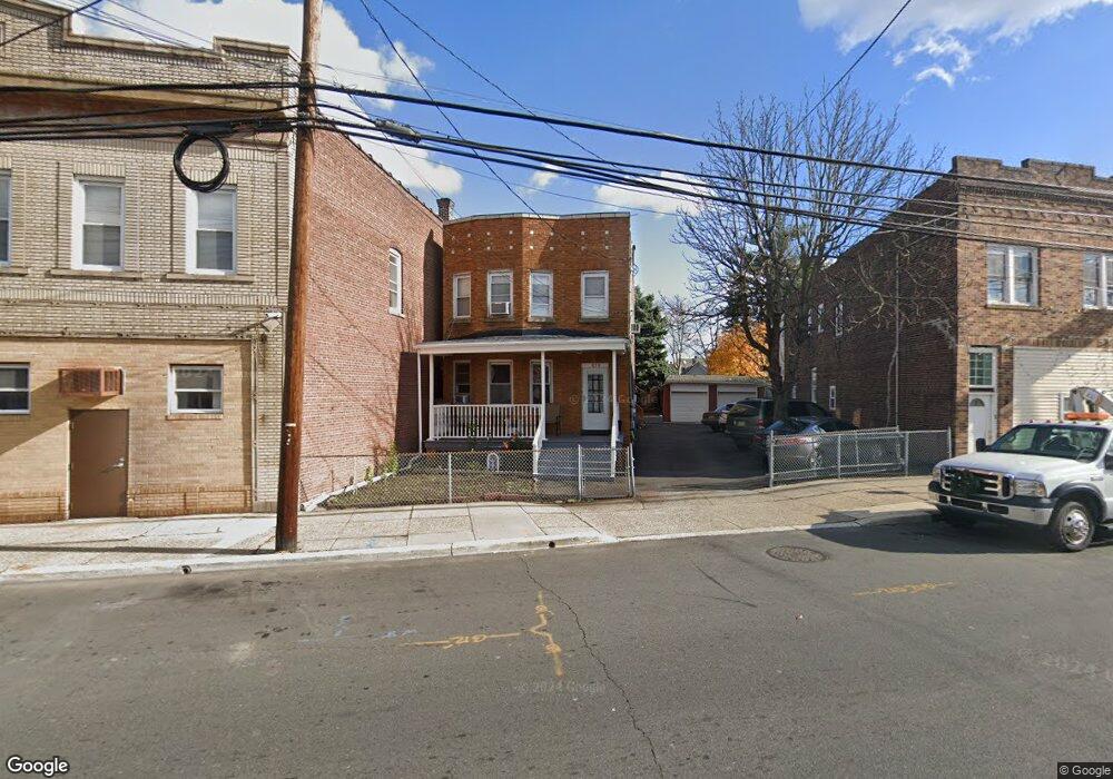
778 State St Perth Amboy, NJ 08861
Hall Avenue NeighborhoodEstimated Value: $501,246 - $629,000
--
Bed
--
Bath
1,796
Sq Ft
$312/Sq Ft
Est. Value
About This Home
This home is located at 778 State St, Perth Amboy, NJ 08861 and is currently estimated at $560,062, approximately $311 per square foot. 778 State St is a home located in Middlesex County with nearby schools including Perth Amboy High School, Academy for Urban Leadership Charter School, and Assumption Catholic School.
Ownership History
Date
Name
Owned For
Owner Type
Purchase Details
Closed on
Aug 15, 2000
Sold by
Gurneak Joseph
Bought by
Rodriguez Maria Nela Valdez
Current Estimated Value
Home Financials for this Owner
Home Financials are based on the most recent Mortgage that was taken out on this home.
Original Mortgage
$101,650
Outstanding Balance
$36,545
Interest Rate
8.1%
Estimated Equity
$523,517
Create a Home Valuation Report for This Property
The Home Valuation Report is an in-depth analysis detailing your home's value as well as a comparison with similar homes in the area
Home Values in the Area
Average Home Value in this Area
Purchase History
| Date | Buyer | Sale Price | Title Company |
|---|---|---|---|
| Rodriguez Maria Nela Valdez | $107,000 | -- |
Source: Public Records
Mortgage History
| Date | Status | Borrower | Loan Amount |
|---|---|---|---|
| Open | Rodriguez Maria Nela Valdez | $101,650 |
Source: Public Records
Tax History Compared to Growth
Tax History
| Year | Tax Paid | Tax Assessment Tax Assessment Total Assessment is a certain percentage of the fair market value that is determined by local assessors to be the total taxable value of land and additions on the property. | Land | Improvement |
|---|---|---|---|---|
| 2025 | $8,505 | $281,900 | $79,000 | $202,900 |
| 2024 | $7,446 | $281,900 | $79,000 | $202,900 |
| 2023 | $7,446 | $247,300 | $66,100 | $181,200 |
| 2022 | $7,357 | $247,300 | $66,100 | $181,200 |
| 2021 | $7,367 | $247,300 | $66,100 | $181,200 |
| 2020 | $7,365 | $247,300 | $66,100 | $181,200 |
| 2019 | $7,392 | $247,300 | $66,100 | $181,200 |
| 2018 | $7,328 | $247,300 | $66,100 | $181,200 |
| 2017 | $7,313 | $247,300 | $66,100 | $181,200 |
| 2016 | $7,122 | $247,300 | $66,100 | $181,200 |
| 2015 | $7,172 | $247,300 | $66,100 | $181,200 |
| 2014 | $7,216 | $247,300 | $66,100 | $181,200 |
Source: Public Records
Map
Nearby Homes
- 747 Catherine St
- 212 Hall Ave
- 360 Alpine St
- 676 Johnstone St
- 270 Hall Ave
- 794 Harbortown Blvd
- 381 Keene St
- 646 Johnstone St
- 500 Great Beds Ct
- 519 W Side Ave
- 434 Lawrence St Unit 19
- 142 William St
- 522 Johnstone St
- 435 Ashley St
- 465 Mechanic St
- 359 Neville St
- 649 Cornell St
- 264 Washington St
- 287 Washington St
- 0-50-52 Broad St
- 774 State St
- 772 State St
- 770 State St
- 199 Pulaski Ave
- 768 State St
- 768 State St Unit 2
- 768B State St
- 768A State St
- 197 Pulaski Ave
- 777 State St
- 781 State St
- 771 Central Place
- 773 State St
- 187 Pulaski Ave
- 769 State St
- 801 Valley Place
- 194 Pulaski Ave
- 190 Pulaski Ave
- 179 Pulaski Ave
- 774 Central Place