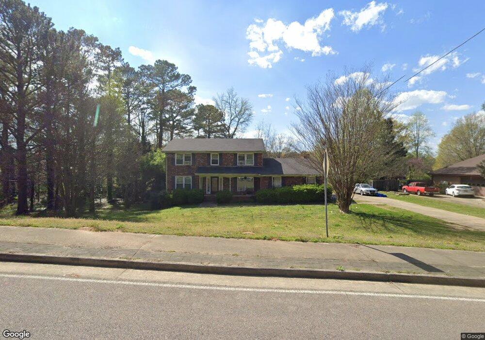
7785 Morant Dr Jonesboro, GA 30236
Estimated Value: $311,088 - $450,000
4
Beds
4
Baths
2,842
Sq Ft
$124/Sq Ft
Est. Value
About This Home
This home is located at 7785 Morant Dr, Jonesboro, GA 30236 and is currently estimated at $351,522, approximately $123 per square foot. 7785 Morant Dr is a home located in Clayton County with nearby schools including James Jackson Elementary School, M. D. Roberts Middle School, and Mount Zion High School.
Ownership History
Date
Name
Owned For
Owner Type
Purchase Details
Closed on
Dec 30, 2016
Sold by
Ramsey Theresa L
Bought by
Brown Jonathan
Current Estimated Value
Home Financials for this Owner
Home Financials are based on the most recent Mortgage that was taken out on this home.
Original Mortgage
$172,633
Outstanding Balance
$142,103
Interest Rate
4.08%
Mortgage Type
VA
Estimated Equity
$209,419
Purchase Details
Closed on
Nov 21, 2003
Sold by
Reece Wesley M and Reece Patsy O
Bought by
Ramsey Theresa L
Home Financials for this Owner
Home Financials are based on the most recent Mortgage that was taken out on this home.
Original Mortgage
$175,400
Interest Rate
5.97%
Mortgage Type
New Conventional
Create a Home Valuation Report for This Property
The Home Valuation Report is an in-depth analysis detailing your home's value as well as a comparison with similar homes in the area
Home Values in the Area
Average Home Value in this Area
Purchase History
| Date | Buyer | Sale Price | Title Company |
|---|---|---|---|
| Brown Jonathan | $169,000 | -- | |
| Ramsey Theresa L | $194,900 | -- |
Source: Public Records
Mortgage History
| Date | Status | Borrower | Loan Amount |
|---|---|---|---|
| Open | Brown Jonathan | $172,633 | |
| Previous Owner | Ramsey Theresa L | $175,400 |
Source: Public Records
Tax History Compared to Growth
Tax History
| Year | Tax Paid | Tax Assessment Tax Assessment Total Assessment is a certain percentage of the fair market value that is determined by local assessors to be the total taxable value of land and additions on the property. | Land | Improvement |
|---|---|---|---|---|
| 2024 | $3,513 | $89,160 | $9,600 | $79,560 |
| 2023 | $3,296 | $90,320 | $9,600 | $80,720 |
| 2022 | $3,476 | $87,680 | $9,600 | $78,080 |
| 2021 | $2,929 | $73,280 | $9,600 | $63,680 |
| 2020 | $2,757 | $68,046 | $9,600 | $58,446 |
| 2019 | $2,589 | $62,912 | $9,600 | $53,312 |
| 2018 | $2,594 | $63,036 | $9,600 | $53,436 |
| 2017 | $2,607 | $63,207 | $9,600 | $53,607 |
| 2016 | $1,740 | $51,908 | $9,600 | $42,308 |
| 2015 | $1,734 | $0 | $0 | $0 |
| 2014 | $1,675 | $51,223 | $9,600 | $41,623 |
Source: Public Records
Map
Nearby Homes
- 2846 Highway 138 E
- 2809 Highway 138 E
- 7719 Glen Devon Rd
- 2884 Kevin Ln Unit 2
- 7595 Teton Ct
- 2919 Cushing Ct Unit 2
- 733 Berkeley Dr
- 732 Berkeley Dr
- 717 Berkeley Dr
- 706 Berkeley Dr
- 708 Berkeley Dr
- 725 Berkeley Dr
- 710 Berkeley Dr
- 745 Berkeley Dr
- 722 Berkeley Dr
- 718 Berkeley Dr
- 719 Berkeley Dr
- 712 Berkeley Dr
- 734 Berkeley Dr
- 702 Berkeley Dr
- 7797 Morant Dr
- 7773 Morant Dr Unit 1
- 1795 Highway 138 SE
- 7761 Morant Dr
- 7776 Morant Dr
- 7764 Morant Dr
- 7749 Morant Dr
- 7752 Morant Dr
- 0 Morant Dr Unit 8251464
- 0 Morant Dr Unit 8150846
- 0 Morant Dr Unit 8959532
- 0 Morant Dr Unit 8782892
- 0 Morant Dr Unit 8820672
- 0 Morant Dr Unit 7060729
- 0 Morant Dr Unit 7151930
- 0 Morant Dr
- 0 Lake Spivey Pkwy Unit 8438794
- 23002506 Lake Spivey Pkwy
- 7737 Morant Dr
- 2888 Lake Spivey Pkwy