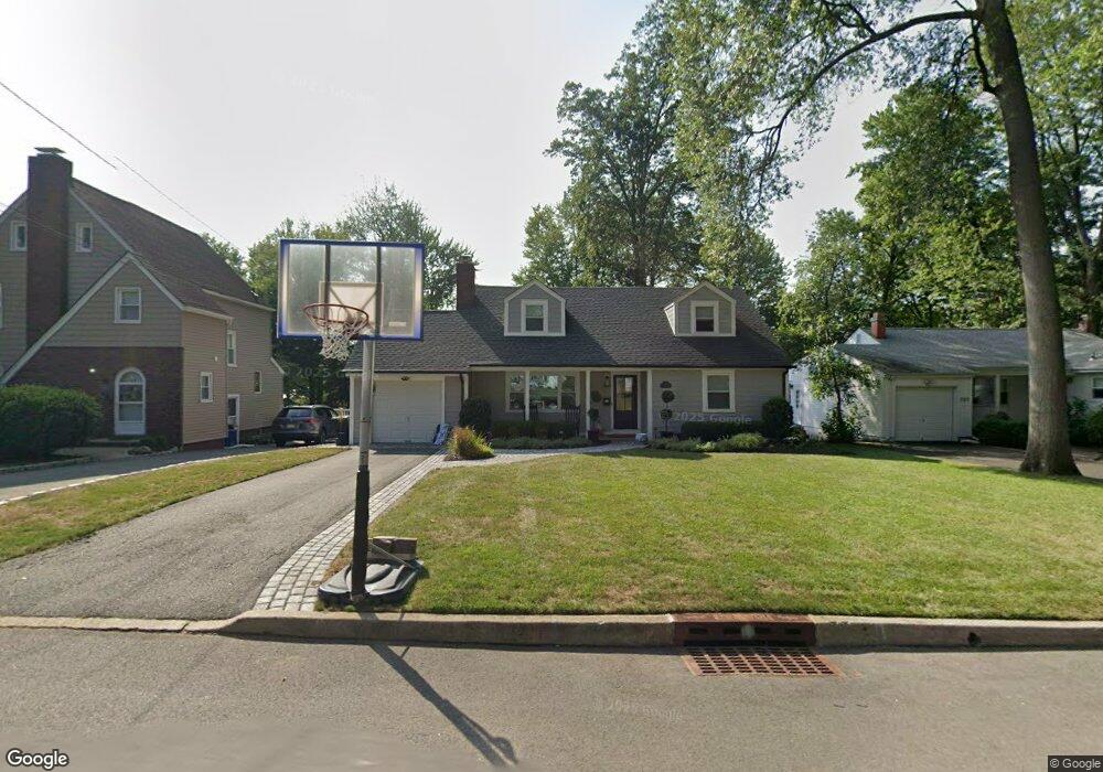
779 6th Ave River Edge, NJ 07661
Estimated Value: $844,488 - $1,027,000
--
Bed
--
Bath
2,036
Sq Ft
$467/Sq Ft
Est. Value
About This Home
This home is located at 779 6th Ave, River Edge, NJ 07661 and is currently estimated at $950,372, approximately $466 per square foot. 779 6th Ave is a home located in Bergen County with nearby schools including Roosevelt Elementary School, River Dell Middle School, and River Dell Regional High School.
Ownership History
Date
Name
Owned For
Owner Type
Purchase Details
Closed on
Jun 23, 2021
Sold by
Mckinley Michael and Mckinley Mary
Bought by
Meehan William C
Current Estimated Value
Home Financials for this Owner
Home Financials are based on the most recent Mortgage that was taken out on this home.
Original Mortgage
$528,750
Outstanding Balance
$478,717
Interest Rate
2.9%
Mortgage Type
New Conventional
Estimated Equity
$471,655
Purchase Details
Closed on
Dec 6, 2004
Purchase Details
Closed on
Jun 20, 2002
Sold by
Truglio Vincent
Bought by
Mclinkey Mathilda M
Home Financials for this Owner
Home Financials are based on the most recent Mortgage that was taken out on this home.
Original Mortgage
$105,000
Interest Rate
6.79%
Create a Home Valuation Report for This Property
The Home Valuation Report is an in-depth analysis detailing your home's value as well as a comparison with similar homes in the area
Home Values in the Area
Average Home Value in this Area
Purchase History
| Date | Buyer | Sale Price | Title Company |
|---|---|---|---|
| Meehan William C | $705,000 | Builders Title Agency Inc | |
| -- | $440,000 | -- | |
| Mclinkey Mathilda M | $362,000 | -- |
Source: Public Records
Mortgage History
| Date | Status | Borrower | Loan Amount |
|---|---|---|---|
| Open | Meehan William C | $528,750 | |
| Previous Owner | Mclinkey Mathilda M | $105,000 |
Source: Public Records
Tax History Compared to Growth
Tax History
| Year | Tax Paid | Tax Assessment Tax Assessment Total Assessment is a certain percentage of the fair market value that is determined by local assessors to be the total taxable value of land and additions on the property. | Land | Improvement |
|---|---|---|---|---|
| 2025 | $14,690 | $708,400 | $360,000 | $348,400 |
| 2024 | $14,324 | $370,500 | $209,600 | $160,900 |
| 2023 | $13,709 | $370,500 | $209,600 | $160,900 |
| 2022 | $13,709 | $370,500 | $209,600 | $160,900 |
| 2021 | $13,438 | $370,500 | $209,600 | $160,900 |
| 2020 | $13,227 | $370,500 | $209,600 | $160,900 |
| 2019 | $12,849 | $370,500 | $209,600 | $160,900 |
| 2018 | $12,578 | $370,500 | $209,600 | $160,900 |
| 2017 | $12,456 | $370,500 | $209,600 | $160,900 |
| 2016 | $12,175 | $370,500 | $209,600 | $160,900 |
| 2015 | $11,919 | $370,500 | $209,600 | $160,900 |
| 2014 | $11,941 | $370,500 | $209,600 | $160,900 |
Source: Public Records
Map
Nearby Homes
- 761 6th Ave
- 766 7th Ave
- 784 Millbrook Rd
- 712 6th Ave
- 374 E Midland Ave
- 331 Ellen Place
- 366 Spring Valley Rd
- 390 Spring Valley Rd
- 327 E Midland Ave
- 855 Kinderkamack Rd
- 276 Greenway Terrace
- 366 Forest Ave
- 33 Lincoln Ave
- 817 Riverdell Rd
- 415 Bailey Rd
- 140 River Edge Ave
- 787 Schaefer Ave
- 168 Voorhis Ave
- 215 Kensington Rd
- 224 Concord Dr