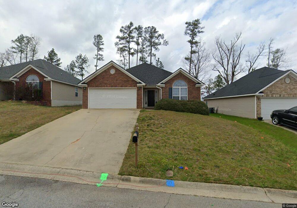
779 Michelle Ct Grovetown, GA 30813
Estimated Value: $242,426 - $248,000
3
Beds
2
Baths
1,526
Sq Ft
$161/Sq Ft
Est. Value
About This Home
This home is located at 779 Michelle Ct, Grovetown, GA 30813 and is currently estimated at $245,107, approximately $160 per square foot. 779 Michelle Ct is a home located in Columbia County with nearby schools including Euchee Creek Elementary School, Grovetown Middle School, and Grovetown High School.
Ownership History
Date
Name
Owned For
Owner Type
Purchase Details
Closed on
Mar 15, 2019
Sold by
Royal David E
Bought by
Royal Family Liv Trust
Current Estimated Value
Purchase Details
Closed on
Mar 25, 2010
Sold by
Brooks Shaun A
Bought by
Royal David
Purchase Details
Closed on
Jul 19, 2006
Sold by
Crozler Construction Inc
Bought by
Brooks Shaun A
Home Financials for this Owner
Home Financials are based on the most recent Mortgage that was taken out on this home.
Original Mortgage
$105,520
Interest Rate
6.68%
Mortgage Type
New Conventional
Create a Home Valuation Report for This Property
The Home Valuation Report is an in-depth analysis detailing your home's value as well as a comparison with similar homes in the area
Home Values in the Area
Average Home Value in this Area
Purchase History
| Date | Buyer | Sale Price | Title Company |
|---|---|---|---|
| Royal Family Liv Trust | -- | -- | |
| Royal David | $135,900 | -- | |
| Brooks Shaun A | $131,900 | -- |
Source: Public Records
Mortgage History
| Date | Status | Borrower | Loan Amount |
|---|---|---|---|
| Previous Owner | Brooks Shaun A | $105,520 |
Source: Public Records
Tax History Compared to Growth
Tax History
| Year | Tax Paid | Tax Assessment Tax Assessment Total Assessment is a certain percentage of the fair market value that is determined by local assessors to be the total taxable value of land and additions on the property. | Land | Improvement |
|---|---|---|---|---|
| 2025 | $2,636 | $94,147 | $18,804 | $75,343 |
| 2024 | $2,663 | $90,296 | $18,504 | $71,792 |
| 2023 | $2,663 | $86,207 | $17,904 | $68,303 |
| 2022 | $2,273 | $73,813 | $15,104 | $58,709 |
| 2021 | $2,099 | $65,206 | $13,404 | $51,802 |
| 2020 | $2,036 | $62,136 | $12,704 | $49,432 |
| 2019 | $1,974 | $59,714 | $12,304 | $47,410 |
| 2018 | $1,918 | $57,074 | $11,504 | $45,570 |
| 2017 | $1,838 | $56,380 | $11,404 | $44,976 |
| 2016 | $1,391 | $51,638 | $11,180 | $40,458 |
| 2015 | $1,376 | $50,986 | $11,380 | $39,606 |
| 2014 | $1,386 | $50,708 | $10,480 | $40,228 |
Source: Public Records
Map
Nearby Homes
- 712 Hollis Ave
- 713 Hollis Ave
- 714 Hollis Ave
- 1252 Birch Cir
- 1251 Birch Cir
- 935 Raghorn Rd
- 933 Raghorn Rd
- 959 Raghorn Rd
- 930 Raghorn Rd
- 926 Raghorn Rd
- 922 Raghorn Rd
- 920 Raghorn Rd
- 570 Lory Ln
- 963 Raghorn Rd
- 965 Raghorn Rd
- 967 Raghorn Rd
- 924 Raghorn Rd
- 970 Raghorn Rd
- Lot 5 Marsdale Dr
- Lot 1 Marsdale Dr
- 781 Michelle Ct
- 783 Michelle Ct
- 775 Michelle Ct
- 0 Michelle Ct
- 785 Michelle Ct
- 773 Michelle Ct
- 774 Michelle Ct
- 770 Michelle Ct
- 787 Michelle Ct
- 771 Michelle Ct
- 319 Elbrus Way
- 769 Michelle Ct
- 420 Urial Dr
- 423 Urial Dr
- 791 Michelle Ct
- 767 Michelle Ct
- 421 Urial Dr
- 418 Urial Dr
- 790 Michelle Ct
- 316 Elbrus Way