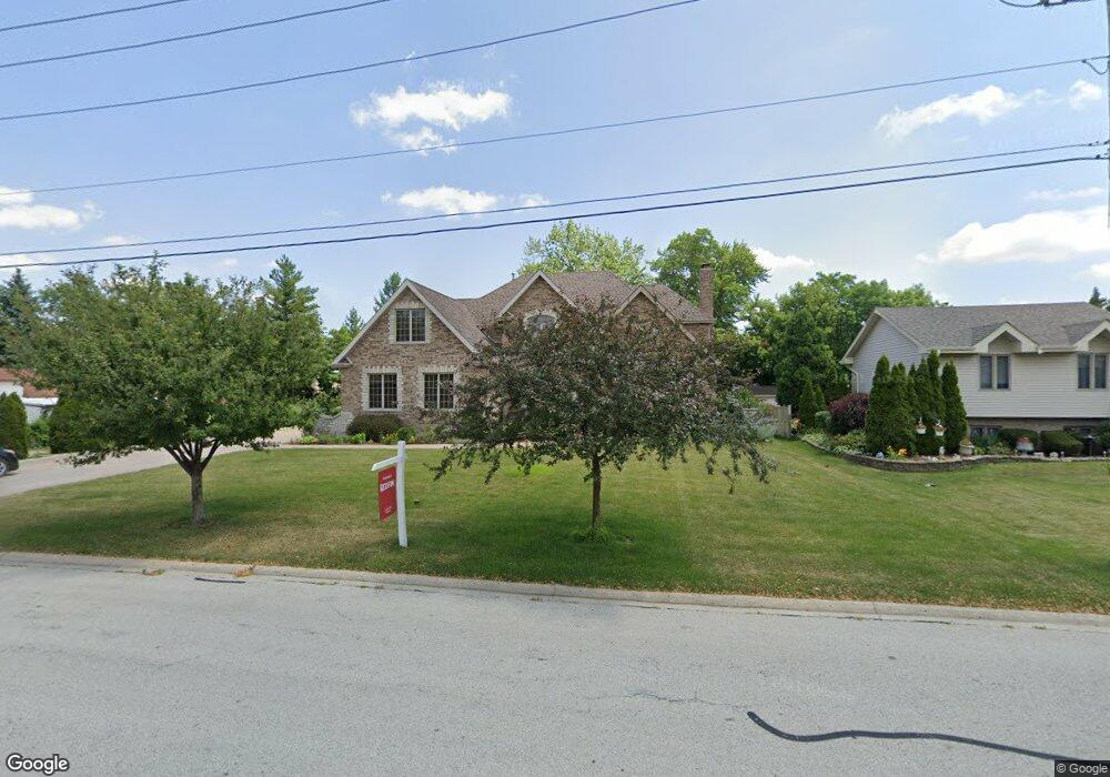
779 N 9th Ave Addison, IL 60101
Estimated Value: $617,000 - $811,000
4
Beds
4
Baths
3,346
Sq Ft
$208/Sq Ft
Est. Value
About This Home
This home is located at 779 N 9th Ave, Addison, IL 60101 and is currently estimated at $695,801, approximately $207 per square foot. 779 N 9th Ave is a home located in DuPage County with nearby schools including Wesley Elementary School, Indian Trail Jr High School, and Addison Trail High School.
Ownership History
Date
Name
Owned For
Owner Type
Purchase Details
Closed on
Jun 26, 2009
Sold by
Morina Reshep and Morina Remzije
Bought by
Morina Rexhep and Morina Remzije
Current Estimated Value
Home Financials for this Owner
Home Financials are based on the most recent Mortgage that was taken out on this home.
Original Mortgage
$417,000
Outstanding Balance
$276,416
Interest Rate
5.62%
Mortgage Type
Stand Alone Refi Refinance Of Original Loan
Estimated Equity
$419,385
Purchase Details
Closed on
Jan 8, 1999
Sold by
Sakalares Dorothy
Bought by
Morina Rexhep and Morina Remzije
Create a Home Valuation Report for This Property
The Home Valuation Report is an in-depth analysis detailing your home's value as well as a comparison with similar homes in the area
Home Values in the Area
Average Home Value in this Area
Purchase History
| Date | Buyer | Sale Price | Title Company |
|---|---|---|---|
| Morina Rexhep | -- | Stewart Title Company | |
| Morina Rexhep | $100,000 | -- |
Source: Public Records
Mortgage History
| Date | Status | Borrower | Loan Amount |
|---|---|---|---|
| Open | Morina Rexhep | $417,000 |
Source: Public Records
Tax History
| Year | Tax Paid | Tax Assessment Tax Assessment Total Assessment is a certain percentage of the fair market value that is determined by local assessors to be the total taxable value of land and additions on the property. | Land | Improvement |
|---|---|---|---|---|
| 2024 | $14,202 | $217,494 | $67,476 | $150,018 |
| 2023 | $13,541 | $199,940 | $62,030 | $137,910 |
| 2022 | $11,062 | $195,020 | $60,510 | $134,510 |
| 2021 | $12,984 | $186,800 | $57,960 | $128,840 |
| 2020 | $12,630 | $178,930 | $55,520 | $123,410 |
| 2019 | $12,540 | $172,040 | $53,380 | $118,660 |
| 2018 | $13,205 | $168,670 | $52,340 | $116,330 |
| 2017 | $12,882 | $161,200 | $50,020 | $111,180 |
| 2016 | $12,571 | $148,830 | $46,180 | $102,650 |
| 2015 | $12,292 | $137,490 | $42,660 | $94,830 |
| 2014 | $12,619 | $140,120 | $44,000 | $96,120 |
| 2013 | $12,353 | $142,980 | $44,900 | $98,080 |
Source: Public Records
Map
Nearby Homes
- 729 N 8th Ave
- 1306 W Byron Ave
- 4N327 7th Ave
- 1113 N Itasca Rd
- 1354 W Byron Ave Unit D
- 4N212 8th Ave
- 19W720 Woodland Ave
- 1130 N Thatcher Ln
- 1137 N Itasca Rd
- 551 N 6th Ave
- 580 N Highlander Way
- 1210 N Foxdale Dr Unit 109
- 1030 W Kendall Terrace
- +/-1.51 Acres Lake St
- 1050 W Woodland Ave
- 1660 W Prescott Place
- 6219 Links Dr Unit 27001
- 6238 Links Dr Unit 4001
- 6221 Links Dr Unit 27002
- 6232 Links Dr Unit 3001
Your Personal Tour Guide
Ask me questions while you tour the home.