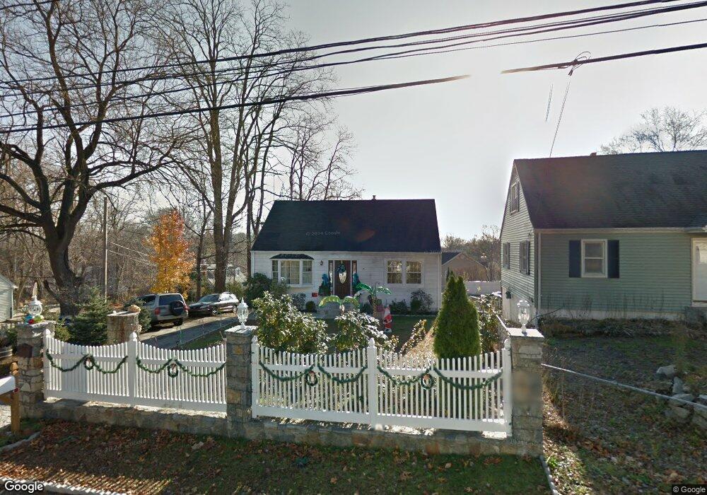
779 Platt St Bridgeport, CT 06606
North End NeighborhoodEstimated Value: $376,000 - $427,000
4
Beds
1
Bath
1,224
Sq Ft
$330/Sq Ft
Est. Value
About This Home
This home is located at 779 Platt St, Bridgeport, CT 06606 and is currently estimated at $404,097, approximately $330 per square foot. 779 Platt St is a home located in Fairfield County with nearby schools including Wilbur L. Cross Elementary School, Central High School, and St Andrew School.
Ownership History
Date
Name
Owned For
Owner Type
Purchase Details
Closed on
Dec 8, 2004
Sold by
Martinez Victor and Martinez Ana
Bought by
Anango Carlos
Current Estimated Value
Home Financials for this Owner
Home Financials are based on the most recent Mortgage that was taken out on this home.
Original Mortgage
$166,400
Interest Rate
6.5%
Purchase Details
Closed on
Oct 11, 1995
Sold by
Yacovelli Paul
Bought by
Martinez Victor H and Martinez Ana M
Purchase Details
Closed on
May 17, 1995
Sold by
Jgv Bldrs Inc
Bought by
Yacovelli Paul
Purchase Details
Closed on
May 10, 1995
Sold by
Ct Galaxy Prop Inc
Bought by
Jgv Bldrs Inc
Create a Home Valuation Report for This Property
The Home Valuation Report is an in-depth analysis detailing your home's value as well as a comparison with similar homes in the area
Home Values in the Area
Average Home Value in this Area
Purchase History
| Date | Buyer | Sale Price | Title Company |
|---|---|---|---|
| Anango Carlos | $208,000 | -- | |
| Anango Carlos | $208,000 | -- | |
| Martinez Victor H | $77,000 | -- | |
| Martinez Victor H | $77,000 | -- | |
| Yacovelli Paul | $24,400 | -- | |
| Yacovelli Paul | $24,400 | -- | |
| Jgv Bldrs Inc | $22,500 | -- | |
| Jgv Bldrs Inc | $22,500 | -- |
Source: Public Records
Mortgage History
| Date | Status | Borrower | Loan Amount |
|---|---|---|---|
| Open | Jgv Bldrs Inc | $214,000 | |
| Closed | Jgv Bldrs Inc | $166,400 |
Source: Public Records
Tax History Compared to Growth
Tax History
| Year | Tax Paid | Tax Assessment Tax Assessment Total Assessment is a certain percentage of the fair market value that is determined by local assessors to be the total taxable value of land and additions on the property. | Land | Improvement |
|---|---|---|---|---|
| 2025 | $6,473 | $148,970 | $72,440 | $76,530 |
| 2024 | $6,473 | $148,970 | $72,440 | $76,530 |
| 2023 | $6,473 | $148,970 | $72,440 | $76,530 |
| 2022 | $6,473 | $148,970 | $72,440 | $76,530 |
| 2021 | $6,473 | $148,970 | $72,440 | $76,530 |
| 2020 | $5,835 | $108,070 | $43,880 | $64,190 |
| 2019 | $5,835 | $108,070 | $43,880 | $64,190 |
| 2018 | $5,876 | $108,070 | $43,880 | $64,190 |
| 2017 | $5,876 | $108,070 | $43,880 | $64,190 |
| 2016 | $5,876 | $108,070 | $43,880 | $64,190 |
| 2015 | $5,433 | $128,750 | $44,280 | $84,470 |
| 2014 | $5,433 | $128,750 | $44,280 | $84,470 |
Source: Public Records
Map
Nearby Homes
- 814 Platt St
- 675 Platt St
- 54 Agnes St
- 25 Broadway
- 238 Griffin Ave
- 355 Exeter St
- 213 Exeter St
- 219 Exeter St
- 500 Woodlawn Avenue Extension
- 65 Clearview Dr
- 354 Beechmont Ave
- 215 Overland Ave
- 123 Exeter St
- 365 Platt St
- 142 Chatham Terrace
- 330 Oakwood St
- 1095 Wayne St
- 45 Stevens St Unit 2
- 285 Alba Ave
- 410 Alba Ave