Estimated Value: $173,000 - $283,000
3
Beds
2
Baths
1,365
Sq Ft
$168/Sq Ft
Est. Value
About This Home
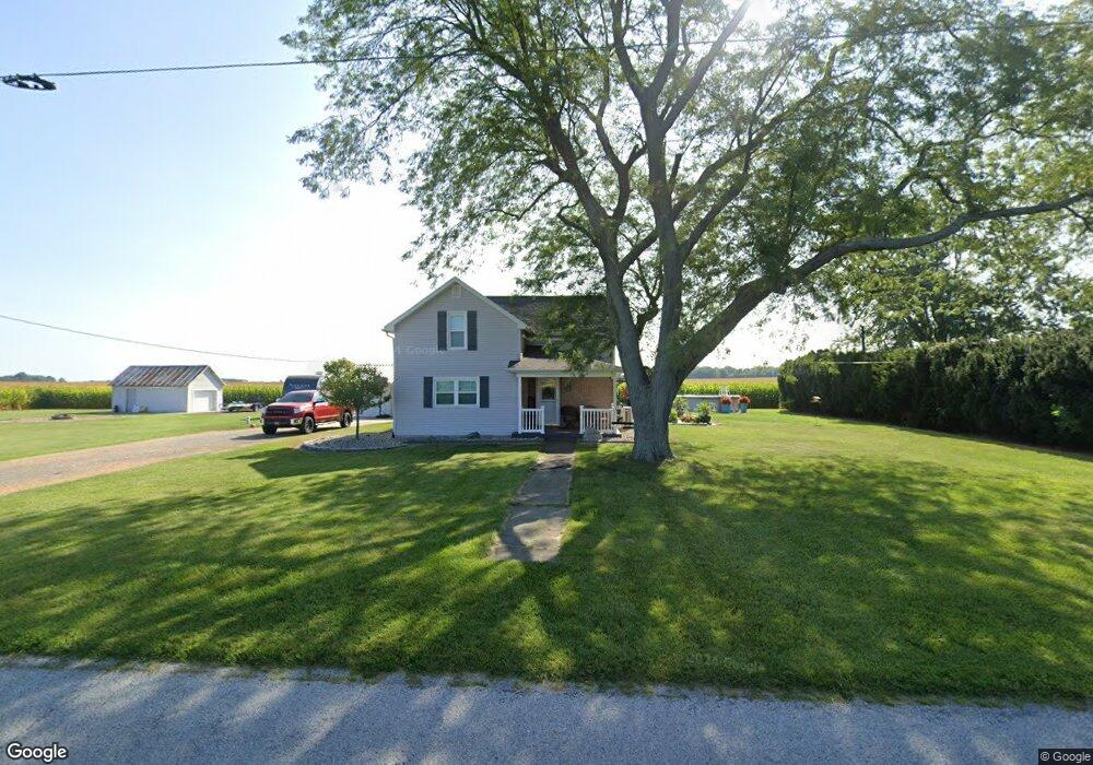
This home is located at 7790 Stewart Rd, Lima, OH 45807 and is currently estimated at $229,437, approximately $168 per square foot. 7790 Stewart Rd is a home located in Allen County with nearby schools including Bath Elementary School, Bath Middle School, and Bath High School.
Ownership History
Date
Name
Owned For
Owner Type
Purchase Details
Closed on
Aug 15, 2011
Sold by
Fannie Mae
Bought by
Hardwick Travis
Current Estimated Value
Purchase Details
Closed on
Jul 19, 2011
Sold by
Basham Kelly J and Basham Renee S
Bought by
Federal Credit Union
Purchase Details
Closed on
Jul 15, 1994
Sold by
Reynolds Lucy
Bought by
Harpest David and Poynter Peggy
Home Financials for this Owner
Home Financials are based on the most recent Mortgage that was taken out on this home.
Original Mortgage
$33,250
Interest Rate
8.6%
Mortgage Type
New Conventional
Purchase Details
Closed on
Nov 19, 1993
Sold by
Reynolds Terry L
Bought by
Reynolds Lucy E
Purchase Details
Closed on
May 1, 1983
Bought by
Reynolds Terry L
Create a Home Valuation Report for This Property
The Home Valuation Report is an in-depth analysis detailing your home's value as well as a comparison with similar homes in the area
Home Values in the Area
Average Home Value in this Area
Purchase History
| Date | Buyer | Sale Price | Title Company |
|---|---|---|---|
| Hardwick Travis | $39,300 | None Available | |
| Federal Credit Union | $40,000 | None Available | |
| Harpest David | $35,000 | -- | |
| Reynolds Lucy E | -- | -- | |
| Reynolds Terry L | $32,600 | -- |
Source: Public Records
Mortgage History
| Date | Status | Borrower | Loan Amount |
|---|---|---|---|
| Previous Owner | Harpest David | $33,250 |
Source: Public Records
Tax History Compared to Growth
Tax History
| Year | Tax Paid | Tax Assessment Tax Assessment Total Assessment is a certain percentage of the fair market value that is determined by local assessors to be the total taxable value of land and additions on the property. | Land | Improvement |
|---|---|---|---|---|
| 2024 | $2,527 | $63,560 | $8,750 | $54,810 |
| 2023 | $2,285 | $52,120 | $7,180 | $44,940 |
| 2022 | $2,328 | $52,120 | $7,180 | $44,940 |
| 2021 | $2,311 | $52,120 | $7,180 | $44,940 |
| 2020 | $1,957 | $40,710 | $6,550 | $34,160 |
| 2019 | $1,957 | $40,710 | $6,550 | $34,160 |
| 2018 | $1,167 | $25,520 | $6,550 | $18,970 |
| 2017 | $1,132 | $23,810 | $6,550 | $17,260 |
| 2016 | $1,142 | $23,810 | $6,550 | $17,260 |
| 2015 | $1,155 | $23,810 | $6,550 | $17,260 |
| 2014 | $1,155 | $24,020 | $6,550 | $17,470 |
| 2013 | $1,162 | $24,020 | $6,550 | $17,470 |
Source: Public Records
Map
Nearby Homes
- 201 Wall St
- 309 Wall St
- 220 Parklane Dr
- 6585 Ottawa Rd
- 300 Sweaney Ave
- 3456 Shearin Ave
- 11059 Ottawa Rd
- 3798 Kissing Hollow Dr
- 3270 Bonnieview Dr
- 108 Highland Lakes Dr
- 4080 Brookshore Dr
- 4050 Brookshore Dr
- 1679 E Bluelick Rd
- 4619 N Thayer Rd
- 147 Elm St
- 308 Delphos Rd
- 2525 W Lincoln Hwy
- 5025 N Cool Rd
- 148 S Water St
- 204 S Broadway St