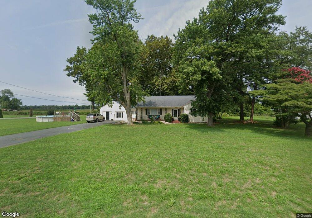
7793 Main St Laurel, DE 19956
Estimated Value: $319,000 - $429,000
4
Beds
2
Baths
2,300
Sq Ft
$154/Sq Ft
Est. Value
About This Home
This home is located at 7793 Main St, Laurel, DE 19956 and is currently estimated at $353,901, approximately $153 per square foot. 7793 Main St is a home located in Sussex County with nearby schools including North Laurel Elementary School, Laurel Elementary School, and Laurel Intermediate Middle School.
Ownership History
Date
Name
Owned For
Owner Type
Purchase Details
Closed on
Apr 16, 2021
Sold by
Elzey Helene E
Bought by
Lee-Elzey Bryant
Current Estimated Value
Home Financials for this Owner
Home Financials are based on the most recent Mortgage that was taken out on this home.
Original Mortgage
$191,919
Outstanding Balance
$171,770
Interest Rate
3%
Mortgage Type
FHA
Estimated Equity
$182,131
Purchase Details
Closed on
Feb 6, 2001
Bought by
Elzey Helene E and Elzey David T
Create a Home Valuation Report for This Property
The Home Valuation Report is an in-depth analysis detailing your home's value as well as a comparison with similar homes in the area
Home Values in the Area
Average Home Value in this Area
Purchase History
| Date | Buyer | Sale Price | Title Company |
|---|---|---|---|
| Lee-Elzey Bryant | -- | None Available | |
| Elzey Helene E | -- | -- |
Source: Public Records
Mortgage History
| Date | Status | Borrower | Loan Amount |
|---|---|---|---|
| Open | Lee-Elzey Bryant | $191,919 |
Source: Public Records
Tax History
| Year | Tax Paid | Tax Assessment Tax Assessment Total Assessment is a certain percentage of the fair market value that is determined by local assessors to be the total taxable value of land and additions on the property. | Land | Improvement |
|---|---|---|---|---|
| 2025 | $911 | $19,300 | $1,500 | $17,800 |
| 2024 | $1,015 | $19,300 | $1,500 | $17,800 |
| 2023 | $1,157 | $19,300 | $1,500 | $17,800 |
| 2022 | $1,005 | $19,300 | $1,500 | $17,800 |
| 2021 | $996 | $19,300 | $1,500 | $17,800 |
| 2020 | $1,021 | $19,300 | $1,500 | $17,800 |
| 2019 | $1,048 | $19,300 | $1,500 | $17,800 |
| 2018 | $1,130 | $19,300 | $0 | $0 |
| 2017 | $1,096 | $19,300 | $0 | $0 |
| 2016 | $1,162 | $19,300 | $0 | $0 |
| 2015 | $1,010 | $19,300 | $0 | $0 |
| 2014 | $885 | $19,300 | $0 | $0 |
Source: Public Records
Map
Nearby Homes
- 7539 Broad Creek Cir
- 7857 Holly Branch Dr
- 8807 Woodland Ferry Rd
- 8617 Portsville Rd
- 31348 Mount Pleasant Rd
- 28740 Seaford Rd
- 6255 Stefland Dr
- 30671 Old Sailors Rd
- 9688 Camp Rd
- 9716 Camp Rd
- LOT 5 Woodland Ferry Rd
- LOT 4 Woodland Ferry Rd
- LOT 2 Woodland Ferry Rd
- 28344 River Rd
- 28828 Boyce Rd
- 1115 W 6th St
- 1176 W 6th St
- 108 Crockett Ave
- 30772 River Rd
- 1154 W 6th St
- 7802 Bethel Rd
- 7805 Bethel Rd
- 7795 Bethel Rd
- 7817 Bethel Rd
- 7794 Main St
- 7826 Bethel Rd
- 7838 Bethel Rd
- 56 Hopkins St
- 7792 Main St
- 7837 Bethel Rd
- 00 Hopkins St
- 7789 Main St
- 54 Hopkins St
- 52 Hopkins St
- 1 Hopkins St Unit 8
- 0 Hopkins St Unit 1001162204
- 0 Hopkins St Unit 1001069992
- 0 Hopkins St Unit 1001153022
- 0 Hopkins St Unit 8 1001151542
- 0 Hopkins St Unit 1001151580
Your Personal Tour Guide
Ask me questions while you tour the home.