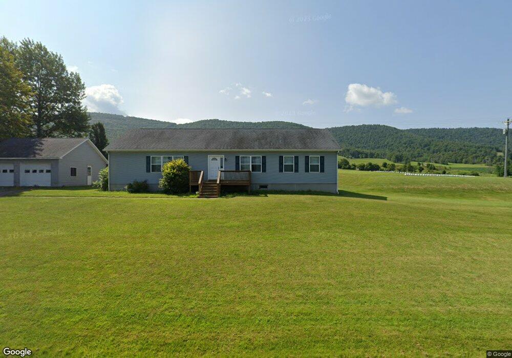
7794 Southside Rd Unit 7854 Canton, PA 17724
Estimated Value: $123,371 - $416,000
4
Beds
5
Baths
--
Sq Ft
0.9
Acres
About This Home
This home is located at 7794 Southside Rd Unit 7854, Canton, PA 17724 and is currently estimated at $230,343. 7794 Southside Rd Unit 7854 is a home located in Bradford County with nearby schools including Canton Area Elementary School and Canton Junior/Senior High School.
Ownership History
Date
Name
Owned For
Owner Type
Purchase Details
Closed on
Oct 29, 2025
Sold by
Tomlinson Theodore J and Tomlinson Karen M
Bought by
Tomlinson Kelly L
Current Estimated Value
Purchase Details
Closed on
Jan 9, 2014
Sold by
Tomlinson Theodore J and Tomlinson Karen M
Bought by
Tomlinson Robert J and Tomlinson Diane L
Home Financials for this Owner
Home Financials are based on the most recent Mortgage that was taken out on this home.
Original Mortgage
$112,000
Interest Rate
4.4%
Mortgage Type
Purchase Money Mortgage
Create a Home Valuation Report for This Property
The Home Valuation Report is an in-depth analysis detailing your home's value as well as a comparison with similar homes in the area
Home Values in the Area
Average Home Value in this Area
Purchase History
| Date | Buyer | Sale Price | Title Company |
|---|---|---|---|
| Tomlinson Kelly L | -- | None Listed On Document | |
| Tomlinson Robert J | $165,000 | None Available |
Source: Public Records
Mortgage History
| Date | Status | Borrower | Loan Amount |
|---|---|---|---|
| Previous Owner | Tomlinson Robert J | $112,000 |
Source: Public Records
Tax History Compared to Growth
Tax History
| Year | Tax Paid | Tax Assessment Tax Assessment Total Assessment is a certain percentage of the fair market value that is determined by local assessors to be the total taxable value of land and additions on the property. | Land | Improvement |
|---|---|---|---|---|
| 2025 | $1,308 | $25,400 | $0 | $0 |
| 2024 | $1,253 | $25,400 | $0 | $0 |
| 2023 | $1,203 | $24,400 | $0 | $0 |
| 2022 | $1,201 | $24,400 | $0 | $0 |
| 2021 | $1,201 | $24,400 | $0 | $0 |
| 2020 | $1,187 | $24,400 | $0 | $0 |
| 2019 | $1,186 | $24,400 | $0 | $0 |
| 2018 | $1,143 | $24,400 | $0 | $0 |
| 2017 | $1,127 | $24,400 | $0 | $0 |
| 2016 | -- | $24,400 | $0 | $0 |
| 2015 | -- | $24,400 | $0 | $0 |
| 2014 | -- | $65,650 | $0 | $0 |
Source: Public Records
Map
Nearby Homes
- 445 Lilley Hill Rd
- 25 Bonney Rd
- 172 Bonney Rd
- 2331 Bailey Corners Rd
- 5947 Rt 514
- 9 Farmall Ln
- 1719 Mountain Rd
- 448 Mcnaught Rd
- 211 Hanks Rd
- 14751 Route 14
- 137 Tuffy Rd
- PARCEL 030 Glory Ridge Rd
- Parc 030 Glory Ridge Rd
- 114 Glory Ridge Rd
- 115 Glory Ridge Rd
- 30 School House Dr
- 63 Brann St
- 108 S Washington St
- 118 E South Ave
- 371 North St
- 0 State Route 3008
- 7911 Southside Rd
- 82 Mill St
- 7924 Southside Rd
- 183 Mitstifer Loop
- 382 Leroy Mountain Rd
- 15 Mitstifer Loop
- 169 Mitstifer Loop
- 183 Mitstifer Loop
- 7573 Southside Rd Unit 7603
- 125 Mitstifer Loop
- 7552 Southside Rd
- 7550 Southside Rd
- 8051 Southside Rd
- 294 Leroy Mountain Rd
- 230 Mill St
- 262 Mill St
- 279 Mill St
- 290 Mill St
- 10006 Route 414