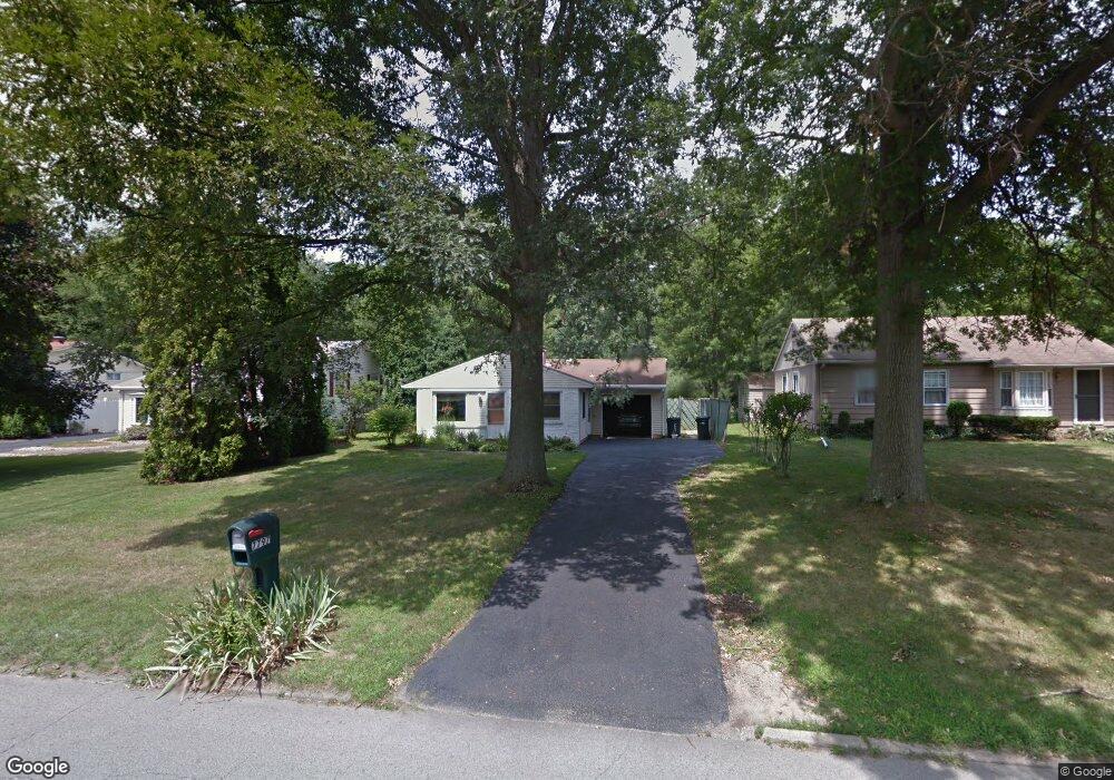
7797 Anderson Ave NE Warren, OH 44484
Estimated Value: $98,000 - $153,000
3
Beds
1
Bath
912
Sq Ft
$135/Sq Ft
Est. Value
About This Home
This home is located at 7797 Anderson Ave NE, Warren, OH 44484 and is currently estimated at $122,693, approximately $134 per square foot. 7797 Anderson Ave NE is a home located in Trumbull County with nearby schools including Howland High School, John F. Kennedy Catholic School - Lower Campus, and Holy Trinity Orthodox Christian Academy.
Ownership History
Date
Name
Owned For
Owner Type
Purchase Details
Closed on
Mar 17, 2022
Sold by
Brooks Ronald R and Brooks Joanne
Bought by
Brooks Julia I
Current Estimated Value
Purchase Details
Closed on
Jun 18, 2021
Sold by
Means Sherry J
Bought by
Brooks Ronald R and Brooks Joanne
Home Financials for this Owner
Home Financials are based on the most recent Mortgage that was taken out on this home.
Original Mortgage
$50,400
Interest Rate
2.9%
Mortgage Type
New Conventional
Purchase Details
Closed on
Jan 1, 1990
Bought by
Sherry J Means
Create a Home Valuation Report for This Property
The Home Valuation Report is an in-depth analysis detailing your home's value as well as a comparison with similar homes in the area
Home Values in the Area
Average Home Value in this Area
Purchase History
| Date | Buyer | Sale Price | Title Company |
|---|---|---|---|
| Brooks Julia I | -- | Nader Thomas C | |
| Brooks Ronald R | $63,000 | None Available | |
| Sherry J Means | -- | -- |
Source: Public Records
Mortgage History
| Date | Status | Borrower | Loan Amount |
|---|---|---|---|
| Previous Owner | Brooks Ronald R | $50,400 |
Source: Public Records
Tax History Compared to Growth
Tax History
| Year | Tax Paid | Tax Assessment Tax Assessment Total Assessment is a certain percentage of the fair market value that is determined by local assessors to be the total taxable value of land and additions on the property. | Land | Improvement |
|---|---|---|---|---|
| 2024 | $1,528 | $28,210 | $7,000 | $21,210 |
| 2023 | $1,528 | $28,210 | $7,000 | $21,210 |
| 2022 | $1,270 | $20,200 | $7,000 | $13,200 |
| 2021 | $1,240 | $20,200 | $7,000 | $13,200 |
| 2020 | $1,245 | $20,200 | $7,000 | $13,200 |
| 2019 | $1,171 | $17,990 | $7,000 | $10,990 |
| 2018 | $1,120 | $17,990 | $7,000 | $10,990 |
| 2017 | $1,007 | $17,990 | $7,000 | $10,990 |
| 2016 | $1,091 | $18,940 | $7,000 | $11,940 |
| 2015 | $1,064 | $18,940 | $7,000 | $11,940 |
| 2014 | $1,027 | $18,940 | $7,000 | $11,940 |
| 2013 | $1,020 | $18,940 | $7,000 | $11,940 |
Source: Public Records
Map
Nearby Homes
- 7979 Brookwood St NE
- 7751 Castle Rock Dr NE
- 108 Westwind Dr NE
- 7707 Raglan Dr NE
- 610 Clifton Dr NE
- 660 Rosegarden Dr NE
- 7697 Micawber Rd NE
- 7837 Raglan Dr NE
- 8531 Red Oak Dr NE
- 741 Shady Ln NE
- 8545 Carriage Hill Dr NE
- 0 King Graves Rd NE
- 8528 Deer Creek Ln NE
- 4260 N River Rd NE
- 4167 N River Rd NE
- 8936 Stetson Dr NE
- 8303 E Market St
- 8848 King Graves Rd NE
- 248 Darlington Rd NE
- 106 N Aspen Ct Unit 4
- 7785 Anderson Ave NE
- 7809 Anderson Ave NE
- 7775 Anderson Ave NE
- 7819 Anderson Ave NE
- 7767 Anderson Ave NE
- 7904 Cherry Hill Dr NE
- 7923 Anderson Ave NE
- 7798 Anderson Ave NE
- 7864 Brookwood St NE
- 7755 Anderson Ave NE
- 7786 Anderson Ave NE
- 7810 Anderson Ave NE
- 7902 Cherry Hill Dr NE
- 7776 Anderson Ave NE
- 7820 Anderson Ave NE
- 7846 Brookwood St NE
- 7933 Anderson Ave NE
- 7906 Cherry Hill Dr NE
- 7747 Anderson Ave NE
- 7924 Anderson Ave NE