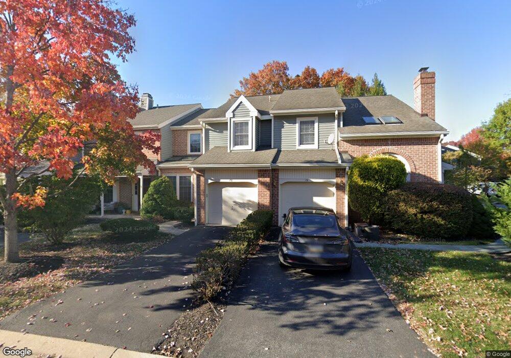
78 Abrams Ln Unit O Chesterbrook, PA 19087
Estimated Value: $534,567 - $610,000
3
Beds
3
Baths
1,352
Sq Ft
$432/Sq Ft
Est. Value
About This Home
This home is located at 78 Abrams Ln Unit O, Chesterbrook, PA 19087 and is currently estimated at $583,392, approximately $431 per square foot. 78 Abrams Ln Unit O is a home located in Chester County with nearby schools including Valley Forge Elementary School, Valley Forge Middle School, and Conestoga Senior High School.
Ownership History
Date
Name
Owned For
Owner Type
Purchase Details
Closed on
Apr 13, 2007
Sold by
Tornvall Michael S
Bought by
Reilly Carol A
Current Estimated Value
Home Financials for this Owner
Home Financials are based on the most recent Mortgage that was taken out on this home.
Original Mortgage
$225,000
Outstanding Balance
$136,265
Interest Rate
6.18%
Mortgage Type
Purchase Money Mortgage
Estimated Equity
$447,127
Purchase Details
Closed on
Jul 17, 1998
Sold by
Demito Michael S and Demito Patricia A
Bought by
Tornvall Michael S
Home Financials for this Owner
Home Financials are based on the most recent Mortgage that was taken out on this home.
Original Mortgage
$134,800
Interest Rate
6.99%
Create a Home Valuation Report for This Property
The Home Valuation Report is an in-depth analysis detailing your home's value as well as a comparison with similar homes in the area
Home Values in the Area
Average Home Value in this Area
Purchase History
| Date | Buyer | Sale Price | Title Company |
|---|---|---|---|
| Reilly Carol A | $355,000 | None Available | |
| Tornvall Michael S | $168,500 | -- |
Source: Public Records
Mortgage History
| Date | Status | Borrower | Loan Amount |
|---|---|---|---|
| Open | Reilly Carol A | $225,000 | |
| Previous Owner | Tornvall Michael S | $134,800 | |
| Closed | Tornvall Michael S | $16,850 |
Source: Public Records
Tax History Compared to Growth
Tax History
| Year | Tax Paid | Tax Assessment Tax Assessment Total Assessment is a certain percentage of the fair market value that is determined by local assessors to be the total taxable value of land and additions on the property. | Land | Improvement |
|---|---|---|---|---|
| 2025 | $5,618 | $159,490 | $40,810 | $118,680 |
| 2024 | $5,618 | $159,490 | $40,810 | $118,680 |
| 2023 | $5,277 | $159,490 | $40,810 | $118,680 |
| 2022 | $5,141 | $159,490 | $40,810 | $118,680 |
| 2021 | $5,043 | $159,490 | $40,810 | $118,680 |
| 2020 | $4,904 | $159,490 | $40,810 | $118,680 |
| 2019 | $4,749 | $159,490 | $40,810 | $118,680 |
| 2018 | $4,655 | $159,490 | $40,810 | $118,680 |
| 2017 | $4,544 | $159,490 | $40,810 | $118,680 |
| 2016 | -- | $159,490 | $40,810 | $118,680 |
| 2015 | -- | $159,490 | $40,810 | $118,680 |
| 2014 | -- | $159,490 | $40,810 | $118,680 |
Source: Public Records
Map
Nearby Homes
- 301 Hanover Ct
- 68 Amity Dr
- 1586 Salomon Ln
- 307 Cheswold Ct Unit 307
- 19 Painters Ln
- 170, 200, 220 Old State Rd
- 413 Cannon Ct Unit 413
- 412 Cannon Ct Unit 412
- 793 Tory Hollow Rd
- 293 Valley Stream Ln
- 0 Valley Stream Ln Unit PACT2109946
- 463 Old Forge Crossing Unit 463
- 232 Old Forge Crossing
- 363 Old Forge Crossing
- 108 Valley Stream Cir Unit 108A
- 387 Devonshire Rd
- 306 Devonshire Rd
- 620 Washington Place Unit 20
- 1410 Washington Place Unit 10
- 107 Reveille Rd
- 77 Abrams Ln
- 77 Abrams Ct
- 79 Abrams Ln
- 76 Abrams Ln
- 75 Abrams Ln
- 75 Abrams Ct
- 74 Abrams Ct
- 74 Abrams Ln
- 1 Windsor Cir
- 48 Stonehurst Ct Unit I
- 53 Abrams Ln Unit K53D
- 53 Abrams Ct
- 54 Abrams Ln Unit K
- 47 Stonehurst Ct
- 2 Windsor Cir Unit A
- 55 Abrams Ln Unit K
- 52 Abrams Ln
- 55 Abrams Ct
- 52 Abrams Ct
- 56 Abrams Ln