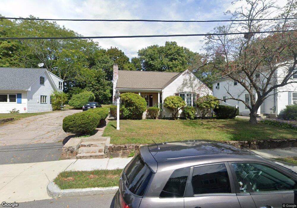
78 Ames St Quincy, MA 02169
Estimated Value: $560,000 - $725,000
3
Beds
2
Baths
1,256
Sq Ft
$528/Sq Ft
Est. Value
About This Home
This home is located at 78 Ames St, Quincy, MA 02169 and is currently estimated at $663,597, approximately $528 per square foot. 78 Ames St is a home located in Norfolk County with nearby schools including South West Middle School, Lincoln-Hancock Community School, and Quincy High School.
Ownership History
Date
Name
Owned For
Owner Type
Purchase Details
Closed on
Mar 6, 1986
Bought by
Salgado George G
Current Estimated Value
Create a Home Valuation Report for This Property
The Home Valuation Report is an in-depth analysis detailing your home's value as well as a comparison with similar homes in the area
Home Values in the Area
Average Home Value in this Area
Purchase History
| Date | Buyer | Sale Price | Title Company |
|---|---|---|---|
| Salgado George G | $129,000 | -- |
Source: Public Records
Mortgage History
| Date | Status | Borrower | Loan Amount |
|---|---|---|---|
| Open | Salgado George G | $153,000 | |
| Closed | Salgado George G | $50,000 | |
| Closed | Salgado George G | $120,000 | |
| Closed | Salgado George G | $10,000 |
Source: Public Records
Tax History Compared to Growth
Tax History
| Year | Tax Paid | Tax Assessment Tax Assessment Total Assessment is a certain percentage of the fair market value that is determined by local assessors to be the total taxable value of land and additions on the property. | Land | Improvement |
|---|---|---|---|---|
| 2025 | $6,699 | $581,000 | $313,900 | $267,100 |
| 2024 | $6,356 | $564,000 | $299,100 | $264,900 |
| 2023 | $5,929 | $532,700 | $285,000 | $247,700 |
| 2022 | $5,554 | $463,600 | $228,300 | $235,300 |
| 2021 | $5,522 | $454,900 | $228,300 | $226,600 |
| 2020 | $5,525 | $444,500 | $228,300 | $216,200 |
| 2019 | $5,161 | $411,200 | $221,800 | $189,400 |
| 2018 | $5,171 | $387,600 | $205,500 | $182,100 |
| 2017 | $4,969 | $350,700 | $195,800 | $154,900 |
| 2016 | $4,645 | $323,500 | $178,200 | $145,300 |
| 2015 | $4,488 | $307,400 | $168,200 | $139,200 |
| 2014 | $4,265 | $287,000 | $168,200 | $118,800 |
Source: Public Records
Map
Nearby Homes
- 211 West St Unit 12B
- 63 Adele Rd
- 808 Willard St Unit F11
- 36 Greystone St Unit 36
- 52 Bunker Hill Ln
- 55 Station St Unit 1
- 42 West St
- 203 Centre St
- 57A West St
- 21 Totman St Unit 204
- 21 Totman St Unit 306
- 21 Totman St Unit 410
- 21 Totman St Unit 309
- 21 Totman St Unit Model-1
- 21 Totman St Unit 202
- 21 Totman St Unit 2
- 72 Centre St Unit J
- 28 Miller St Unit 8
- 347 Centre St
- 2 Ricciuti Dr Unit 8