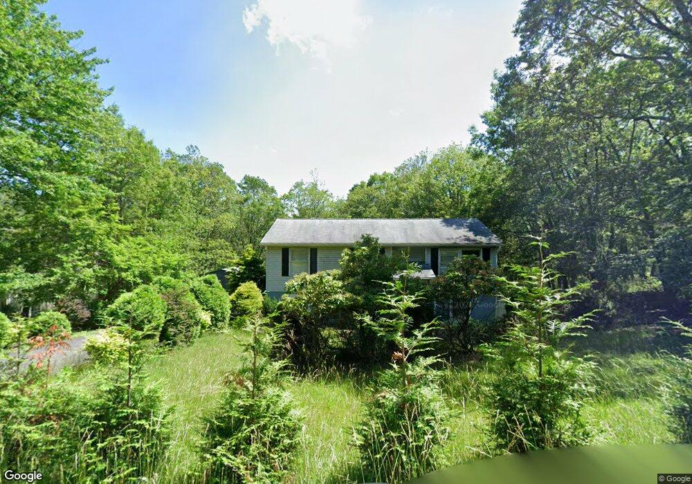
78 Arapahoe Rd Albrightsville, PA 18210
Estimated Value: $215,935 - $260,000
3
Beds
1
Bath
960
Sq Ft
$255/Sq Ft
Est. Value
About This Home
This home is located at 78 Arapahoe Rd, Albrightsville, PA 18210 and is currently estimated at $244,984, approximately $255 per square foot. 78 Arapahoe Rd is a home located in Carbon County with nearby schools including Jim Thorpe Area High School.
Ownership History
Date
Name
Owned For
Owner Type
Purchase Details
Closed on
Sep 28, 2007
Sold by
Koszalka Ryszard
Bought by
Brown Colville O and Brown Janice M
Current Estimated Value
Home Financials for this Owner
Home Financials are based on the most recent Mortgage that was taken out on this home.
Original Mortgage
$121,500
Outstanding Balance
$23,257
Interest Rate
7.95%
Mortgage Type
Adjustable Rate Mortgage/ARM
Estimated Equity
$221,727
Create a Home Valuation Report for This Property
The Home Valuation Report is an in-depth analysis detailing your home's value as well as a comparison with similar homes in the area
Home Values in the Area
Average Home Value in this Area
Purchase History
| Date | Buyer | Sale Price | Title Company |
|---|---|---|---|
| Brown Colville O | $135,000 | None Available |
Source: Public Records
Mortgage History
| Date | Status | Borrower | Loan Amount |
|---|---|---|---|
| Open | Brown Colville O | $121,500 |
Source: Public Records
Tax History Compared to Growth
Tax History
| Year | Tax Paid | Tax Assessment Tax Assessment Total Assessment is a certain percentage of the fair market value that is determined by local assessors to be the total taxable value of land and additions on the property. | Land | Improvement |
|---|---|---|---|---|
| 2025 | $2,595 | $42,188 | $3,950 | $38,238 |
| 2024 | $2,469 | $42,188 | $3,950 | $38,238 |
| 2023 | $2,437 | $42,188 | $3,950 | $38,238 |
| 2022 | $2,437 | $42,188 | $3,950 | $38,238 |
| 2021 | $2,437 | $42,188 | $3,950 | $38,238 |
| 2020 | $2,437 | $42,188 | $3,950 | $38,238 |
| 2019 | $2,353 | $42,188 | $3,950 | $38,238 |
| 2018 | $2,353 | $42,188 | $3,950 | $38,238 |
| 2017 | $2,353 | $42,188 | $3,950 | $38,238 |
| 2016 | -- | $42,188 | $3,950 | $38,238 |
| 2015 | -- | $42,188 | $3,950 | $38,238 |
| 2014 | -- | $42,188 | $3,950 | $38,238 |
Source: Public Records
Map
Nearby Homes
- 2329 Arapahoe Rd
- Lot# MV2329 Arapahoe Rd
- 55 Arapahoe Rd Unit MV2330
- Lot#MV2329 Arapahoe Rd
- 119 Seneca Rd
- 67 Seneca Rd
- 0 Iowa Rd Unit PM-135382
- 80 Spokane Rd
- 2490 Pawnee Trail
- 2546 Pawnee Trail
- 38 Spokane Rd
- 0 Mv2514 Pawnee Trail
- 0 Nosirrah Rd Unit PM-121356
- 2053 Nosirrah Rd
- 2111 Nosirrah Rd
- 2055 Nosirrah Rd
- 2237 Nosirrah Rd
- 18 Ute Trail
- 0 Ute Trail
- 26 Seneca Rd
- 84 Arapahoe Rd
- 72 Arapahoe Rd
- 73 Arapahoe Rd
- 88 Arapahoe Rd
- 2373 Iowa Rd
- 71 Iowa Rd
- 68 Arapahoe Rd
- Lot 2322 Arapahoe Road & Minisink Trail
- 0 Arapahoe Road & Minisink Trail Unit 10-6863
- 0 Arapahoe Road & Minisink Trail
- 67 Arapahoe Rd
- MV2374 Iowa Rd
- 2323 Arapahoe Rd
- LOT 2376 Iowa Rd
- 2376 Iowa Rd
- 86 Seneca Rd
- 91 Arapahoe Rd
- 2322 Arapahoe Rd
- 78 Seneca Rd
- 17 Iowa Rd