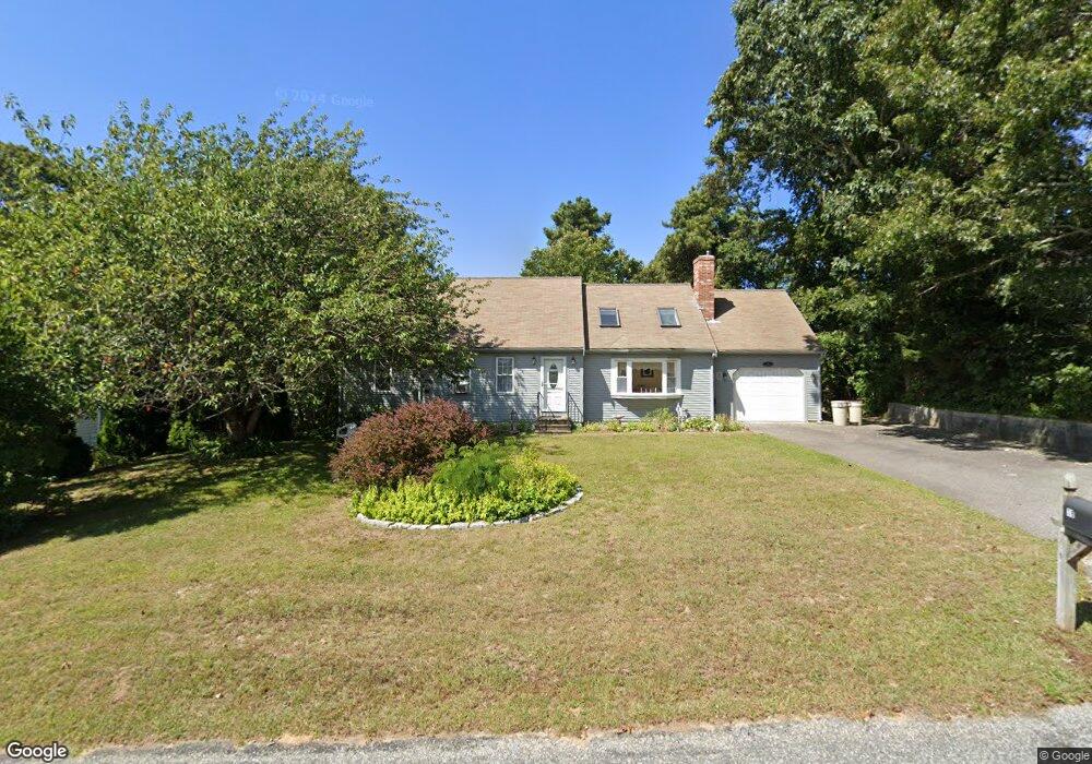
78 Barnacle Rd Yarmouth Port, MA 02675
Yarmouth Port NeighborhoodEstimated Value: $661,715 - $765,000
3
Beds
2
Baths
1,501
Sq Ft
$474/Sq Ft
Est. Value
About This Home
This home is located at 78 Barnacle Rd, Yarmouth Port, MA 02675 and is currently estimated at $711,429, approximately $473 per square foot. 78 Barnacle Rd is a home located in Barnstable County with nearby schools including Dennis-Yarmouth Regional High School, St. Pius X. School, and Trinity Christian Academy of Cape Cod.
Ownership History
Date
Name
Owned For
Owner Type
Purchase Details
Closed on
Jul 15, 2003
Sold by
Carron James R
Bought by
Guarino Marilyn R
Current Estimated Value
Purchase Details
Closed on
Apr 26, 2000
Sold by
Mccullom Douglas C
Bought by
Carron James R
Purchase Details
Closed on
Nov 6, 1998
Sold by
Jones Paul T
Bought by
Mccullom Douglas C
Purchase Details
Closed on
Mar 20, 1997
Sold by
Curnow Francis J and Curnow Gail M
Bought by
Jones Paul T
Create a Home Valuation Report for This Property
The Home Valuation Report is an in-depth analysis detailing your home's value as well as a comparison with similar homes in the area
Home Values in the Area
Average Home Value in this Area
Purchase History
| Date | Buyer | Sale Price | Title Company |
|---|---|---|---|
| Guarino Marilyn R | $325,000 | -- | |
| Carron James R | $177,500 | -- | |
| Mccullom Douglas C | $138,500 | -- | |
| Jones Paul T | $122,100 | -- |
Source: Public Records
Mortgage History
| Date | Status | Borrower | Loan Amount |
|---|---|---|---|
| Open | Jones Paul T | $167,000 | |
| Closed | Jones Paul T | $160,000 |
Source: Public Records
Tax History Compared to Growth
Tax History
| Year | Tax Paid | Tax Assessment Tax Assessment Total Assessment is a certain percentage of the fair market value that is determined by local assessors to be the total taxable value of land and additions on the property. | Land | Improvement |
|---|---|---|---|---|
| 2025 | $4,454 | $629,100 | $165,000 | $464,100 |
| 2024 | $4,205 | $569,800 | $143,500 | $426,300 |
| 2023 | $4,131 | $509,400 | $130,400 | $379,000 |
| 2022 | $3,911 | $426,000 | $124,500 | $301,500 |
| 2021 | $3,632 | $379,900 | $124,500 | $255,400 |
| 2020 | $3,595 | $359,500 | $131,800 | $227,700 |
| 2019 | $3,296 | $326,300 | $131,800 | $194,500 |
| 2018 | $3,131 | $304,300 | $109,800 | $194,500 |
| 2017 | $3,049 | $304,300 | $109,800 | $194,500 |
| 2016 | $2,949 | $295,500 | $101,000 | $194,500 |
| 2015 | $2,771 | $276,000 | $96,600 | $179,400 |
Source: Public Records
Map
Nearby Homes
- 86 Pompano Rd
- 1 Barnacle Rd
- 43 Canterbury Rd
- 44 Stratford Ln
- 25 Oak Glen
- 25 Oak Glen Village Unit 25
- 34 Kates Path
- 34 Kates Path Unit 34
- 17 Kates Path Unit A
- 228 Kates Path
- 64 Kates Path
- 2 Pine Grove
- 7 Forest Gate Unit 7
- 8 Rowley Ln
- 30 W Woods Cir Unit 30
- 30 W Woods
- 6 Nimble Hill Dr
- 50 John Hall Cartway
- 50 John Hall Cartway Unit 50
- 42 John Hall Cartway Unit 42