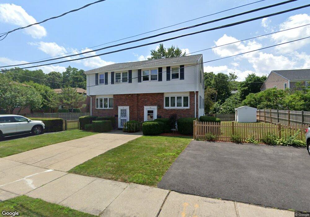
78 Bryon Rd Unit 80 Chestnut Hill, MA 02467
Oak Hill NeighborhoodEstimated Value: $688,000 - $847,000
3
Beds
3
Baths
1,360
Sq Ft
$567/Sq Ft
Est. Value
About This Home
This home is located at 78 Bryon Rd Unit 80, Chestnut Hill, MA 02467 and is currently estimated at $770,983, approximately $566 per square foot. 78 Bryon Rd Unit 80 is a home located in Middlesex County with nearby schools including Memorial Spaulding Elementary School, Oak Hill Middle School, and Newton South High School.
Ownership History
Date
Name
Owned For
Owner Type
Purchase Details
Closed on
Jun 16, 2020
Sold by
Lee Billy W and Lee Tai C
Bought by
Lee Thomas K and Lee Katie
Current Estimated Value
Home Financials for this Owner
Home Financials are based on the most recent Mortgage that was taken out on this home.
Original Mortgage
$400,000
Outstanding Balance
$354,569
Interest Rate
3.2%
Mortgage Type
New Conventional
Estimated Equity
$416,414
Create a Home Valuation Report for This Property
The Home Valuation Report is an in-depth analysis detailing your home's value as well as a comparison with similar homes in the area
Home Values in the Area
Average Home Value in this Area
Purchase History
| Date | Buyer | Sale Price | Title Company |
|---|---|---|---|
| Lee Thomas K | $572,000 | None Available |
Source: Public Records
Mortgage History
| Date | Status | Borrower | Loan Amount |
|---|---|---|---|
| Open | Lee Thomas K | $400,000 |
Source: Public Records
Tax History
| Year | Tax Paid | Tax Assessment Tax Assessment Total Assessment is a certain percentage of the fair market value that is determined by local assessors to be the total taxable value of land and additions on the property. | Land | Improvement |
|---|---|---|---|---|
| 2025 | $7,199 | $734,600 | $0 | $734,600 |
| 2024 | $6,961 | $713,200 | $0 | $713,200 |
| 2023 | $6,812 | $669,200 | $0 | $669,200 |
| 2022 | $6,704 | $637,300 | $0 | $637,300 |
| 2021 | $6,469 | $601,200 | $0 | $601,200 |
| 2020 | $6,277 | $601,200 | $0 | $601,200 |
| 2019 | $6,100 | $583,700 | $0 | $583,700 |
| 2018 | $4,789 | $564,800 | $0 | $564,800 |
| 2017 | $5,925 | $532,800 | $0 | $532,800 |
| 2016 | $5,666 | $497,900 | $0 | $497,900 |
| 2015 | $5,505 | $474,200 | $0 | $474,200 |
Source: Public Records
Map
Nearby Homes
- 66 Bryon Rd Unit 2
- 42 Bryon Rd Unit 6
- 64 Bryon Rd Unit 1
- 44 Broadlawn Park Unit 22
- 28 Westgate Rd Unit 3
- 17 Tirrell Crescent
- 1307 Lagrange St Unit 1307
- 16 Dorcar Rd
- 50-56 Broadlawn Park Unit 221
- 134 Rangeley Rd
- 923 Lagrange St
- 66 Brookline St
- 95 Beverly Rd
- 16 High Rock Terrace
- 100 Anderer Ln Unit 2
- 29 Clifton Rd
- 459 Dudley Rd
- 133 Oak Hill St
- 99 Baldpate Hill Rd
- 72 Wallis Rd
- 78 Bryon Rd Unit 80
- 286 Lagrange St Unit 288
- 288 Lagrange St Unit 288
- 292 Lagrange St
- 290 Lagrange St
- 292 Lagrange St Unit 292,1
- 292 Lagrange St Unit 292
- 76 Bryon Rd Unit 4
- 76 Bryon Rd Unit 3
- 76 Bryon Rd Unit 6,76
- 76 Bryon Rd Unit 2
- 76 Bryon Rd Unit 6
- 76 Bryon Rd Unit 5
- 60 Bryant Rd Unit 2
- 71 Bryon Rd Unit 71
- 71 Bryon Rd
- 71 Bryon Rd
- 69 Bryon Rd Unit 71
- 300 Lagrange St Unit 302
- 68 Bryon Rd Unit 5
Your Personal Tour Guide
Ask me questions while you tour the home.