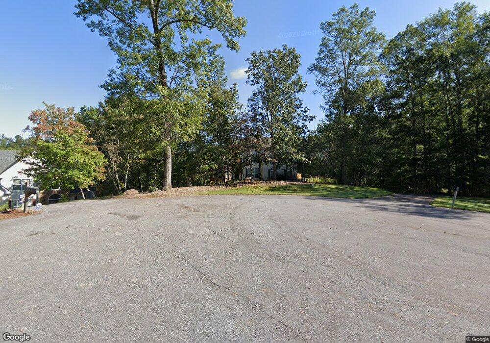
78 Buckeye Ridge W Dahlonega, GA 30533
Estimated Value: $529,254 - $687,000
--
Bed
3
Baths
2,702
Sq Ft
$224/Sq Ft
Est. Value
About This Home
This home is located at 78 Buckeye Ridge W, Dahlonega, GA 30533 and is currently estimated at $606,064, approximately $224 per square foot. 78 Buckeye Ridge W is a home located in Lumpkin County with nearby schools including Clay County Middle School and Lumpkin County High School.
Ownership History
Date
Name
Owned For
Owner Type
Purchase Details
Closed on
Jun 30, 2005
Sold by
R & M Capital Llc
Bought by
Durrance Matthew P
Current Estimated Value
Home Financials for this Owner
Home Financials are based on the most recent Mortgage that was taken out on this home.
Original Mortgage
$137,900
Outstanding Balance
$71,427
Interest Rate
5.54%
Mortgage Type
New Conventional
Estimated Equity
$534,637
Purchase Details
Closed on
Nov 17, 2004
Sold by
Gold Cove Development Corp
Bought by
R & M Capital Llc
Purchase Details
Closed on
Jun 30, 1995
Bought by
Gold Cove Development Corp
Create a Home Valuation Report for This Property
The Home Valuation Report is an in-depth analysis detailing your home's value as well as a comparison with similar homes in the area
Home Values in the Area
Average Home Value in this Area
Purchase History
| Date | Buyer | Sale Price | Title Company |
|---|---|---|---|
| Durrance Matthew P | $297,900 | -- | |
| R & M Capital Llc | $116,500 | -- | |
| Gold Cove Development Corp | -- | -- |
Source: Public Records
Mortgage History
| Date | Status | Borrower | Loan Amount |
|---|---|---|---|
| Open | Durrance Matthew P | $137,900 |
Source: Public Records
Tax History Compared to Growth
Tax History
| Year | Tax Paid | Tax Assessment Tax Assessment Total Assessment is a certain percentage of the fair market value that is determined by local assessors to be the total taxable value of land and additions on the property. | Land | Improvement |
|---|---|---|---|---|
| 2024 | $4,444 | $194,633 | $14,000 | $180,633 |
| 2023 | $3,860 | $183,661 | $14,000 | $169,661 |
| 2022 | $4,422 | $180,630 | $14,000 | $166,630 |
| 2021 | $3,891 | $153,987 | $13,060 | $140,927 |
| 2020 | $3,916 | $150,441 | $13,060 | $137,381 |
| 2019 | $3,952 | $150,441 | $13,060 | $137,381 |
| 2018 | $3,724 | $133,263 | $13,060 | $120,203 |
| 2017 | $3,635 | $127,649 | $13,060 | $114,589 |
| 2016 | $3,490 | $118,691 | $13,060 | $105,631 |
| 2015 | $3,107 | $118,691 | $13,060 | $105,631 |
| 2014 | $3,107 | $119,851 | $13,060 | $106,791 |
| 2013 | -- | $121,012 | $13,060 | $107,952 |
Source: Public Records
Map
Nearby Homes
- 668 Gold Cove Dr
- 0 Gold Crest Dr Unit 7623108
- 0 Gold Crest Dr Unit 10373986
- 201 Perkins Rd
- 205 Perkins Rd
- 2041 Long Branch Rd
- 2041 Long Branch Rd Unit TRACT 2A
- 245 Perkins Rd
- 0 Gold View Dr
- 72 Rustin Ridge Unit 276
- 58 Rustin Ridge Unit 278
- 42 Rustin Ridge Unit 285
- 85 Waterloo Dr
- 1376 Robinson Rd
- 0 Stamp Mill Dr
- 133 Stamp Mill Dr
- 134 Prospector Ridge
- 38 Cavender Run
- 1364 Birch River Dr
- 176 Stamp Mill Ln
- 110 Buckeye Ridge W
- 110 Buckeye Ridge W Unit 13
- 54 Buckeye Ridge W
- 54 Buckeye Ridge W Unit 16
- 54 Buckeye Ridge W Unit RIIDGE
- 54 Buckeye Ridge W Unit 2
- 95 Buckeye Ridge W
- 30 Buckeye Ridge W
- 55 Buckeye Ridge W
- 0 Buckeye Ridge W Unit 8710216
- 0 Buckeye Ridge W Unit 8627261
- W Buckeye Ridge W
- 520 Gold Cove Dr Unit 14
- 520 Gold Cove Dr
- 538 Gold Cove Dr
- 89 Buckeye Ridge W
- 396 Gold Cove Dr
- 23 Buckeye Ridge W
- 3 Buckeye Ridge E
- 425 Buckeye Ln S
