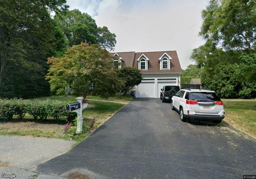
78 Carlgate Rd North Attleboro, MA 02760
North Attleboro NeighborhoodEstimated Value: $877,000 - $984,000
3
Beds
2
Baths
2,699
Sq Ft
$338/Sq Ft
Est. Value
About This Home
This home is located at 78 Carlgate Rd, North Attleboro, MA 02760 and is currently estimated at $912,350, approximately $338 per square foot. 78 Carlgate Rd is a home located in Bristol County with nearby schools including North Attleboro High School and St John The Evangelist School.
Ownership History
Date
Name
Owned For
Owner Type
Purchase Details
Closed on
Oct 31, 1996
Sold by
Whatmouth Corp
Bought by
Howad Allan D
Current Estimated Value
Home Financials for this Owner
Home Financials are based on the most recent Mortgage that was taken out on this home.
Original Mortgage
$145,000
Outstanding Balance
$14,265
Interest Rate
8.07%
Mortgage Type
Purchase Money Mortgage
Estimated Equity
$898,085
Create a Home Valuation Report for This Property
The Home Valuation Report is an in-depth analysis detailing your home's value as well as a comparison with similar homes in the area
Home Values in the Area
Average Home Value in this Area
Purchase History
| Date | Buyer | Sale Price | Title Company |
|---|---|---|---|
| Howad Allan D | $75,000 | -- |
Source: Public Records
Mortgage History
| Date | Status | Borrower | Loan Amount |
|---|---|---|---|
| Open | Howad Allan D | $55,000 | |
| Closed | Howad Allan D | $15,000 | |
| Open | Howad Allan D | $145,000 |
Source: Public Records
Tax History Compared to Growth
Tax History
| Year | Tax Paid | Tax Assessment Tax Assessment Total Assessment is a certain percentage of the fair market value that is determined by local assessors to be the total taxable value of land and additions on the property. | Land | Improvement |
|---|---|---|---|---|
| 2025 | $9,308 | $789,500 | $133,600 | $655,900 |
| 2024 | $8,967 | $777,000 | $140,300 | $636,700 |
| 2023 | $8,922 | $697,600 | $140,300 | $557,300 |
| 2022 | $8,247 | $592,000 | $153,600 | $438,400 |
| 2021 | $8,221 | $576,100 | $173,700 | $402,400 |
| 2020 | $7,488 | $521,800 | $167,000 | $354,800 |
| 2019 | $7,362 | $517,000 | $139,700 | $377,300 |
| 2018 | $6,502 | $487,400 | $139,700 | $347,700 |
| 2017 | $5,954 | $450,400 | $139,700 | $310,700 |
| 2016 | $6,114 | $462,500 | $162,000 | $300,500 |
| 2015 | $6,245 | $475,300 | $182,200 | $293,100 |
| 2014 | $5,812 | $439,000 | $148,000 | $291,000 |
Source: Public Records
Map
Nearby Homes
- 11 Primrose Terrace
- 82 Reservoir St
- 47 Glenfield Rd
- 31 Walnut Rd
- 121 E Washington St Unit 13
- 121 E Washington St Unit 11
- 121 E Washington St Unit 12
- 121 E Washington St Unit 8
- 121 E Washington St Unit 6
- 90 Walnut Rd
- 47 Juniper Rd Unit F9
- 30 Juniper Rd Unit 37
- 25 Gregory Way
- 49 Hoppin Hill Ave
- 1 Diamond St
- 130 E Washington St Unit 36
- 130 E Washington St Unit 84
- 130 E Washington St Unit 71
- 334 S Washington St
- 0 Anawan Rd
- 212 Colonial Rd
- 194 Colonial Rd
- 231 Colonial Rd
- 58 Carlgate Rd
- 234 Colonial Rd
- 221 Colonial Rd
- 84 John f Mason Rd
- 211 Colonial Rd
- 128 Eden Park Dr
- 23 Maddy Ln
- 23 Maddy Ln
- 118 Eden Park Dr
- 246 Colonial Rd
- 201 Colonial Rd
- 255 Colonial Rd
- 50 Carlgate Rd
- 8 Maddy Ln
- 45 Carlgate Rd
- 37 Maddy Ln
- 37 Maddy Ln