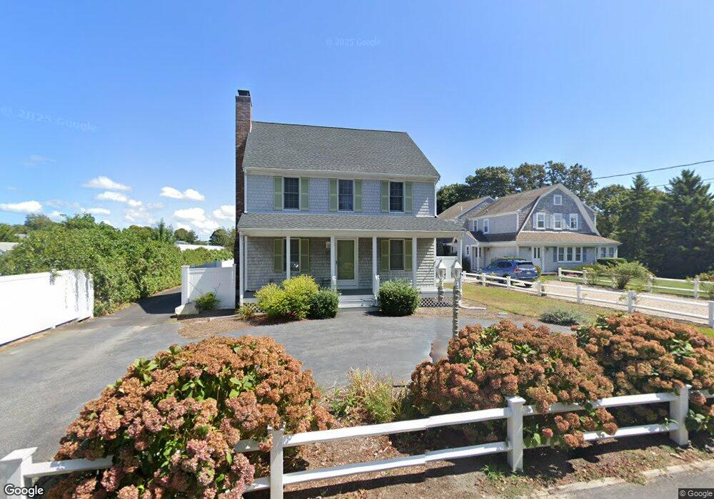
78 Depot St Dennis Port, MA 02639
Dennis Port NeighborhoodEstimated Value: $606,000 - $1,091,000
3
Beds
2
Baths
1,640
Sq Ft
$525/Sq Ft
Est. Value
About This Home
This home is located at 78 Depot St, Dennis Port, MA 02639 and is currently estimated at $860,401, approximately $524 per square foot. 78 Depot St is a home located in Barnstable County with nearby schools including Dennis-Yarmouth Regional High School and St. Pius X. School.
Ownership History
Date
Name
Owned For
Owner Type
Purchase Details
Closed on
Nov 7, 2022
Sold by
Stgelais Matthew A
Bought by
Murphy Caitlyn M and Murphy Laura A
Current Estimated Value
Purchase Details
Closed on
Feb 24, 2017
Sold by
Murphy Laura A
Bought by
Murphy Laura A and Saint Gelais Matthew A
Home Financials for this Owner
Home Financials are based on the most recent Mortgage that was taken out on this home.
Original Mortgage
$60,000
Interest Rate
4.2%
Mortgage Type
New Conventional
Purchase Details
Closed on
Feb 17, 2017
Sold by
Thomas M Murphy T
Bought by
Murphy Laura A
Home Financials for this Owner
Home Financials are based on the most recent Mortgage that was taken out on this home.
Original Mortgage
$60,000
Interest Rate
4.2%
Mortgage Type
New Conventional
Purchase Details
Closed on
May 31, 2012
Sold by
Murphy Thomas M and Murphy Laura A
Bought by
Thomas M Murphy T and Murphy Thomas M
Purchase Details
Closed on
Nov 27, 2006
Sold by
Murphy Laura A and Murphy Thomas M
Bought by
Laura A Murphy T and Murphy Laura A
Create a Home Valuation Report for This Property
The Home Valuation Report is an in-depth analysis detailing your home's value as well as a comparison with similar homes in the area
Home Values in the Area
Average Home Value in this Area
Purchase History
| Date | Buyer | Sale Price | Title Company |
|---|---|---|---|
| Murphy Caitlyn M | -- | None Available | |
| Murphy Laura A | -- | -- | |
| Murphy Laura A | -- | -- | |
| Thomas M Murphy T | -- | -- | |
| Laura A Murphy T | -- | -- |
Source: Public Records
Mortgage History
| Date | Status | Borrower | Loan Amount |
|---|---|---|---|
| Previous Owner | Murphy Laura A | $60,000 |
Source: Public Records
Tax History Compared to Growth
Tax History
| Year | Tax Paid | Tax Assessment Tax Assessment Total Assessment is a certain percentage of the fair market value that is determined by local assessors to be the total taxable value of land and additions on the property. | Land | Improvement |
|---|---|---|---|---|
| 2025 | $3,066 | $708,100 | $293,800 | $414,300 |
| 2024 | $3,134 | $714,000 | $282,600 | $431,400 |
| 2023 | $3,054 | $654,000 | $256,900 | $397,100 |
| 2022 | $2,812 | $502,100 | $202,500 | $299,600 |
| 2021 | $2,869 | $475,800 | $198,500 | $277,300 |
| 2020 | $2,747 | $450,400 | $198,500 | $251,900 |
| 2019 | $2,838 | $460,000 | $211,300 | $248,700 |
| 2018 | $2,663 | $420,000 | $201,100 | $218,900 |
| 2017 | $2,458 | $399,600 | $185,300 | $214,300 |
| 2016 | $2,334 | $357,400 | $174,700 | $182,700 |
| 2015 | $2,287 | $357,400 | $174,700 | $182,700 |
| 2014 | $2,282 | $359,400 | $164,100 | $195,300 |
Source: Public Records
Map
Nearby Homes
- 11 Ocean Park W
- 402 Old Wharf Rd
- 402 Old Wharf Rd
- 26 Manning Rd
- 9 Chase Ave Unit 6
- 405 Old Wharf Rd Unit B204
- 405 Old Wharf Rd Unit B204
- 102 Sea St
- 12 Cross St
- 159 Center St Unit 22
- 1 E Belmont Unit 630
- 22 Ferncliff Rd
- 1 Belmont Rd Unit 630
- 1 Belmont Rd Unit 513
- 73 Division St
- 37-A Beach Hills Rd
- 3 Fairbanks Dr
- 37 Beach Hills Rd
- 148 Belmont Rd
- 221 Upper County Rd Unit 2A
- 74 Depot St
- 73 Depot St Unit 73
- 73 Depot St Unit 73-75
- 73 Depot St
- 73 Depot St Unit 1
- 82 Depot St
- 70 Depot St
- 67 Depot St
- 63 Depot St
- 19 Eldridge Ln
- 75 Depot St
- 75 Depot St Unit 1
- 64 Depot St
- 14 Chase St
- 20 Chase St Unit B
- 20 Chase St Unit A
- 20 Chase St Unit 4
- 20 Chase St Unit 11
- 20 Chase St Unit 3
- 20 Chase St