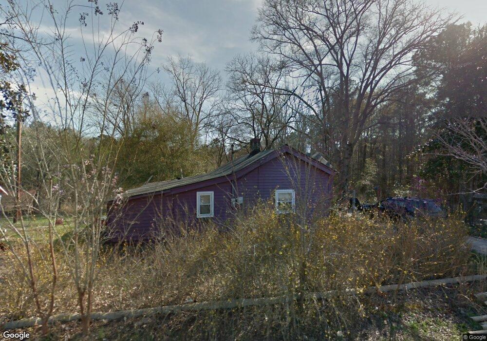
78 Freeman Rd Lagrange, GA 30240
Estimated Value: $141,000 - $181,000
3
Beds
1
Bath
1,258
Sq Ft
$124/Sq Ft
Est. Value
About This Home
This home is located at 78 Freeman Rd, Lagrange, GA 30240 and is currently estimated at $155,457, approximately $123 per square foot. 78 Freeman Rd is a home located in Troup County with nearby schools including Berta Weathersbee Elementary School, Long Cane Elementary School, and Whitesville Road Elementary School.
Ownership History
Date
Name
Owned For
Owner Type
Purchase Details
Closed on
Jul 18, 1996
Sold by
Sara Eady
Bought by
Brown Terry L and Brown Sandra L
Current Estimated Value
Purchase Details
Closed on
Jul 13, 1995
Sold by
Sara E Brown
Bought by
Sara Eady
Purchase Details
Closed on
Jul 17, 1972
Sold by
Msr Audrey N Freeman
Bought by
Sara E Brown
Purchase Details
Closed on
Jan 1, 1972
Bought by
Msr Audrey N Freeman
Purchase Details
Closed on
Jan 1, 1944
Create a Home Valuation Report for This Property
The Home Valuation Report is an in-depth analysis detailing your home's value as well as a comparison with similar homes in the area
Purchase History
| Date | Buyer | Sale Price | Title Company |
|---|---|---|---|
| Brown Terry L | $40,000 | -- | |
| Sara Eady | -- | -- | |
| Sara E Brown | -- | -- | |
| Msr Audrey N Freeman | -- | -- | |
| -- | -- | -- |
Source: Public Records
Tax History
| Year | Tax Paid | Tax Assessment Tax Assessment Total Assessment is a certain percentage of the fair market value that is determined by local assessors to be the total taxable value of land and additions on the property. | Land | Improvement |
|---|---|---|---|---|
| 2025 | $946 | $37,792 | $19,840 | $17,952 |
| 2024 | $889 | $34,592 | $19,840 | $14,752 |
| 2023 | $405 | $34,752 | $19,840 | $14,912 |
| 2022 | $897 | $34,112 | $19,840 | $14,272 |
| 2021 | $980 | $34,492 | $20,720 | $13,772 |
| 2020 | $980 | $34,492 | $20,720 | $13,772 |
| 2019 | $994 | $34,932 | $20,720 | $14,212 |
| 2018 | $914 | $30,296 | $16,560 | $13,736 |
| 2017 | $854 | $30,296 | $16,560 | $13,736 |
Source: Public Records
Map
Nearby Homes
- 22 Freeman Rd
- 3009 Old West Point Rd
- 288 Bradfield Dr
- 105 Redwood Dr
- 2239 Pegasus Pkwy
- 808 S Fling Rd
- 0 Bradfield Dr Unit 10568803
- 53 Horace Carter Rd
- 0 Glass Bridge Rd Unit 10679358
- 8 Horace Carter Rd
- 427 Fling Rd
- 509 Connie Dr
- 402 Ginger Cir
- 640 Hudson Rd
- 3 Reed Dr
- 112 Foxdale Dr
- 205 Grady St
- 117 Jones St
- 115 Jones St
- 0 Unit 10514554
- 87 Freeman Rd
- 73 Freeman Rd
- 99 Freeman Rd
- 111 Freeman Rd
- 123 Freeman Rd
- 135 Freeman Rd
- 993 Old West Point Rd
- 1013 Old West Point Rd
- 1001 Old West Point Rd
- 987 Old West Point Rd
- 975 Old West Point Rd
- 949 Old West Point Rd
- 963 Old West Point Rd
- 1000 Old West Point Rd
- 2940 Old West Point Rd
- 935 Old West Point Rd
- 2990 Old West Point Rd
- 3001 Old West Point Rd
- 3000 Old West Point Rd
- 903 Old West Point Rd
Your Personal Tour Guide
Ask me questions while you tour the home.