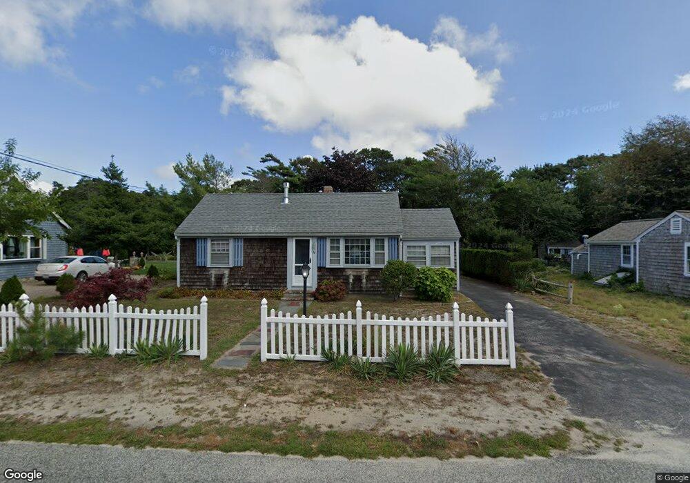
78 Glendon Rd Dennis Port, MA 02639
Dennis Port NeighborhoodEstimated Value: $511,000 - $654,000
2
Beds
1
Bath
800
Sq Ft
$724/Sq Ft
Est. Value
About This Home
This home is located at 78 Glendon Rd, Dennis Port, MA 02639 and is currently estimated at $579,295, approximately $724 per square foot. 78 Glendon Rd is a home located in Barnstable County with nearby schools including Dennis-Yarmouth Regional High School and St. Pius X. School.
Ownership History
Date
Name
Owned For
Owner Type
Purchase Details
Closed on
Jan 4, 1996
Sold by
Claupin Richard M and Claupin Esther H
Bought by
Donohoe Vincent K and Donohoe Bridget T
Current Estimated Value
Home Financials for this Owner
Home Financials are based on the most recent Mortgage that was taken out on this home.
Original Mortgage
$89,600
Outstanding Balance
$2,430
Interest Rate
7.34%
Mortgage Type
Purchase Money Mortgage
Estimated Equity
$576,865
Create a Home Valuation Report for This Property
The Home Valuation Report is an in-depth analysis detailing your home's value as well as a comparison with similar homes in the area
Home Values in the Area
Average Home Value in this Area
Purchase History
| Date | Buyer | Sale Price | Title Company |
|---|---|---|---|
| Donohoe Vincent K | $112,000 | -- | |
| Donohoe Vincent K | $112,000 | -- |
Source: Public Records
Mortgage History
| Date | Status | Borrower | Loan Amount |
|---|---|---|---|
| Open | Donohoe Vincent K | $89,600 | |
| Closed | Donohoe Vincent K | $89,600 |
Source: Public Records
Tax History Compared to Growth
Tax History
| Year | Tax Paid | Tax Assessment Tax Assessment Total Assessment is a certain percentage of the fair market value that is determined by local assessors to be the total taxable value of land and additions on the property. | Land | Improvement |
|---|---|---|---|---|
| 2025 | $2,535 | $585,500 | $311,200 | $274,300 |
| 2024 | $2,378 | $541,700 | $299,300 | $242,400 |
| 2023 | $2,308 | $494,300 | $272,100 | $222,200 |
| 2022 | $2,121 | $378,800 | $214,400 | $164,400 |
| 2021 | $4,436 | $344,400 | $210,200 | $134,200 |
| 2020 | $2,028 | $332,400 | $210,200 | $122,200 |
| 2019 | $4,200 | $333,100 | $223,800 | $109,300 |
| 2018 | $3,945 | $313,000 | $213,000 | $100,000 |
| 2017 | $1,803 | $293,200 | $196,200 | $97,000 |
| 2016 | $1,742 | $266,700 | $185,000 | $81,700 |
| 2015 | $1,613 | $252,000 | $170,300 | $81,700 |
| 2014 | $1,534 | $241,600 | $159,900 | $81,700 |
Source: Public Records
Map
Nearby Homes
- 154 Old Wharf Rd Unit 26
- 154 Old Wharf Rd Unit 14
- 217 Old Wharf Rd Unit 64
- 64 Beaten Rd
- 120 Old Wharf Rd Unit 11
- 112 Old Wharf Rd Unit E4
- 112 Old Wharf Rd Unit E1
- 241 Old Wharf Rd Unit 82
- 241 Old Wharf Rd Unit 127
- 241 Old Wharf Rd Unit 90
- 262 Old Wharf Rd Unit 67
- 262 Old Wharf Rd Unit 5
- 262 Old Wharf Rd Unit 5
- 262 Old Wharf Rd Unit 20
- 262 Old Wharf Rd Unit 87
- 37 Ocean Dr Unit 2
- 37 Beach Hills Rd
- 37-A Beach Hills Rd
- 31 Easy St
- 22 Ferncliff Rd
- 74 Glendon Rd
- 82 Glendon Rd
- 72 Glendon Rd
- 86 Glendon Rd
- 69 Glendon Rd
- 69 Glendon Rd Unit B
- 68 Glendon Rd
- 88 Glendon Rd
- 75 Glendon Rd Unit 75A
- 75 Glendon Rd
- 50-A Glendon Rd
- 69-A Glendon Rd
- 69A Glendon Rd
- 79 Glendon Rd
- 71 Glendon Rd
- 66 Glendon Rd
- 69-B Glendon Rd
- 69B Glendon Rd
- 81 Glendon Rd
- 0 Glendon Rd Unit 20510276