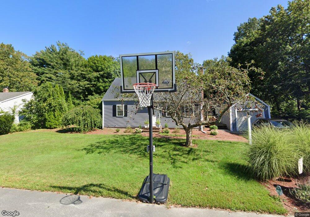
78 Hamilton Rd Wrentham, MA 02093
Estimated Value: $520,000 - $580,000
2
Beds
2
Baths
1,224
Sq Ft
$451/Sq Ft
Est. Value
About This Home
This home is located at 78 Hamilton Rd, Wrentham, MA 02093 and is currently estimated at $551,575, approximately $450 per square foot. 78 Hamilton Rd is a home located in Norfolk County with nearby schools including Delaney Elementary School, Charles E Roderick, and Discovery Daycare Center.
Ownership History
Date
Name
Owned For
Owner Type
Purchase Details
Closed on
Aug 12, 2002
Sold by
Mckenna Thomas J
Bought by
King Michael P and King Erin C
Current Estimated Value
Home Financials for this Owner
Home Financials are based on the most recent Mortgage that was taken out on this home.
Original Mortgage
$215,900
Interest Rate
6.58%
Mortgage Type
Purchase Money Mortgage
Purchase Details
Closed on
Aug 31, 1993
Sold by
Cynthia Horbaczewski Mark P and Cynthia Horbaczeewski
Bought by
Luca Andrea C
Home Financials for this Owner
Home Financials are based on the most recent Mortgage that was taken out on this home.
Original Mortgage
$133,450
Interest Rate
7.06%
Mortgage Type
Purchase Money Mortgage
Create a Home Valuation Report for This Property
The Home Valuation Report is an in-depth analysis detailing your home's value as well as a comparison with similar homes in the area
Purchase History
| Date | Buyer | Sale Price | Title Company |
|---|---|---|---|
| King Michael P | $269,900 | -- | |
| Luca Andrea C | $140,500 | -- |
Source: Public Records
Mortgage History
| Date | Status | Borrower | Loan Amount |
|---|---|---|---|
| Open | Luca Andrea C | $216,000 | |
| Closed | Luca Andrea C | $40,500 | |
| Closed | King Michael P | $215,900 | |
| Previous Owner | Luca Andrea C | $133,450 |
Source: Public Records
Tax History
| Year | Tax Paid | Tax Assessment Tax Assessment Total Assessment is a certain percentage of the fair market value that is determined by local assessors to be the total taxable value of land and additions on the property. | Land | Improvement |
|---|---|---|---|---|
| 2025 | $6,021 | $519,500 | $289,600 | $229,900 |
| 2024 | $5,639 | $469,900 | $289,600 | $180,300 |
| 2023 | $5,321 | $421,600 | $263,300 | $158,300 |
| 2022 | $4,584 | $335,300 | $202,700 | $132,600 |
| 2021 | $4,767 | $338,800 | $212,400 | $126,400 |
| 2020 | $4,556 | $319,700 | $191,500 | $128,200 |
| 2019 | $4,220 | $298,900 | $176,800 | $122,100 |
| 2018 | $4,330 | $304,100 | $176,900 | $127,200 |
| 2017 | $4,103 | $287,900 | $173,500 | $114,400 |
| 2016 | $4,030 | $282,200 | $168,500 | $113,700 |
| 2015 | $3,926 | $262,100 | $162,000 | $100,100 |
| 2014 | $3,665 | $239,400 | $142,800 | $96,600 |
Source: Public Records
Map
Nearby Homes
- 15 Tilting Rock Rd
- 10 Nature View Dr
- 15 Nature View Dr
- 282 Thurston St
- 576 Dedham St
- 1 Weber Farm Rd Unit 1
- 4 Weber Farm Rd Unit 4
- 6 Weber Farm Rd Unit 6
- 11 Weber Farm Rd Unit 11
- 135 Creek St Unit 2
- 8 Weber Farm Rd Unit 8
- 483 Thurston St
- 30 Weber Farm Rd Unit 30
- 3 Earle Stewart Ln
- 2 Earle Stewart Ln
- 25 Foxboro Rd
- 12 Earle Stewart Ln
- 10 Earle Stewart Ln Unit Lot 5
- 500 Franklin St
- 9 Sharon Ave
- 86 Hamilton Rd
- 70 Hamilton Rd
- 75 Hamilton Rd
- 67 Hamilton Rd
- 83 Hamilton Rd
- 94 Hamilton Rd
- 62 Hamilton Rd
- 93 Hamilton Rd
- 35 Trafalgar Square
- 59 Hamilton Rd
- 54 Hamilton Rd
- 102 Hamilton Rd
- 101 Hamilton Rd
- 25 Trafalgar Square
- 86 Woodland Rd
- 45 Trafalgar Square
- 49 Hamilton Rd
- 80 Woodland Rd
- 46 Hamilton Rd
- 15 Trafalgar Square
Your Personal Tour Guide
Ask me questions while you tour the home.