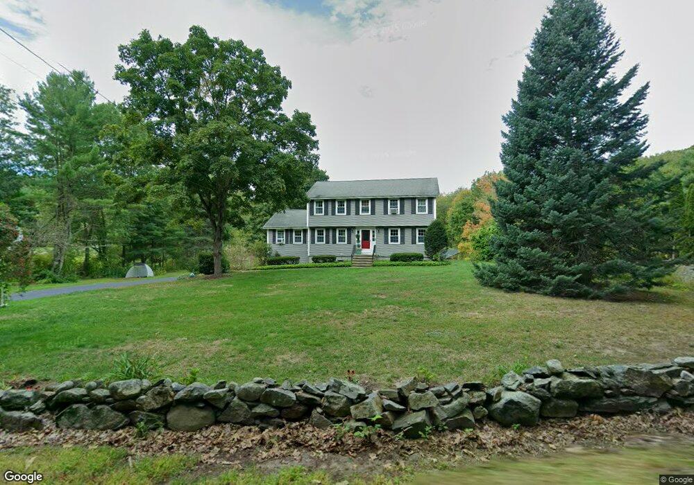
78 High St Dunstable, MA 01827
Estimated Value: $681,068 - $770,000
4
Beds
3
Baths
2,072
Sq Ft
$354/Sq Ft
Est. Value
About This Home
This home is located at 78 High St, Dunstable, MA 01827 and is currently estimated at $732,767, approximately $353 per square foot. 78 High St is a home located in Middlesex County with nearby schools including Groton Dunstable Regional High School, World Academy, and Academy of Notre Dame - Upper School.
Ownership History
Date
Name
Owned For
Owner Type
Purchase Details
Closed on
Apr 17, 2015
Sold by
Lewis Mark S
Bought by
Callahan Valerie M and Callahan James J
Current Estimated Value
Home Financials for this Owner
Home Financials are based on the most recent Mortgage that was taken out on this home.
Original Mortgage
$290,400
Outstanding Balance
$220,135
Interest Rate
3.72%
Mortgage Type
New Conventional
Estimated Equity
$512,632
Purchase Details
Closed on
Dec 21, 2012
Sold by
Lewis Mark S and Lewis Deborah J
Bought by
Lewis Mark S
Home Financials for this Owner
Home Financials are based on the most recent Mortgage that was taken out on this home.
Original Mortgage
$220,000
Interest Rate
3.43%
Mortgage Type
New Conventional
Purchase Details
Closed on
Oct 22, 1999
Sold by
Faubel Kenneth T and Faubel Valerie E
Bought by
Lewis Mark S and Lewis Deborah J
Create a Home Valuation Report for This Property
The Home Valuation Report is an in-depth analysis detailing your home's value as well as a comparison with similar homes in the area
Home Values in the Area
Average Home Value in this Area
Purchase History
| Date | Buyer | Sale Price | Title Company |
|---|---|---|---|
| Callahan Valerie M | $363,000 | -- | |
| Lewis Mark S | $160,000 | -- | |
| Lewis Mark S | $160,000 | -- | |
| Lewis Mark S | $260,500 | -- |
Source: Public Records
Mortgage History
| Date | Status | Borrower | Loan Amount |
|---|---|---|---|
| Open | Callahan Valerie M | $290,400 | |
| Previous Owner | Lewis Mark S | $220,000 | |
| Previous Owner | Lewis Mark S | $90,000 | |
| Previous Owner | Lewis Mark S | $205,000 |
Source: Public Records
Tax History
| Year | Tax Paid | Tax Assessment Tax Assessment Total Assessment is a certain percentage of the fair market value that is determined by local assessors to be the total taxable value of land and additions on the property. | Land | Improvement |
|---|---|---|---|---|
| 2025 | $8,161 | $593,500 | $226,800 | $366,700 |
| 2024 | $7,746 | $554,900 | $207,200 | $347,700 |
| 2023 | $7,460 | $498,300 | $207,200 | $291,100 |
| 2022 | $7,018 | $460,200 | $207,200 | $253,000 |
| 2021 | $6,892 | $420,000 | $189,300 | $230,700 |
| 2020 | $6,920 | $410,900 | $189,300 | $221,600 |
| 2019 | $6,800 | $398,600 | $189,300 | $209,300 |
| 2018 | $6,702 | $382,100 | $187,600 | $194,500 |
| 2017 | $6,427 | $377,600 | $187,600 | $190,000 |
| 2016 | $6,085 | $367,700 | $179,400 | $188,300 |
| 2015 | $5,784 | $345,700 | $151,700 | $194,000 |
| 2014 | $5,452 | $345,700 | $151,700 | $194,000 |
Source: Public Records
Map
Nearby Homes
- 0 Lowell St
- 62 Brook St
- 319 Pleasant St
- 153 Off Pond St
- 6 Green Heron Ln Unit U22
- 38 Georgetown Dr
- 11 Lojko Dr
- 141 Ridge Rd
- 20 Georgetown Dr
- 58 Wilderness Dr
- 1 Doucet Ave
- 77 Wilderness Dr
- 65 Wilderness Dr
- 1 Wilderness Dr
- 2 Wilderness Dr
- 4 Wilderness Dr
- 79 Wilderness Dr
- 8 Wilderness Dr
- 3 Wilderness Dr
- 7 Wilderness Dr
Your Personal Tour Guide
Ask me questions while you tour the home.