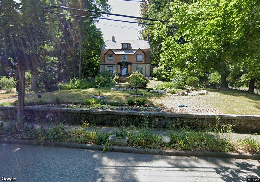
78 Hull St Newtonville, MA 02460
Newtonville NeighborhoodEstimated Value: $1,904,000 - $2,574,000
5
Beds
4
Baths
3,420
Sq Ft
$667/Sq Ft
Est. Value
About This Home
This home is located at 78 Hull St, Newtonville, MA 02460 and is currently estimated at $2,280,875, approximately $666 per square foot. 78 Hull St is a home located in Middlesex County with nearby schools including Cabot Elementary School, F.A. Day Middle School, and Newton North High School.
Ownership History
Date
Name
Owned For
Owner Type
Purchase Details
Closed on
Jul 7, 2011
Sold by
Gordon-Sheehan Ft and Gordon Mark R
Bought by
Gordon Richard D and Hinton Carmelita
Current Estimated Value
Home Financials for this Owner
Home Financials are based on the most recent Mortgage that was taken out on this home.
Original Mortgage
$523,750
Outstanding Balance
$361,851
Interest Rate
4.6%
Mortgage Type
Purchase Money Mortgage
Estimated Equity
$1,919,024
Purchase Details
Closed on
Jul 19, 1994
Sold by
Phillips Ervin and Phillips Elizabeth
Bought by
Simons Patricia M
Home Financials for this Owner
Home Financials are based on the most recent Mortgage that was taken out on this home.
Original Mortgage
$318,400
Interest Rate
8.51%
Mortgage Type
Purchase Money Mortgage
Create a Home Valuation Report for This Property
The Home Valuation Report is an in-depth analysis detailing your home's value as well as a comparison with similar homes in the area
Home Values in the Area
Average Home Value in this Area
Purchase History
| Date | Buyer | Sale Price | Title Company |
|---|---|---|---|
| Gordon Richard D | -- | -- | |
| Simons Patricia M | $414,500 | -- |
Source: Public Records
Mortgage History
| Date | Status | Borrower | Loan Amount |
|---|---|---|---|
| Open | Gordon Richard D | $523,750 | |
| Closed | Gordon Richard D | $75,000 | |
| Previous Owner | Simons Patricia M | $595,000 | |
| Previous Owner | Simons Patricia M | $486,750 | |
| Previous Owner | Simons Patricia M | $318,400 |
Source: Public Records
Tax History Compared to Growth
Tax History
| Year | Tax Paid | Tax Assessment Tax Assessment Total Assessment is a certain percentage of the fair market value that is determined by local assessors to be the total taxable value of land and additions on the property. | Land | Improvement |
|---|---|---|---|---|
| 2025 | $18,356 | $1,873,100 | $1,135,100 | $738,000 |
| 2024 | $17,749 | $1,818,500 | $1,102,000 | $716,500 |
| 2023 | $17,024 | $1,672,300 | $868,000 | $804,300 |
| 2022 | $15,702 | $1,492,600 | $803,700 | $688,900 |
| 2021 | $14,686 | $1,364,900 | $758,200 | $606,700 |
| 2020 | $14,250 | $1,364,900 | $758,200 | $606,700 |
| 2019 | $13,847 | $1,325,100 | $736,100 | $589,000 |
| 2018 | $13,502 | $1,247,900 | $655,100 | $592,800 |
| 2017 | $13,092 | $1,177,300 | $618,000 | $559,300 |
| 2016 | $12,521 | $1,100,300 | $577,600 | $522,700 |
| 2015 | $11,939 | $1,028,300 | $539,800 | $488,500 |
Source: Public Records
Map
Nearby Homes
- 61 Lakeview Ave
- 22 Walnut Place Unit 1
- 300 Cabot St
- 34 Morton Rd
- 123-125 Mount Vernon St
- 123 Mount Vernon St Unit 2
- 887 Commonwealth Ave
- 97 Valentine St
- 935 Washington St Unit 8
- 911 Washington St
- 957 Washington St Unit 1
- 10 Washington Park
- 10 Washington Park Unit 2
- 10 Washington Park Unit 1
- 127-129 Withington Rd Unit 1
- 110 Harvard St Unit A
- 3 Cedar St
- 308 Prince St
- 44 Blake St Unit 2
- 12 Wiswall St
- 70 Hull St
- 20 Beaumont Ave
- 20 Prospect Park
- 90 Hull St
- 15 Beaumont Ave
- 60 Hull St
- 24 Prospect Park
- 21 Beaumont Ave
- 98 Hull St Unit 98
- 100 Hull St Unit 2
- 100 Hull St Unit 1
- 100 Hull St Unit 100
- 54 Hull St
- 54 Hull St
- 21 Prospect Park
- 104 Hull St
- 40 Beaumont Ave
- 34 Prospect Park
- 398 Lowell Ave
- 404 Lowell Ave