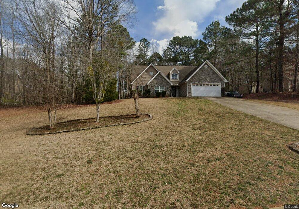
78 Kimbell Farm Dr Locust Grove, GA 30248
Estimated Value: $302,000 - $339,000
3
Beds
2
Baths
1,700
Sq Ft
$184/Sq Ft
Est. Value
About This Home
This home is located at 78 Kimbell Farm Dr, Locust Grove, GA 30248 and is currently estimated at $312,876, approximately $184 per square foot. 78 Kimbell Farm Dr is a home located in Henry County with nearby schools including Unity Grove Elementary School, Locust Grove Middle School, and Locust Grove High School.
Ownership History
Date
Name
Owned For
Owner Type
Purchase Details
Closed on
Aug 16, 2007
Sold by
Houston Robin D
Bought by
Vanwinkle James C and Van Winkle Cynthia L
Current Estimated Value
Home Financials for this Owner
Home Financials are based on the most recent Mortgage that was taken out on this home.
Original Mortgage
$33,800
Interest Rate
6.34%
Mortgage Type
Unknown
Purchase Details
Closed on
Sep 10, 2004
Sold by
Suburban Builders Inc
Bought by
Houston Robin D
Home Financials for this Owner
Home Financials are based on the most recent Mortgage that was taken out on this home.
Original Mortgage
$115,900
Interest Rate
5.87%
Mortgage Type
New Conventional
Create a Home Valuation Report for This Property
The Home Valuation Report is an in-depth analysis detailing your home's value as well as a comparison with similar homes in the area
Home Values in the Area
Average Home Value in this Area
Purchase History
| Date | Buyer | Sale Price | Title Company |
|---|---|---|---|
| Vanwinkle James C | $169,000 | -- | |
| Houston Robin D | $144,900 | -- |
Source: Public Records
Mortgage History
| Date | Status | Borrower | Loan Amount |
|---|---|---|---|
| Closed | Vanwinkle James C | $33,800 | |
| Open | Vanwinkle James C | $135,200 | |
| Previous Owner | Houston Robin D | $115,900 |
Source: Public Records
Tax History Compared to Growth
Tax History
| Year | Tax Paid | Tax Assessment Tax Assessment Total Assessment is a certain percentage of the fair market value that is determined by local assessors to be the total taxable value of land and additions on the property. | Land | Improvement |
|---|---|---|---|---|
| 2025 | $748 | $105,120 | $16,000 | $89,120 |
| 2024 | $748 | $123,960 | $16,000 | $107,960 |
| 2023 | $484 | $104,800 | $14,800 | $90,000 |
| 2022 | $629 | $93,560 | $14,800 | $78,760 |
| 2021 | $629 | $74,560 | $14,800 | $59,760 |
| 2020 | $629 | $69,440 | $12,000 | $57,440 |
| 2019 | $629 | $63,400 | $12,000 | $51,400 |
| 2018 | $1,633 | $61,240 | $10,800 | $50,440 |
| 2016 | $1,830 | $53,720 | $10,000 | $43,720 |
| 2015 | $1,625 | $47,360 | $10,000 | $37,360 |
| 2014 | $1,543 | $44,920 | $10,000 | $34,920 |
Source: Public Records
Map
Nearby Homes
- 604 Onieda Dr
- 305 Annie Ln Unit 2
- 601 Amerigo Ct
- 165 Caraway Rd
- 218 Baxter Ln
- 521 Deadwood Trail
- 705 Seabolt Rd
- 678 Seabolt Rd
- 230 Leguin Mill Rd
- 108 Caraway Rd
- 1000 Coan Dr
- 1850 Old Jackson Rd
- 1627 Leguin Mill Rd
- 143 Kimbell Farm Dr
- 1680 Leguin Mill Rd
- 100 Harbin Trail
- 943 Colvin Dr
- 1126 Old Jackson Rd
- 121, 125, 129 Case Dr
- 560 Coan Dr
- 80 Kimbell Farm Dr
- 74 Kimbell Farm Dr
- 707 Emertrey Dr Unit 540
- 707 Emertrey Dr
- 709 Emertrey Dr
- 81 Kimbell Farm Dr Unit 514
- 81 Kimbell Farm Dr
- 81 Kimbell Farm Dr
- 81 Kimbell Farm Dr Unit 81
- 703 Emertrey Dr
- 705 Emertrey Dr
- 79 Kimbell Farm Dr Unit 5
- 68 Kimbell Farm Dr
- 73 Kimbell Farm Dr
- 77 Kimbell Farm Dr
- 711 Emertrey Dr
- 711 Emertrey Dr Unit 538
- 71 Kimbell Farm Dr
- 75 Kimbell Farm Dr
- 712 Emertrey Dr