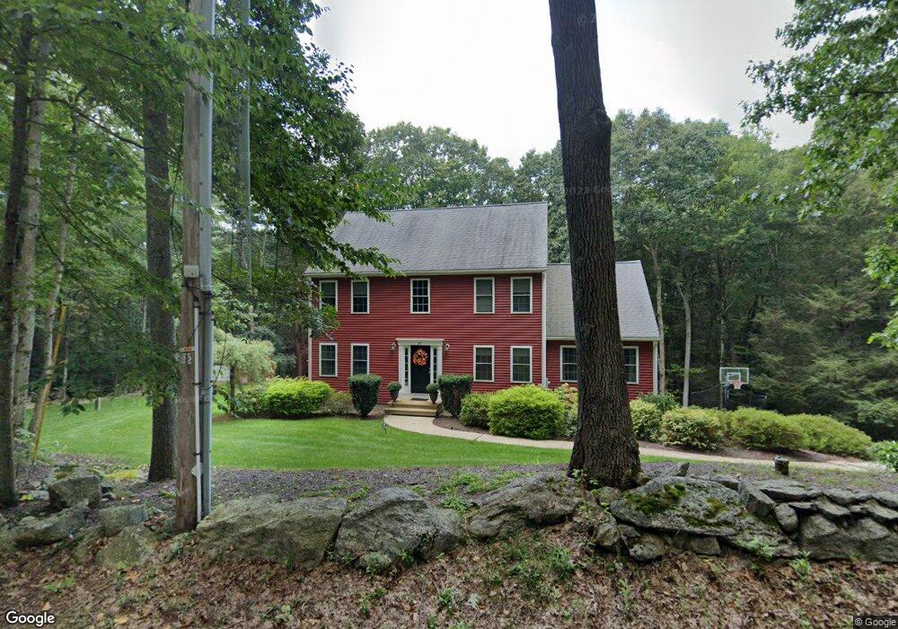
78 King Rd Charlton, MA 01507
Estimated Value: $550,661 - $647,000
3
Beds
3
Baths
2,104
Sq Ft
$290/Sq Ft
Est. Value
About This Home
This home is located at 78 King Rd, Charlton, MA 01507 and is currently estimated at $610,915, approximately $290 per square foot. 78 King Rd is a home located in Worcester County with nearby schools including Shepherd Hill Regional High School and ViewPoint Christian Academy.
Ownership History
Date
Name
Owned For
Owner Type
Purchase Details
Closed on
Feb 22, 2008
Sold by
Geshelin Jason R and Geshelin Lori A
Bought by
Dono Christopher N and Dono Tara A
Current Estimated Value
Home Financials for this Owner
Home Financials are based on the most recent Mortgage that was taken out on this home.
Original Mortgage
$339,625
Outstanding Balance
$212,426
Interest Rate
5.9%
Mortgage Type
Purchase Money Mortgage
Estimated Equity
$398,489
Purchase Details
Closed on
Mar 8, 2005
Sold by
Fiver Homes Inc
Bought by
Geshelin Jason R and Geshelin Lori A
Home Financials for this Owner
Home Financials are based on the most recent Mortgage that was taken out on this home.
Original Mortgage
$297,000
Interest Rate
5.66%
Mortgage Type
Purchase Money Mortgage
Create a Home Valuation Report for This Property
The Home Valuation Report is an in-depth analysis detailing your home's value as well as a comparison with similar homes in the area
Home Values in the Area
Average Home Value in this Area
Purchase History
| Date | Buyer | Sale Price | Title Company |
|---|---|---|---|
| Dono Christopher N | $357,500 | -- | |
| Dono Christopher N | $357,500 | -- | |
| Geshelin Jason R | $330,000 | -- | |
| Geshelin Jason R | $330,000 | -- | |
| Fiver Homes Inc | -- | -- |
Source: Public Records
Mortgage History
| Date | Status | Borrower | Loan Amount |
|---|---|---|---|
| Open | Dono Christopher N | $339,625 | |
| Closed | Geshelin Jason R | $339,625 | |
| Previous Owner | Geshelin Jason R | $297,000 |
Source: Public Records
Tax History Compared to Growth
Tax History
| Year | Tax Paid | Tax Assessment Tax Assessment Total Assessment is a certain percentage of the fair market value that is determined by local assessors to be the total taxable value of land and additions on the property. | Land | Improvement |
|---|---|---|---|---|
| 2025 | $5,101 | $458,300 | $81,200 | $377,100 |
| 2024 | $4,925 | $434,300 | $78,200 | $356,100 |
| 2023 | $4,795 | $394,000 | $75,100 | $318,900 |
| 2022 | $5,058 | $380,600 | $73,900 | $306,700 |
| 2021 | $4,973 | $331,300 | $72,100 | $259,200 |
| 2020 | $4,860 | $325,300 | $66,100 | $259,200 |
| 2019 | $4,805 | $325,300 | $66,100 | $259,200 |
| 2018 | $4,392 | $325,300 | $66,100 | $259,200 |
| 2017 | $4,155 | $294,700 | $60,100 | $234,600 |
| 2016 | $4,061 | $294,700 | $60,100 | $234,600 |
| 2015 | $3,955 | $294,700 | $60,100 | $234,600 |
| 2014 | $3,850 | $304,100 | $64,500 | $239,600 |
Source: Public Records
Map
Nearby Homes
- 74 King Rd
- 6 Blackwell Dr
- 60 Saundersdale Rd
- 16 Sandersdale Rd
- 0 Sandersdale Rd
- 9 Piehl Dr
- 280 Dudley Southbridge Rd
- 92 Haggerty Rd
- 93 Haggerty Rd
- 76 Number 6 Schoolhouse Rd
- 0 Old Dudley Rd
- 325 Ashland Ave Unit 12
- 768 Ashland Ave
- 11 Lempicki Rd
- 2 W Dudley Rd
- 43 Ramshorn Rd
- 0 Blood Rd
- 27 Douty St
- 0 Old North Woodstock Rd
- 264 Dresser Hill Rd