Estimated Value: $1,197,365 - $1,445,000
4
Beds
3
Baths
3,197
Sq Ft
$418/Sq Ft
Est. Value
About This Home
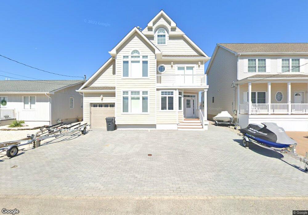
This home is located at 78 Longpoint Dr, Brick, NJ 08723 and is currently estimated at $1,337,841, approximately $418 per square foot. 78 Longpoint Dr is a home located in Ocean County with nearby schools including Osbornville Elementary School, Lake Riviera Middle School, and Brick Township High School.
Ownership History
Date
Name
Owned For
Owner Type
Purchase Details
Closed on
Jan 24, 2006
Sold by
Manisera Conrad
Bought by
Marovitz Steven J and Marovitz Theresa M
Current Estimated Value
Home Financials for this Owner
Home Financials are based on the most recent Mortgage that was taken out on this home.
Original Mortgage
$500,000
Interest Rate
5.83%
Mortgage Type
New Conventional
Purchase Details
Closed on
Jun 4, 2003
Sold by
Nye Deborah L
Bought by
Manisera Conrad
Home Financials for this Owner
Home Financials are based on the most recent Mortgage that was taken out on this home.
Original Mortgage
$240,000
Interest Rate
5.71%
Purchase Details
Closed on
Feb 3, 1999
Sold by
Nye Jean
Bought by
Vernon Susan Nye and Nye Deborah
Purchase Details
Closed on
Feb 20, 1998
Sold by
Nye Jean
Bought by
Vernon Susan Nye and Nye Deborah
Purchase Details
Closed on
Jul 6, 1994
Sold by
Ge Capital Asset Mtg
Bought by
Bernstein Stanley
Home Financials for this Owner
Home Financials are based on the most recent Mortgage that was taken out on this home.
Original Mortgage
$212,000
Interest Rate
8.19%
Create a Home Valuation Report for This Property
The Home Valuation Report is an in-depth analysis detailing your home's value as well as a comparison with similar homes in the area
Home Values in the Area
Average Home Value in this Area
Purchase History
| Date | Buyer | Sale Price | Title Company |
|---|---|---|---|
| Marovitz Steven J | $875,000 | None Available | |
| Manisera Conrad | $310,000 | -- | |
| Vernon Susan Nye | -- | -- | |
| Vernon Susan Nye | -- | -- | |
| Bernstein Stanley | $265,000 | -- |
Source: Public Records
Mortgage History
| Date | Status | Borrower | Loan Amount |
|---|---|---|---|
| Closed | Marovitz Steven J | $500,000 | |
| Previous Owner | Manisera Conrad | $240,000 | |
| Previous Owner | Bernstein Stanley | $212,000 |
Source: Public Records
Tax History
| Year | Tax Paid | Tax Assessment Tax Assessment Total Assessment is a certain percentage of the fair market value that is determined by local assessors to be the total taxable value of land and additions on the property. | Land | Improvement |
|---|---|---|---|---|
| 2025 | $15,813 | $612,200 | $240,000 | $372,200 |
| 2024 | $15,030 | $612,200 | $240,000 | $372,200 |
Source: Public Records
Map
Nearby Homes
- 80 Longpoint Dr
- 76 Longpoint Dr
- 82 Longpoint Dr
- 74 Longpoint Dr
- 72 Longpoint Dr
- 75 Longpoint Dr
- 84 Longpoint Dr
- 79 Longpoint Dr
- 37 Halsey Dr
- 35 Halsey Dr
- 73 Longpoint Dr
- 39 Halsey Dr
- 70 Longpoint Dr
- 31 Halsey Dr
- 83 Longpoint Dr
- 41 Halsey Dr
- 67 Longpoint Dr
- 29 Halsey Dr
- 68 Longpoint Dr
- 86 Longpoint Dr
Your Personal Tour Guide
Ask me questions while you tour the home.