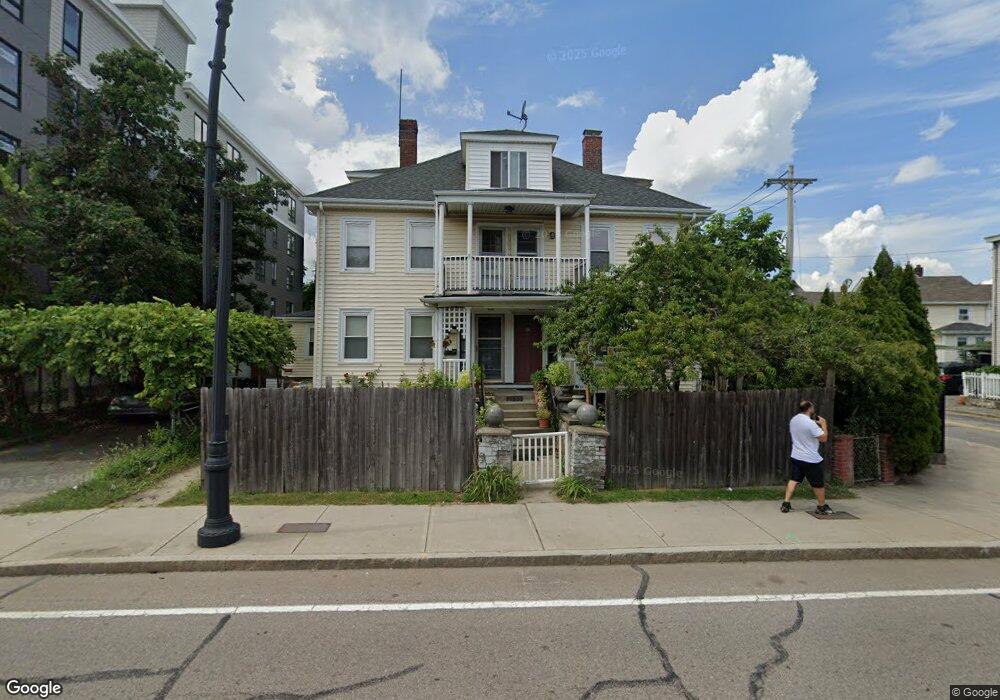
78 Mcgrath Hwy Unit B Quincy, MA 02169
Quincy Center NeighborhoodEstimated Value: $543,000 - $610,000
3
Beds
2
Baths
1,539
Sq Ft
$373/Sq Ft
Est. Value
About This Home
This home is located at 78 Mcgrath Hwy Unit B, Quincy, MA 02169 and is currently estimated at $574,635, approximately $373 per square foot. 78 Mcgrath Hwy Unit B is a home located in Norfolk County with nearby schools including Point Webster Middle School, Clifford H. Marshall Elementary School, and Quincy High School.
Ownership History
Date
Name
Owned For
Owner Type
Purchase Details
Closed on
Oct 18, 2013
Sold by
Mico Agron and Mico Eriselda
Bought by
Mico Agron and Mico Gjenovefa
Current Estimated Value
Home Financials for this Owner
Home Financials are based on the most recent Mortgage that was taken out on this home.
Original Mortgage
$200,800
Outstanding Balance
$150,904
Interest Rate
4.58%
Mortgage Type
New Conventional
Estimated Equity
$423,731
Purchase Details
Closed on
Jul 18, 2008
Sold by
Mico Agron
Bought by
Mico Agron and Mico Eriselda
Purchase Details
Closed on
Apr 30, 2007
Sold by
Prendi Ervin
Bought by
Mico Agron
Home Financials for this Owner
Home Financials are based on the most recent Mortgage that was taken out on this home.
Original Mortgage
$206,250
Interest Rate
6.18%
Mortgage Type
Purchase Money Mortgage
Create a Home Valuation Report for This Property
The Home Valuation Report is an in-depth analysis detailing your home's value as well as a comparison with similar homes in the area
Home Values in the Area
Average Home Value in this Area
Purchase History
| Date | Buyer | Sale Price | Title Company |
|---|---|---|---|
| Mico Agron | -- | -- | |
| Mico Agron | -- | -- | |
| Mico Agron | -- | -- | |
| Mico Agron | -- | -- | |
| Mico Agron | -- | -- | |
| Mico Agron | $275,000 | -- | |
| Mico Agron | $275,000 | -- |
Source: Public Records
Mortgage History
| Date | Status | Borrower | Loan Amount |
|---|---|---|---|
| Open | Mico Agron | $200,800 | |
| Closed | Mico Agron | $200,800 | |
| Previous Owner | Mico Agron | $206,250 |
Source: Public Records
Tax History Compared to Growth
Tax History
| Year | Tax Paid | Tax Assessment Tax Assessment Total Assessment is a certain percentage of the fair market value that is determined by local assessors to be the total taxable value of land and additions on the property. | Land | Improvement |
|---|---|---|---|---|
| 2025 | $6,241 | $541,300 | $0 | $541,300 |
| 2024 | $6,032 | $535,200 | $0 | $535,200 |
| 2023 | $5,286 | $474,900 | $0 | $474,900 |
| 2022 | $4,584 | $382,600 | $0 | $382,600 |
| 2021 | $4,495 | $370,300 | $0 | $370,300 |
| 2020 | $4,455 | $358,400 | $0 | $358,400 |
| 2019 | $4,316 | $343,900 | $0 | $343,900 |
| 2018 | $4,250 | $318,600 | $0 | $318,600 |
| 2017 | $4,241 | $299,300 | $0 | $299,300 |
| 2016 | $4,072 | $283,600 | $0 | $283,600 |
| 2015 | $3,932 | $269,300 | $0 | $269,300 |
| 2014 | $3,724 | $250,600 | $0 | $250,600 |
Source: Public Records
Map
Nearby Homes
- 66 Mcgrath Hwy Unit 407
- 66 Mcgrath Hwy Unit 405
- 66 Mcgrath Hwy Unit 308
- 66 Mcgrath Hwy Unit 303
- 66 Mcgrath Hwy Unit 508
- 59 Spear St Unit 302
- 59 Spear St Unit 301
- 59 Spear St Unit 202
- 106 Washington St Unit 45
- 187 Washington St
- 35 Miller Stile Rd
- 2 Cliveden St Unit 601E
- 2 Cliveden St Unit 405E
- 18 Cliveden St Unit 406W
- 18 Cliveden St Unit 201W
- 20 Whitney Rd Unit 1
- 33 Elm St
- 313 Washington St
- 1 Adams St Unit 707
- 105 Sea St Unit 301
- 78 Mcgrath Hwy Unit A
- 78 Mcgrath Hwy Unit 1
- 78 Mayor Thomas j Mcgrath Hwy Unit A
- 78 Mayor Thomas j Mcgrath Hwy Unit 78A
- 80 Mayor Thomas j Mcgrath Hwy
- 21 Major Thomas J McGrath Hwy Unit 504
- 53 Newcomb St
- 88 Mayor Thomas j Mcgrath Hwy
- 90 Mayor Thomas j Mcgrath Hwy
- 66 Mcgrath Hwy Unit 203
- 66 Mcgrath Hwy Unit 304
- 56 Newcomb St Unit 1
- 56 Newcomb St Unit 2
- 56 Newcomb St Unit R
- 54 Newcomb St Unit 1
- 70 Spear St
- 999 Newcomb St
- 49 Newcomb St
- 49 Newcomb St Unit 2
- 51 Newcomb St