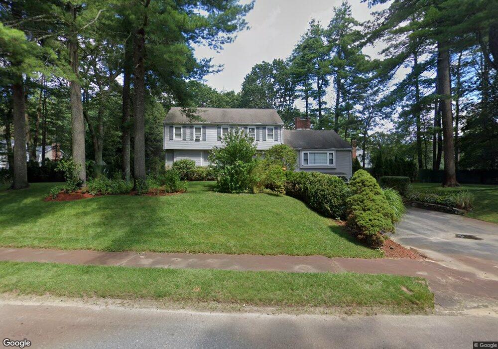
78 Meadowbrook Cir Sudbury, MA 01776
Estimated Value: $1,239,032 - $1,606,000
4
Beds
4
Baths
3,064
Sq Ft
$446/Sq Ft
Est. Value
About This Home
This home is located at 78 Meadowbrook Cir, Sudbury, MA 01776 and is currently estimated at $1,365,258, approximately $445 per square foot. 78 Meadowbrook Cir is a home located in Middlesex County with nearby schools including Peter Noyes Elementary School, Ephraim Curtis Middle School, and Lincoln-Sudbury Regional High School.
Ownership History
Date
Name
Owned For
Owner Type
Purchase Details
Closed on
Feb 28, 2000
Sold by
Sternburg Scott and Sternburg Wendy J
Bought by
Bullis Bruce D
Current Estimated Value
Home Financials for this Owner
Home Financials are based on the most recent Mortgage that was taken out on this home.
Original Mortgage
$417,200
Outstanding Balance
$135,645
Interest Rate
8.15%
Mortgage Type
Purchase Money Mortgage
Estimated Equity
$1,229,613
Purchase Details
Closed on
Sep 26, 1988
Sold by
Gabbe Fred M
Bought by
Sternburg Scott
Home Financials for this Owner
Home Financials are based on the most recent Mortgage that was taken out on this home.
Original Mortgage
$230,000
Interest Rate
10.51%
Mortgage Type
Purchase Money Mortgage
Create a Home Valuation Report for This Property
The Home Valuation Report is an in-depth analysis detailing your home's value as well as a comparison with similar homes in the area
Home Values in the Area
Average Home Value in this Area
Purchase History
| Date | Buyer | Sale Price | Title Company |
|---|---|---|---|
| Bullis Bruce D | $521,500 | -- | |
| Sternburg Scott | $380,000 | -- |
Source: Public Records
Mortgage History
| Date | Status | Borrower | Loan Amount |
|---|---|---|---|
| Open | Sternburg Scott | $417,200 | |
| Previous Owner | Sternburg Scott | $217,000 | |
| Previous Owner | Sternburg Scott | $25,000 | |
| Previous Owner | Sternburg Scott | $230,000 |
Source: Public Records
Tax History Compared to Growth
Tax History
| Year | Tax Paid | Tax Assessment Tax Assessment Total Assessment is a certain percentage of the fair market value that is determined by local assessors to be the total taxable value of land and additions on the property. | Land | Improvement |
|---|---|---|---|---|
| 2025 | $16,278 | $1,111,900 | $461,600 | $650,300 |
| 2024 | $15,690 | $1,073,900 | $448,000 | $625,900 |
| 2023 | $14,797 | $938,300 | $414,800 | $523,500 |
| 2022 | $14,528 | $804,900 | $380,400 | $424,500 |
| 2021 | $13,838 | $734,900 | $380,400 | $354,500 |
| 2020 | $13,559 | $734,900 | $380,400 | $354,500 |
| 2019 | $13,162 | $734,900 | $380,400 | $354,500 |
| 2018 | $12,965 | $723,100 | $400,400 | $322,700 |
| 2017 | $12,686 | $715,100 | $395,600 | $319,500 |
| 2016 | $12,287 | $690,300 | $380,400 | $309,900 |
| 2015 | $11,778 | $669,200 | $365,600 | $303,600 |
| 2014 | $11,756 | $652,000 | $354,800 | $297,200 |
Source: Public Records
Map
Nearby Homes
- 7 Saddle Ridge Rd
- 14 Tanbark Rd
- 89 Bridle Path
- 25 Bridle Path
- 30 Rolling Ln
- 270 Old Lancaster Rd
- 12 Hickory Rd
- 21 Summer St
- 0 Robbins Rd
- 54 Stone Rd
- 143 Peakham Rd
- 24 Goodnow Rd
- 36 Old Forge Ln
- 24 Woodland Rd
- 7 Adams Rd
- 47 Fairbank Rd
- 1011 Boston Post Rd
- 4 Elderberry Cir
- 0 Boston Post Rd
- 36 Concord Rd
- 373 Peakham Rd
- 70 Meadowbrook Cir
- 81 Meadowbrook Cir
- 73 Meadowbrook Cir
- 87 Meadowbrook Cir
- 64 Meadowbrook Cir
- 381 Peakham Rd
- 378 Peakham Rd
- 362 Peakham Rd
- 65 Meadowbrook Cir
- 384 Peakham Rd
- 358 Peakham Rd
- 15 Wilson Rd
- 357 Peakham Rd
- 58 Meadowbrook Cir
- 387 Peakham Rd
- 16 Wilson Rd
- 25 Meadowbrook Cir
- 63 Meadowbrook Cir
- 356 Peakham Rd