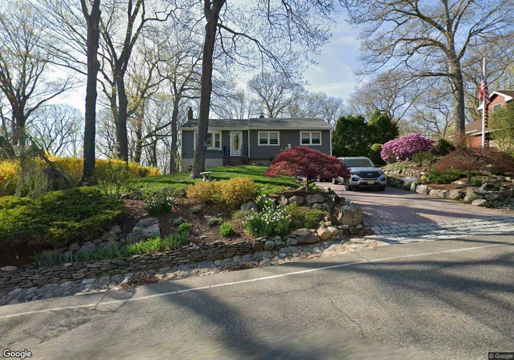
78 Mohawk Trail Ringwood, NJ 07456
Estimated Value: $634,000 - $753,000
Studio
--
Bath
1,878
Sq Ft
$360/Sq Ft
Est. Value
About This Home
This home is located at 78 Mohawk Trail, Ringwood, NJ 07456 and is currently estimated at $676,248, approximately $360 per square foot. 78 Mohawk Trail is a home located in Passaic County with nearby schools including Robert Erskine Elementary School, Eleanor G. Hewitt Intermediate School, and Martin J. Ryerson Middle School.
Ownership History
Date
Name
Owned For
Owner Type
Purchase Details
Closed on
Jul 19, 2006
Sold by
Exrx Kathleen Ray
Bought by
Emmick Joseph M and Emmick Susan W
Current Estimated Value
Home Financials for this Owner
Home Financials are based on the most recent Mortgage that was taken out on this home.
Original Mortgage
$330,000
Outstanding Balance
$24,190
Interest Rate
6.67%
Mortgage Type
New Conventional
Estimated Equity
$652,058
Purchase Details
Closed on
Aug 6, 1998
Sold by
Struble Philip C and Struble Gayle J
Bought by
Ray Peter and Ray Kathleen
Home Financials for this Owner
Home Financials are based on the most recent Mortgage that was taken out on this home.
Original Mortgage
$85,000
Interest Rate
6.86%
Create a Home Valuation Report for This Property
The Home Valuation Report is an in-depth analysis detailing your home's value as well as a comparison with similar homes in the area
Home Values in the Area
Average Home Value in this Area
Purchase History
| Date | Buyer | Sale Price | Title Company |
|---|---|---|---|
| Emmick Joseph M | $500,000 | -- | |
| Ray Peter | $280,000 | -- |
Source: Public Records
Mortgage History
| Date | Status | Borrower | Loan Amount |
|---|---|---|---|
| Open | Emmick Joseph M | $330,000 | |
| Previous Owner | Ray Peter | $85,000 |
Source: Public Records
Tax History
| Year | Tax Paid | Tax Assessment Tax Assessment Total Assessment is a certain percentage of the fair market value that is determined by local assessors to be the total taxable value of land and additions on the property. | Land | Improvement |
|---|---|---|---|---|
| 2025 | $13,392 | $321,700 | $164,400 | $157,300 |
| 2024 | $12,948 | $321,700 | $164,400 | $157,300 |
Source: Public Records
Map
Nearby Homes
- 30 Voorhis Place
- 390 Lakeview Ave
- 31 Weir Place
- 21 Tice Place
- 61 Oliver Place
- 83 Lakeview Ave
- 28 Bear Mountain Rd
- 53 Pequot Rd
- 24 The Loop
- 131 James Dr
- 312 Cupsaw Dr
- 39 Old Rd
- 68 Marcia Rd
- 69 Buena Vista Dr
- 54 Alta Vista Dr
- 16 Wildwood Terrace
- 25 Alta Vista Dr
- 4 Birch Rd
- 364 Skyline Lake Dr
- 21 Skyview Rd
- 90 Mohawk Trail
- 86 Mohawk Trail
- 94 Mohawk Trail
- 98 Mohawk Trail
- 93 Mohawk Trail
- 6 Maple Rd
- 89 Mohawk Trail
- 102 Mohawk Trail
- 6 Summit Point
- 45 Kingsley Rd
- 53 Kingsley Rd
- 95 Mohawk Trail
- 49 Kingsley Rd
- 41 Kingsley Rd
- 10 Maple Rd
- 14 Maple Rd
- 7 Overlook Terrace
- 37 Kingsley Rd
- 104 Mohawk Trail
- 1 Underhill Terrace
Your Personal Tour Guide
Ask me questions while you tour the home.