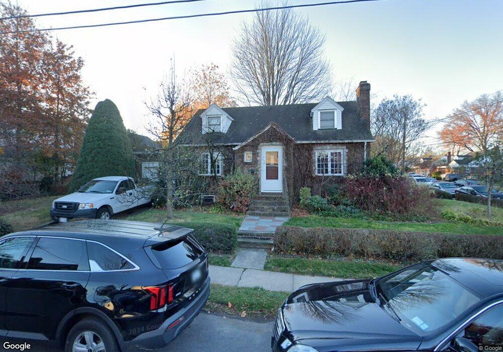
78 Morrison Ave Staten Island, NY 10310
West Brighton NeighborhoodEstimated Value: $678,265 - $832,000
--
Bed
4
Baths
1,105
Sq Ft
$707/Sq Ft
Est. Value
About This Home
This home is located at 78 Morrison Ave, Staten Island, NY 10310 and is currently estimated at $781,316, approximately $707 per square foot. 78 Morrison Ave is a home located in Richmond County with nearby schools including P.S. 45 John Tyler, Is 61 William A Morris, and Curtis High School.
Ownership History
Date
Name
Owned For
Owner Type
Purchase Details
Closed on
Dec 17, 2001
Sold by
Newgarden Robert Anthony
Bought by
Newgarden Robert Anthony and Agudelo Liliana S
Current Estimated Value
Purchase Details
Closed on
Jul 5, 2001
Sold by
Newgarden Thomas E and Teracina Jean L
Bought by
Newgarden Robert Anthony
Create a Home Valuation Report for This Property
The Home Valuation Report is an in-depth analysis detailing your home's value as well as a comparison with similar homes in the area
Home Values in the Area
Average Home Value in this Area
Purchase History
| Date | Buyer | Sale Price | Title Company |
|---|---|---|---|
| Newgarden Robert Anthony | -- | -- | |
| Newgarden Robert Anthony | -- | Commonwealth Land Title Ins |
Source: Public Records
Tax History Compared to Growth
Tax History
| Year | Tax Paid | Tax Assessment Tax Assessment Total Assessment is a certain percentage of the fair market value that is determined by local assessors to be the total taxable value of land and additions on the property. | Land | Improvement |
|---|---|---|---|---|
| 2025 | $6,192 | $40,080 | $17,437 | $22,643 |
| 2024 | $6,204 | $39,720 | $16,600 | $23,120 |
| 2023 | $6,261 | $32,227 | $15,677 | $16,550 |
| 2022 | $5,782 | $38,940 | $20,460 | $18,480 |
| 2021 | $6,047 | $41,040 | $20,460 | $20,580 |
| 2020 | $5,729 | $40,440 | $20,460 | $19,980 |
| 2019 | $5,325 | $38,280 | $20,460 | $17,820 |
| 2018 | $5,177 | $26,856 | $16,681 | $10,175 |
| 2017 | $5,134 | $26,653 | $18,624 | $8,029 |
| 2016 | $4,717 | $25,145 | $18,205 | $6,940 |
| 2015 | $3,990 | $23,722 | $15,038 | $8,684 |
| 2014 | $3,990 | $22,380 | $17,040 | $5,340 |
Source: Public Records
Map
Nearby Homes
- 100 Lawrence Ave
- 20 Baker Place
- 34 Harvest Ave
- 152 Harvest Ave
- 605 Bard Ave
- 54 City Blvd
- 432 Pelton Ave
- 244 Delafield Ave
- 145 Norma Place
- 677 Bement Ave
- 372 Sharon Ave
- 1 Whitewood Ave
- 710 Oakland Ave
- 386 N Burgher Ave
- 335 Oakland Ave
- 1 Sunset Hill Dr
- 331 Oakland Ave
- 354 Hoyt Ave
- 751 Oakland Ave
- 112 Delafield Ave