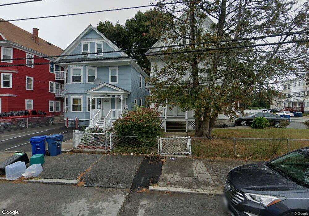
78 Osgood St Unit 80 Lawrence, MA 01843
South Common NeighborhoodEstimated Value: $716,000 - $871,000
4
Beds
2
Baths
2,502
Sq Ft
$320/Sq Ft
Est. Value
About This Home
This home is located at 78 Osgood St Unit 80, Lawrence, MA 01843 and is currently estimated at $800,000, approximately $319 per square foot. 78 Osgood St Unit 80 is a home located in Essex County with nearby schools including John Breen School, South Lawrence East Elementary School, and School For Exceptional Studies.
Ownership History
Date
Name
Owned For
Owner Type
Purchase Details
Closed on
Sep 10, 2020
Sold by
Medina Lucy
Bought by
Osgood Street Rt
Current Estimated Value
Purchase Details
Closed on
May 21, 2012
Sold by
Forest Ana E
Bought by
Medina Lucy
Purchase Details
Closed on
Jun 17, 1996
Sold by
Morris Christine E
Bought by
Forest Ana
Create a Home Valuation Report for This Property
The Home Valuation Report is an in-depth analysis detailing your home's value as well as a comparison with similar homes in the area
Home Values in the Area
Average Home Value in this Area
Purchase History
| Date | Buyer | Sale Price | Title Company |
|---|---|---|---|
| Osgood Street Rt | -- | None Available | |
| Medina Lucy | -- | -- | |
| Forest Ana | $49,500 | -- |
Source: Public Records
Mortgage History
| Date | Status | Borrower | Loan Amount |
|---|---|---|---|
| Previous Owner | Forest Ana | $78,000 |
Source: Public Records
Tax History Compared to Growth
Tax History
| Year | Tax Paid | Tax Assessment Tax Assessment Total Assessment is a certain percentage of the fair market value that is determined by local assessors to be the total taxable value of land and additions on the property. | Land | Improvement |
|---|---|---|---|---|
| 2025 | $5,741 | $652,400 | $99,700 | $552,700 |
| 2024 | $5,805 | $627,600 | $107,900 | $519,700 |
| 2023 | $5,477 | $539,100 | $100,100 | $439,000 |
| 2022 | $5,178 | $452,600 | $90,700 | $361,900 |
| 2021 | $4,879 | $397,600 | $90,700 | $306,900 |
| 2020 | $4,691 | $377,400 | $86,000 | $291,400 |
| 2019 | $4,907 | $358,700 | $71,400 | $287,300 |
| 2018 | $4,594 | $320,800 | $67,700 | $253,100 |
| 2017 | $4,091 | $266,700 | $63,900 | $202,800 |
| 2016 | $4,005 | $258,200 | $52,700 | $205,500 |
| 2015 | $3,930 | $259,900 | $52,700 | $207,200 |
Source: Public Records
Map
Nearby Homes
- 78-80 Osgood St
- 64 Salem St
- 46 Loring St
- 176-178 Bailey St
- 111 Cambridge St Unit D
- 139-141 Foster St
- 356-360 S Union St
- 91 Farnham St
- 27-29 Dorchester St
- 317 Middlesex St
- 11 Fernwood St
- 114 Beverly St
- 78 Union St Unit 80
- 127 Marblehead St Unit A
- 177 & 183 Massachusetts Ave
- 11 Patton St
- 83 Jamaica St
- 42 Durso Ave
- 68 Belmont St Unit 68
- 33 Herrick Rd
- 78-80 Osgood St Unit 1
- 74 Osgood St Unit 76
- 270 Farnham St Unit 3
- 270 Farnham St Unit 2
- 270 Farnham St Unit 1
- 270 Farnham St Unit 272
- 70 Osgood St Unit 72
- 274 Farnham St Unit 276
- 84 Osgood St Unit 86
- 82 Osgood St Unit 84
- 81 Osgood St
- 66 Osgood St Unit 68
- 66 Osgood St Unit 2
- 280 Farnham St Unit 282
- 280 Farnham St Unit 3
- 282 Farnham St
- 280 Farnham St Unit 2
- 75 Osgood St Unit 77
- 273-275 Farnham St
- 273 Farnham St Unit 275