Estimated Value: $6,840,000 - $9,790,000
7
Beds
6
Baths
8,530
Sq Ft
$991/Sq Ft
Est. Value
About This Home
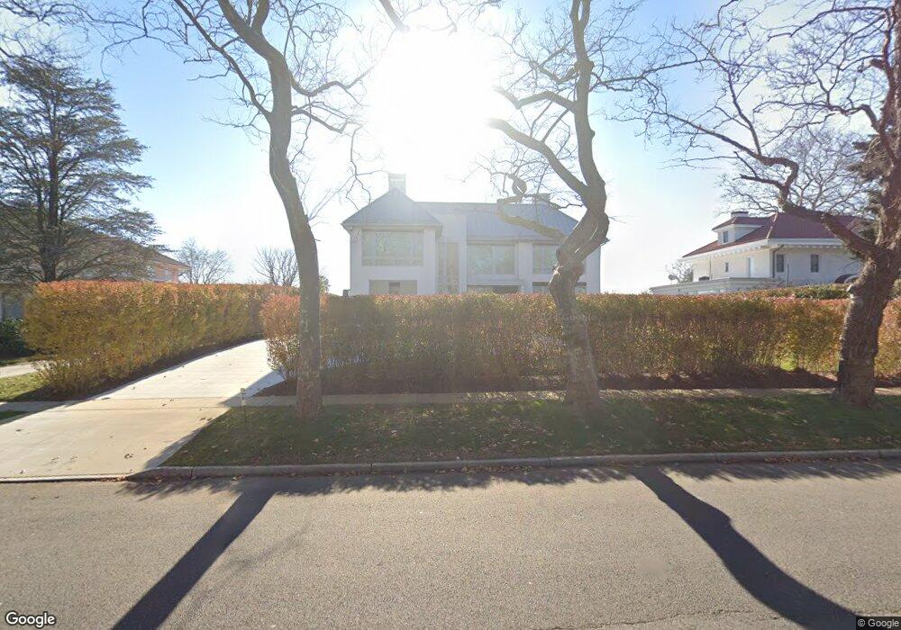
This home is located at 78 Phillips Ave, Deal, NJ 07723 and is currently estimated at $8,451,642, approximately $990 per square foot. 78 Phillips Ave is a home with nearby schools including Deal Elementary School, Hope Academy Charter School, and St. Mary of the Assumption School.
Ownership History
Date
Name
Owned For
Owner Type
Purchase Details
Closed on
Jan 3, 2011
Sold by
Ashkenazi Ezra S
Bought by
Sutton Carol and Kassin Joyce
Current Estimated Value
Purchase Details
Closed on
Sep 16, 2010
Sold by
Ashkenazi Ezra S and Ashkenazi Sharyn
Bought by
Ashkenazi Ezra S
Purchase Details
Closed on
May 11, 2007
Sold by
Segall David and Segall Maria
Bought by
Shaalo Solomon and Shaalo Marcelle
Create a Home Valuation Report for This Property
The Home Valuation Report is an in-depth analysis detailing your home's value as well as a comparison with similar homes in the area
Home Values in the Area
Average Home Value in this Area
Purchase History
| Date | Buyer | Sale Price | Title Company |
|---|---|---|---|
| Sutton Carol | -- | None Available | |
| Ashkenazi Ezra S | -- | None Available | |
| Shaalo Solomon | $5,150,000 | United General Title Ins Co |
Source: Public Records
Tax History Compared to Growth
Tax History
| Year | Tax Paid | Tax Assessment Tax Assessment Total Assessment is a certain percentage of the fair market value that is determined by local assessors to be the total taxable value of land and additions on the property. | Land | Improvement |
|---|---|---|---|---|
| 2025 | $42,547 | $11,285,200 | $5,596,800 | $5,688,400 |
| 2024 | $40,267 | $9,964,200 | $4,861,700 | $5,102,500 |
| 2023 | $40,267 | $8,753,800 | $4,271,900 | $4,481,900 |
| 2022 | $36,180 | $6,456,300 | $3,309,500 | $3,146,800 |
| 2021 | $17,544 | $5,566,100 | $2,610,000 | $2,956,100 |
| 2020 | $19,434 | $2,721,800 | $2,721,800 | $0 |
| 2019 | $17,544 | $2,474,400 | $2,474,400 | $0 |
| 2018 | $16,174 | $2,330,600 | $2,330,600 | $0 |
| 2017 | $16,244 | $2,330,600 | $2,330,600 | $0 |
| 2016 | $15,225 | $2,178,100 | $2,178,100 | $0 |
| 2015 | $15,573 | $2,178,100 | $2,178,100 | $0 |
| 2014 | $15,173 | $2,125,000 | $2,125,000 | $0 |
Source: Public Records
Map
Nearby Homes
- 116 Phillips Ave
- 10 Campbell Ct
- 160 Ocean Ave
- 103 Poplar Ave
- 328 Elberon Blvd
- 0 Overbrook Ave
- 267 Roosevelt Ave
- 1 Country Club Dr
- 271 Jerome Ave
- 24 Berger Ave
- 306 Roosevelt Ave
- 296 Garfield Ave
- 206 S Lincoln Ave
- 210 Larchwood Ave
- 1039 Norwood Ave
- 101 Lincoln Ave
- 404 Brookside Ave
- 460 Runyan Ave
- 408 Crosby Ave
- 1001 Norwood Ave Unit 5
- 74 Phillips Ave
- 84 Phillips Ave
- 115 Almyr Ave
- 68 Phillips Ave
- 69 Brighton Ave
- 81 Phillips Ave
- 77 Brighton Ave
- 55 Brighton Ave
- 77 Phillips Ave
- 85 Phillips Ave
- 106 Almyr Ave
- 75 Phillips Ave
- 62 Phillips Ave
- 69 Phillips Ave
- 91 Phillips Ave
- 53 Brighton Ave
- 85 Brighton Ave
- 93 Almyr Ave
- 98 Phillips Ave
- 61 Phillips Ave