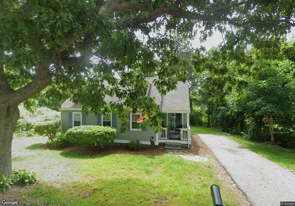
78 Puritan Rd Bourne, MA 2532
Buzzards Bay NeighborhoodEstimated Value: $460,000 - $499,000
3
Beds
1
Bath
1,152
Sq Ft
$420/Sq Ft
Est. Value
About This Home
This home is located at 78 Puritan Rd, Bourne, MA 2532 and is currently estimated at $483,420, approximately $419 per square foot. 78 Puritan Rd is a home located in Barnstable County with nearby schools including Bourne High School and St Margaret Regional School.
Ownership History
Date
Name
Owned For
Owner Type
Purchase Details
Closed on
Feb 18, 2025
Sold by
Giery Michael
Bought by
Hanratty Patricia and Bancroft Cheryl L
Current Estimated Value
Home Financials for this Owner
Home Financials are based on the most recent Mortgage that was taken out on this home.
Original Mortgage
$371,200
Outstanding Balance
$368,348
Interest Rate
6.91%
Mortgage Type
Purchase Money Mortgage
Estimated Equity
$115,073
Purchase Details
Closed on
Jan 30, 2013
Sold by
Pacheco Wayne
Bought by
Giery Michael
Purchase Details
Closed on
May 18, 2012
Sold by
Fnma
Bought by
Pacheco Wayne
Purchase Details
Closed on
Jul 9, 2010
Sold by
Quigley Ann and Fnma
Bought by
Federal National Mortgage Association
Purchase Details
Closed on
Aug 30, 1999
Sold by
Sumner Ann L
Bought by
Fleming Jason and Quigley Ann
Home Financials for this Owner
Home Financials are based on the most recent Mortgage that was taken out on this home.
Original Mortgage
$113,900
Interest Rate
7.53%
Mortgage Type
Purchase Money Mortgage
Purchase Details
Closed on
Nov 19, 1998
Sold by
Gilpin William J and Grant David A
Bought by
Sumner Ann L
Home Financials for this Owner
Home Financials are based on the most recent Mortgage that was taken out on this home.
Original Mortgage
$84,400
Interest Rate
6.49%
Mortgage Type
Purchase Money Mortgage
Purchase Details
Closed on
Dec 5, 1996
Sold by
Sherman Frederick C
Bought by
Gilpin William J and Grant David A
Purchase Details
Closed on
Jun 2, 1995
Sold by
Favor Richard
Bought by
Sherman Frederick C
Purchase Details
Closed on
Oct 7, 1994
Sold by
Browne Fred C
Bought by
Favor Richard
Purchase Details
Closed on
Sep 9, 1994
Sold by
Snyder Eric M E and Estill Wm C
Bought by
Baybank
Create a Home Valuation Report for This Property
The Home Valuation Report is an in-depth analysis detailing your home's value as well as a comparison with similar homes in the area
Home Values in the Area
Average Home Value in this Area
Purchase History
| Date | Buyer | Sale Price | Title Company |
|---|---|---|---|
| Hanratty Patricia | $464,000 | None Available | |
| Giery Michael | $210,000 | -- | |
| Giery Michael | $210,000 | -- | |
| Giery Michael | $210,000 | -- | |
| Giery Michael | $210,000 | -- | |
| Pacheco Wayne | $125,000 | -- | |
| Pacheco Wayne | $125,000 | -- | |
| Pacheco Wayne | $125,000 | -- | |
| Pacheco Wayne | $125,000 | -- | |
| Federal National Mortgage Association | $139,000 | -- | |
| Federal National Mortgage Association | $139,000 | -- | |
| Fleming Jason | $119,900 | -- | |
| Fleming Jason | $119,900 | -- | |
| Sumner Ann L | $105,500 | -- | |
| Sumner Ann L | $105,500 | -- | |
| Gilpin William J | $89,500 | -- | |
| Gilpin William J | $89,500 | -- | |
| Gilpin William J | $89,500 | -- | |
| Sherman Frederick C | $82,500 | -- | |
| Sherman Frederick C | $82,500 | -- | |
| Favor Richard | $56,000 | -- | |
| Favor Richard | $56,000 | -- | |
| Baybank | $52,800 | -- | |
| Baybank | $52,800 | -- |
Source: Public Records
Mortgage History
| Date | Status | Borrower | Loan Amount |
|---|---|---|---|
| Open | Hanratty Patricia | $371,200 | |
| Previous Owner | Fleming Jason | $113,900 | |
| Previous Owner | Sumner Ann L | $84,400 |
Source: Public Records
Tax History
| Year | Tax Paid | Tax Assessment Tax Assessment Total Assessment is a certain percentage of the fair market value that is determined by local assessors to be the total taxable value of land and additions on the property. | Land | Improvement |
|---|---|---|---|---|
| 2025 | $3,337 | $427,300 | $184,200 | $243,100 |
| 2024 | $3,269 | $407,600 | $175,400 | $232,200 |
| 2023 | $3,178 | $360,700 | $155,200 | $205,500 |
| 2022 | $3,032 | $300,500 | $137,400 | $163,100 |
| 2021 | $2,945 | $273,400 | $125,000 | $148,400 |
| 2020 | $2,716 | $252,900 | $123,800 | $129,100 |
| 2019 | $3,144 | $245,600 | $123,800 | $121,800 |
| 2018 | $2,465 | $233,900 | $117,900 | $116,000 |
| 2017 | $2,764 | $231,700 | $116,800 | $114,900 |
| 2016 | $2,298 | $226,200 | $116,800 | $109,400 |
| 2015 | $2,012 | $199,800 | $116,800 | $83,000 |
Source: Public Records
Map
Nearby Homes
- 23 Alderberry Rd
- 0 Lewis Point Rd
- 48 Maple St
- 73 Lewis Point Rd
- 3 Wolf Rd
- 46 Holt Rd Unit A
- 40-A Lafayette Ave
- 304 Main St
- 151 - 153 Main St
- 4 Van Bummel Rd
- 9 Hideaway Rd Unit F
- 810 Head of The Bay Rd
- 38 Old Bridge Rd
- 56 Rip Van Winkle Way
- 13 Hideaway Village Unit G
- 6 Honora Ct
- 60 Sandwich Rd
- 11 Buzzards Bay Dr
- 90-92 Sandwich Rd Unit 2
- 92 Choctaw Dr