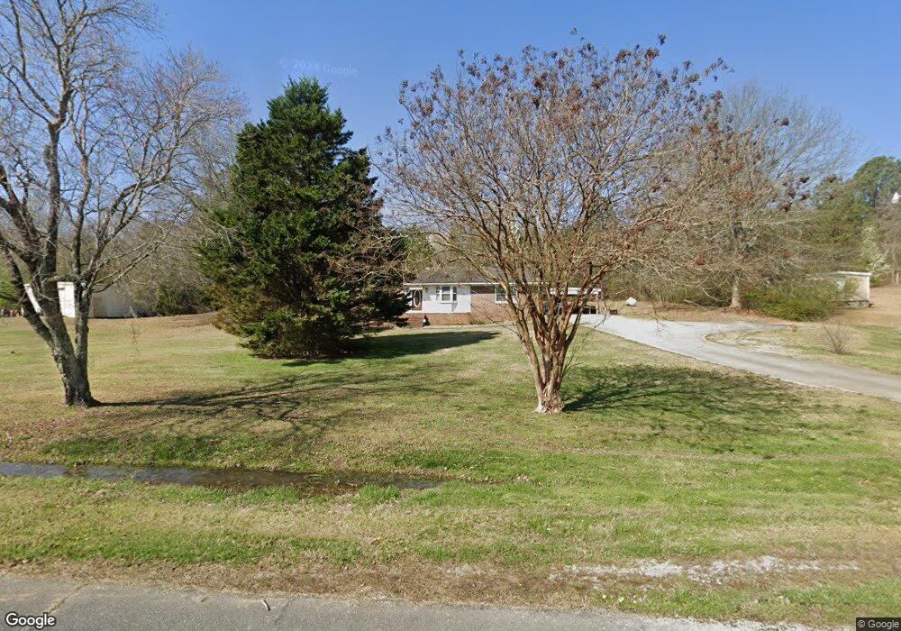
78 Reynolds Rd Cedartown, GA 30125
Estimated Value: $277,335 - $313,000
3
Beds
2
Baths
1,848
Sq Ft
$162/Sq Ft
Est. Value
About This Home
This home is located at 78 Reynolds Rd, Cedartown, GA 30125 and is currently estimated at $300,084, approximately $162 per square foot. 78 Reynolds Rd is a home located in Polk County with nearby schools including Cedar Christian School.
Ownership History
Date
Name
Owned For
Owner Type
Purchase Details
Closed on
Apr 7, 2025
Sold by
Brown Alice M
Bought by
Morgan Jeffery Todd
Current Estimated Value
Purchase Details
Closed on
Dec 2, 2010
Sold by
Brown Julius Fred
Bought by
Brown Alice M
Purchase Details
Closed on
Jul 6, 1995
Sold by
Rogers Clayton and Rogers Dorothy G
Bought by
Brown Julius Fred and Brown Alice M
Purchase Details
Closed on
Apr 23, 1975
Bought by
Rogers Clayton
Purchase Details
Closed on
May 4, 1971
Bought by
Rogers Clayton
Create a Home Valuation Report for This Property
The Home Valuation Report is an in-depth analysis detailing your home's value as well as a comparison with similar homes in the area
Home Values in the Area
Average Home Value in this Area
Purchase History
| Date | Buyer | Sale Price | Title Company |
|---|---|---|---|
| Morgan Jeffery Todd | -- | -- | |
| Brown Alice M | -- | -- | |
| Brown Alice M | -- | -- | |
| Brown Julius Fred | $60,000 | -- | |
| Rogers Clayton | -- | -- | |
| Rogers Clayton | -- | -- | |
| Rogers Clayton | -- | -- |
Source: Public Records
Tax History Compared to Growth
Tax History
| Year | Tax Paid | Tax Assessment Tax Assessment Total Assessment is a certain percentage of the fair market value that is determined by local assessors to be the total taxable value of land and additions on the property. | Land | Improvement |
|---|---|---|---|---|
| 2024 | $1,179 | $71,113 | $7,083 | $64,030 |
| 2023 | $848 | $49,103 | $7,083 | $42,020 |
| 2022 | $625 | $39,732 | $4,722 | $35,010 |
| 2021 | $633 | $39,732 | $4,722 | $35,010 |
| 2020 | $635 | $39,732 | $4,722 | $35,010 |
| 2019 | $475 | $31,032 | $4,722 | $26,310 |
| 2018 | $465 | $30,218 | $4,722 | $25,496 |
| 2017 | $455 | $30,218 | $4,722 | $25,496 |
| 2016 | $552 | $33,792 | $8,297 | $25,496 |
| 2015 | $553 | $33,792 | $8,297 | $25,496 |
| 2014 | $556 | $33,792 | $8,297 | $25,496 |
Source: Public Records
Map
Nearby Homes
- 0 Mountain Home Rd Unit 1020-B 10351940
- 0 Mountain Home Rd Unit 1020-C 10351948
- 0 Mountain Home Rd Unit 1020-A 10351930
- 323 Mountain Home Rd
- 148 Persons Rd
- 0 Old Potash Rd Unit 7675402
- 0 Old Potash Rd Unit 10636176
- 35 Harris Loop
- 820 Potash Rd
- 382 5th St
- 293 4th St
- 119 Jackson St
- 1849 Prior Station Rd Unit 77.57 ACRES
- 1849 Prior Station Rd
- 00 Cornelius Rd
- 309 Walnut St
- 605 W Girard Ave
- 2460 Hidden Creek Rd
- 422 Walnut St
- 1003 Fairview Ave
- 58 Reynolds Rd
- 44 Reynolds Rd
- 43 Reynolds Rd
- 120 Reynolds Rd
- 41 Emmet Rd
- 24 Reynolds Rd
- 97 Emmet Rd
- 85 Emmet Rd
- 19 Reynolds Rd
- 741 Prior Station Rd
- 793 Prior Station Rd
- 727 Prior Station Rd
- 102 Emmet Rd
- 104 Emmet Rd
- 175 Reynolds Rd
- 237 Reynolds Rd
- 215 Reynolds Rd
- 825 Prior Station Rd
- 241 Emmet Rd
- 651 Prior Station Rd