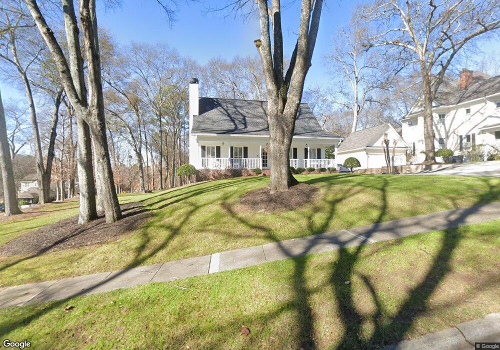
78 S Barton St Norcross, GA 30071
Estimated Value: $511,198 - $613,000
3
Beds
3
Baths
2,152
Sq Ft
$259/Sq Ft
Est. Value
About This Home
This home is located at 78 S Barton St, Norcross, GA 30071 and is currently estimated at $558,300, approximately $259 per square foot. 78 S Barton St is a home located in Gwinnett County with nearby schools including Norcross Elementary School, Summerour Middle School, and Paul Duke STEM High School.
Ownership History
Date
Name
Owned For
Owner Type
Purchase Details
Closed on
Feb 28, 1997
Sold by
Mcmahan Robert E Edwina B
Bought by
Stanford Danny R Donna G
Current Estimated Value
Purchase Details
Closed on
Mar 22, 1995
Sold by
Bruce Milton J
Bought by
Mcmahan Robert E Edwina
Create a Home Valuation Report for This Property
The Home Valuation Report is an in-depth analysis detailing your home's value as well as a comparison with similar homes in the area
Home Values in the Area
Average Home Value in this Area
Purchase History
| Date | Buyer | Sale Price | Title Company |
|---|---|---|---|
| Stanford Danny R Donna G | $173,000 | -- | |
| Mcmahan Robert E Edwina | $133,500 | -- |
Source: Public Records
Mortgage History
| Date | Status | Borrower | Loan Amount |
|---|---|---|---|
| Closed | Mcmahan Robert E Edwina | $0 |
Source: Public Records
Tax History
| Year | Tax Paid | Tax Assessment Tax Assessment Total Assessment is a certain percentage of the fair market value that is determined by local assessors to be the total taxable value of land and additions on the property. | Land | Improvement |
|---|---|---|---|---|
| 2025 | $4,296 | $190,600 | $50,000 | $140,600 |
| 2024 | $3,208 | $190,600 | $50,000 | $140,600 |
| 2023 | $3,208 | $130,400 | $26,720 | $103,680 |
| 2022 | $3,221 | $130,400 | $26,720 | $103,680 |
| 2021 | $3,499 | $163,840 | $26,720 | $137,120 |
| 2020 | $4,065 | $163,840 | $26,720 | $137,120 |
| 2019 | $3,838 | $109,600 | $24,000 | $85,600 |
| 2018 | $2,904 | $109,600 | $24,000 | $85,600 |
| 2016 | $3,280 | $126,520 | $24,000 | $102,520 |
| 2015 | $2,912 | $79,320 | $20,000 | $59,320 |
| 2014 | -- | $79,320 | $20,000 | $59,320 |
Source: Public Records
Map
Nearby Homes
- 479 Holcomb Bridge Rd
- 2575 Morehead St
- 76 Jones St
- 519 Holcomb Bridge Rd
- 6065 Cushing Cir
- 551 Sunset Dr
- 231 Sunset Hills Dr
- 186 Wingo St
- 204 Wingo St
- 5969 Kenn Manor Way
- 435 Webb Dr
- 453 Hunter St
- 695 Holcomb Bridge Rd
- 438 Langford Dr
- 6070 Georgetown Park Dr
- 5596 Buford Hwy
- 782 Holcomb Bridge Rd
- 465 Langford Dr
- 505 Cochran Dr
- 112 Summer Place
- 62 S Barton St
- 196 Holcomb Bridge Rd
- 81 S Barton St
- 251 Holcomb Bridge Rd
- 211 Holcomb Bridge Rd
- 233 Holcomb Bridge Rd
- 53 S Barton St
- 34 S Barton St
- 269 Holcomb Bridge Rd
- 216 Holcomb Bridge Rd
- 189 Holcomb Bridge Rd
- 174 Holcomb Bridge Rd
- 298 Old Commons Ct
- 318 Old Commons Ct Unit 1
- 318 Old Commons Ct
- 18 S Barton St
- 197 Park Dr
- 156 Holcomb Bridge Rd
- 167 Holcomb Bridge Rd
- S S Barton St
Your Personal Tour Guide
Ask me questions while you tour the home.