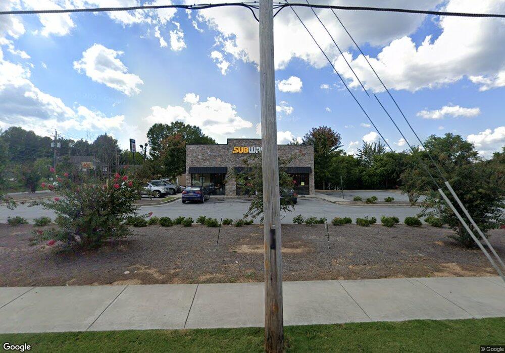
78 S Main St Cleveland, GA 30528
2
Beds
--
Bath
1,845
Sq Ft
0.55
Acres
About This Home
This home is located at 78 S Main St, Cleveland, GA 30528. 78 S Main St is a home located in White County with nearby schools including White County 9th Grade Academy, Tesnatee Gap Elementary (Old White County Intermediate), and Jack P. Nix Elementary School.
Ownership History
Date
Name
Owned For
Owner Type
Purchase Details
Closed on
May 18, 2017
Bought by
Cleveland Investment Grp Llc
Purchase Details
Closed on
Jan 31, 2017
Bought by
Hwy 441 Investment Grp Llc
Purchase Details
Closed on
Apr 24, 2015
Sold by
Brannon Marcelle S
Bought by
Banks David L
Purchase Details
Closed on
Jan 1, 2007
Sold by
Not Provided
Bought by
The Pantry Inc
Purchase Details
Closed on
Feb 1, 2006
Sold by
Not Provided
Bought by
Miles Lois Smith
Create a Home Valuation Report for This Property
The Home Valuation Report is an in-depth analysis detailing your home's value as well as a comparison with similar homes in the area
Home Values in the Area
Average Home Value in this Area
Purchase History
| Date | Buyer | Sale Price | Title Company |
|---|---|---|---|
| Cleveland Investment Grp Llc | -- | -- | |
| Hwy 441 Investment Grp Llc | $255,000 | -- | |
| Banks David L | -- | -- | |
| Brannon Marcelle S | -- | -- | |
| The Pantry Inc | -- | -- | |
| The Pantry Inc | -- | -- | |
| The Pantry Inc | $400,000 | -- | |
| Miles Lois Smith | -- | -- |
Source: Public Records
Tax History Compared to Growth
Tax History
| Year | Tax Paid | Tax Assessment Tax Assessment Total Assessment is a certain percentage of the fair market value that is determined by local assessors to be the total taxable value of land and additions on the property. | Land | Improvement |
|---|---|---|---|---|
| 2025 | $5,219 | $201,588 | $100,000 | $101,588 |
| 2024 | $5,219 | $201,588 | $100,000 | $101,588 |
| 2023 | $5,722 | $206,288 | $100,000 | $106,288 |
| 2022 | $5,938 | $206,288 | $100,000 | $106,288 |
| 2021 | $6,591 | $201,396 | $100,000 | $101,396 |
| 2020 | $7,047 | $206,776 | $100,000 | $106,776 |
| 2019 | $6,948 | $202,976 | $100,000 | $102,976 |
| 2018 | $3,423 | $100,000 | $100,000 | $0 |
| 2017 | $2,783 | $84,392 | $72,000 | $12,392 |
| 2016 | $2,783 | $84,392 | $72,000 | $12,392 |
| 2015 | $2,694 | $212,480 | $72,600 | $12,392 |
| 2014 | $2,649 | $211,940 | $0 | $0 |
Source: Public Records
Map
Nearby Homes
- 915 Holiness
- 1 E Jarrard St
- 108 E Underwood St
- 93 Colonial Dr
- LOT 2 Helipad Rd
- 230 Campbell St
- 232 Campbell St
- 0 Helen Hwy Unit 10620481
- 0 W Kytle St Unit 10623685
- 0 Townview Dr Unit 10495967
- 145 Charles Dr
- 225 E Underwood St
- 62 North Ave
- 438 LOT B Dixon Dr
- 165 Jackson Heights Unit 1
- 171 Jackson Heights Unit 2
- 171 Jackson Heights
- 177 Jackson Heights
- 183 Jackson Heights Unit 4
- 183 Jackson Heights
- 56 S Bell St
- 00 S Main St
- 0 S Main St Unit 20072809
- 0 S Main St Unit 20080686
- 0 S Main St Unit 20087908
- 0 S Main St Unit 20092762
- 0 S Main St Unit 20098522
- 109 S Main St
- 00 W Kytle St
- 0 Georgia 115 Unit 7481565
- 0 Georgia 115 Unit 7078415
- 0 Georgia 115 Unit 2876451
- E Georgia 115
- 73 W Underwood St
- S S Brooks St
- 67 W Kytle St
- 15 S Main St
- 8 Hood St
- 08 Hood St
- 0 Hood St Unit 7464512