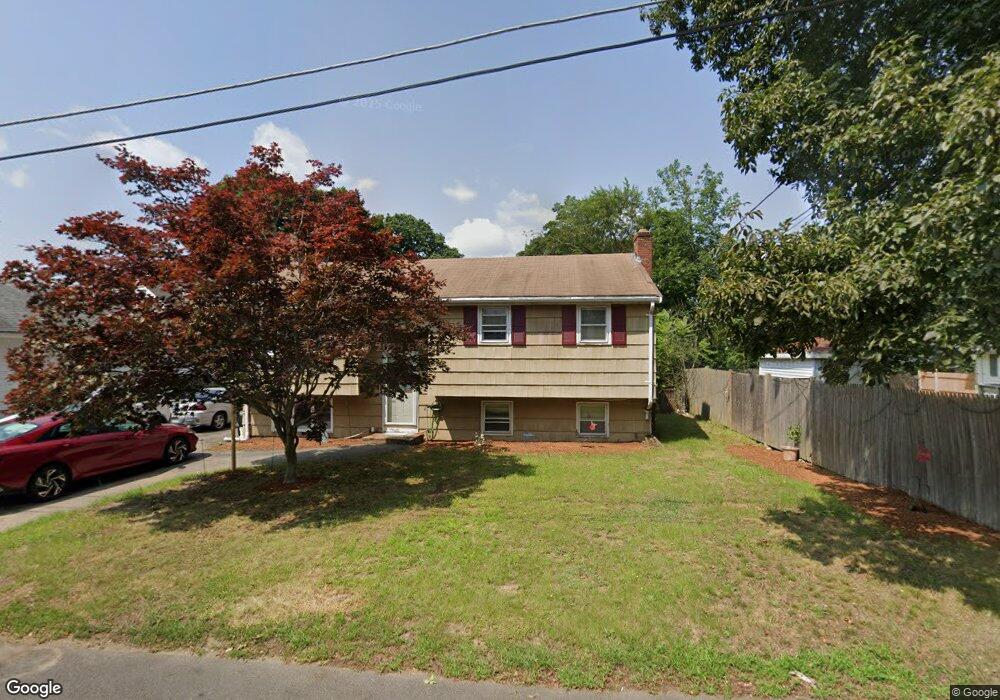
78 Sherman St Brockton, MA 02302
Estimated Value: $503,000 - $715,000
4
Beds
2
Baths
1,928
Sq Ft
$318/Sq Ft
Est. Value
About This Home
This home is located at 78 Sherman St, Brockton, MA 02302 and is currently estimated at $612,845, approximately $317 per square foot. 78 Sherman St is a home located in Plymouth County with nearby schools including Brookfield Elementary School, Downey Elementary School, and Ashfield Middle School.
Create a Home Valuation Report for This Property
The Home Valuation Report is an in-depth analysis detailing your home's value as well as a comparison with similar homes in the area
Home Values in the Area
Average Home Value in this Area
Tax History Compared to Growth
Tax History
| Year | Tax Paid | Tax Assessment Tax Assessment Total Assessment is a certain percentage of the fair market value that is determined by local assessors to be the total taxable value of land and additions on the property. | Land | Improvement |
|---|---|---|---|---|
| 2025 | $6,754 | $557,700 | $144,000 | $413,700 |
| 2024 | $6,657 | $553,800 | $144,000 | $409,800 |
| 2023 | $6,175 | $475,700 | $108,700 | $367,000 |
| 2022 | $5,978 | $427,900 | $98,700 | $329,200 |
| 2021 | $5,658 | $390,200 | $91,200 | $299,000 |
| 2020 | $4,934 | $325,700 | $87,600 | $238,100 |
| 2019 | $4,676 | $300,900 | $81,000 | $219,900 |
| 2018 | $5,162 | $321,400 | $81,000 | $240,400 |
| 2017 | $4,064 | $252,400 | $81,000 | $171,400 |
| 2016 | $3,844 | $221,400 | $77,200 | $144,200 |
| 2015 | $3,523 | $194,100 | $77,200 | $116,900 |
| 2014 | $3,564 | $196,600 | $77,200 | $119,400 |
Source: Public Records
Map
Nearby Homes