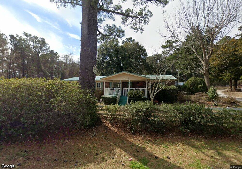
78 Sloop Point Rd Hampstead, NC 28443
Estimated Value: $294,000 - $403,000
3
Beds
2
Baths
1,720
Sq Ft
$200/Sq Ft
Est. Value
About This Home
This home is located at 78 Sloop Point Rd, Hampstead, NC 28443 and is currently estimated at $344,323, approximately $200 per square foot. 78 Sloop Point Rd is a home located in Pender County with nearby schools including Topsail Elementary School, Topsail Middle School, and Topsail High School.
Ownership History
Date
Name
Owned For
Owner Type
Purchase Details
Closed on
Feb 26, 1999
Bought by
Royal Joannah B
Current Estimated Value
Create a Home Valuation Report for This Property
The Home Valuation Report is an in-depth analysis detailing your home's value as well as a comparison with similar homes in the area
Home Values in the Area
Average Home Value in this Area
Purchase History
| Date | Buyer | Sale Price | Title Company |
|---|---|---|---|
| Royal Joannah B | -- | -- |
Source: Public Records
Tax History
| Year | Tax Paid | Tax Assessment Tax Assessment Total Assessment is a certain percentage of the fair market value that is determined by local assessors to be the total taxable value of land and additions on the property. | Land | Improvement |
|---|---|---|---|---|
| 2025 | $1,386 | $256,237 | $78,050 | $178,187 |
| 2024 | $1,386 | $128,231 | $35,235 | $92,996 |
| 2023 | $1,178 | $128,231 | $35,235 | $92,996 |
| 2022 | $1,178 | $128,231 | $35,235 | $92,996 |
| 2021 | $1,178 | $128,231 | $35,235 | $92,996 |
| 2020 | $1,141 | $123,880 | $35,235 | $88,645 |
| 2019 | $1,141 | $123,880 | $35,235 | $88,645 |
| 2018 | $985 | $100,342 | $25,500 | $74,842 |
| 2017 | $985 | $100,342 | $25,500 | $74,842 |
| 2016 | $975 | $100,342 | $25,500 | $74,842 |
| 2015 | $957 | $100,342 | $25,500 | $74,842 |
| 2014 | $758 | $100,342 | $25,500 | $74,842 |
| 2013 | -- | $100,342 | $25,500 | $74,842 |
| 2012 | -- | $100,342 | $25,500 | $74,842 |
Source: Public Records
Map
Nearby Homes
- 0 Us 17 Hwy Unit 100515012
- 233 Hampton Ct
- 102 Whimbrel Way
- 20748 US Highway 17 N
- 23 Stonegate Cir
- 205 E Loon Ct
- 00 Old Whitfield Rd
- 43 Westminster Way
- 21900 US Highway 17 N
- 116 Mansfield Ct
- 800 Wildwood Cir
- 808 Wildwood Cir
- 814 Wildwood Cir
- Lot 46 Crown Pointe Dr
- Lot 50 Crown Pointe Dr
- Lot 49 Crown Pointe Dr
- Lot 48 Crown Pointe Dr
- Lot 42 Crown Pointe Dr
- Lot 45 Crown Pointe Dr
- Lot 9 Bay Harbor Dr
- 78 Sloop Point Rd
- 21224 Us Highway 17
- 154 Sloop Point Rd
- 1 Highway 17
- 17 A Hwy
- 000 Us 17 Hwy N
- 21111 U S 17
- 21241 Us Highway 17
- 102 Topsail Lake Dr
- 21310 Us Highway 17
- 101 Sunset Ct
- 50 Blakes Chapel Rd
- 14.49ac Highway Unit 17
- 234 Sloop Point Rd
- 103 Sunset Ct
- 103 Sunset Ct
- 44 Oak Grove Dr
- 105 Topsail Lake Dr
- 106 Topsail Lake Dr
- 109 Sunset Ct
Your Personal Tour Guide
Ask me questions while you tour the home.