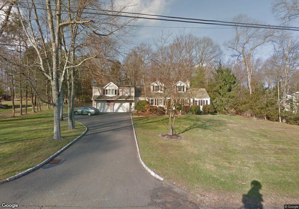
78 White Birch Rd New Canaan, CT 06840
Estimated Value: $1,837,132 - $2,158,000
5
Beds
3
Baths
3,092
Sq Ft
$652/Sq Ft
Est. Value
About This Home
This home is located at 78 White Birch Rd, New Canaan, CT 06840 and is currently estimated at $2,016,533, approximately $652 per square foot. 78 White Birch Rd is a home located in Fairfield County with nearby schools including South Elementary School, Saxe Middle School, and New Canaan High School.
Ownership History
Date
Name
Owned For
Owner Type
Purchase Details
Closed on
Jun 21, 1982
Bought by
Sandstrom John E
Current Estimated Value
Create a Home Valuation Report for This Property
The Home Valuation Report is an in-depth analysis detailing your home's value as well as a comparison with similar homes in the area
Home Values in the Area
Average Home Value in this Area
Purchase History
| Date | Buyer | Sale Price | Title Company |
|---|---|---|---|
| Sandstrom John E | $155,000 | -- |
Source: Public Records
Mortgage History
| Date | Status | Borrower | Loan Amount |
|---|---|---|---|
| Closed | Sandstrom John E | $172,000 | |
| Closed | Sandstrom John E | $187,550 | |
| Closed | Sandstrom John E | $186,350 | |
| Closed | Sandstrom John E | $100,000 |
Source: Public Records
Tax History Compared to Growth
Tax History
| Year | Tax Paid | Tax Assessment Tax Assessment Total Assessment is a certain percentage of the fair market value that is determined by local assessors to be the total taxable value of land and additions on the property. | Land | Improvement |
|---|---|---|---|---|
| 2025 | $14,745 | $883,470 | $530,250 | $353,220 |
| 2024 | $14,259 | $883,470 | $530,250 | $353,220 |
| 2023 | $12,142 | $641,060 | $431,340 | $209,720 |
| 2022 | $11,776 | $641,060 | $431,340 | $209,720 |
| 2021 | $11,642 | $641,060 | $431,340 | $209,720 |
| 2020 | $11,642 | $641,060 | $431,340 | $209,720 |
| 2019 | $11,693 | $641,060 | $431,340 | $209,720 |
| 2018 | $11,853 | $698,880 | $400,960 | $297,920 |
| 2017 | $11,650 | $698,880 | $400,960 | $297,920 |
| 2016 | $11,399 | $698,880 | $400,960 | $297,920 |
| 2015 | $11,175 | $698,880 | $400,960 | $297,920 |
| 2014 | $10,861 | $698,880 | $400,960 | $297,920 |
Source: Public Records
Map
Nearby Homes
- 469 Brookside Rd
- 109 Stephen Mather Rd
- 23 Maplewood Dr
- 58 Old Rock Ln
- 52 Putnam Rd
- 44 Putnam Rd
- 216 White Oak Shade Rd
- 865 Hollow Tree Ridge Rd
- 201 W Norwalk Rd
- 234 Marvin Ridge Rd
- 20 Marianne Rd
- 184 Marvin Ridge Rd
- 25 Gower Rd
- 7 Tommys Ln
- 354 South Ave
- 139 Jelliff Mill Rd
- 202 Weed St
- 100 Spring Water Ln
- 5 Betmarlea Rd
- 175 W Norwalk Rd
- 90 White Birch Rd
- 66 White Birch Rd
- 100 White Birch Rd
- 54 White Birch Rd
- 71 White Birch Rd
- 85 White Birch Rd
- 116 White Birch Rd
- 99 White Birch Rd
- 2 White Birch Rd
- 42 White Birch Rd
- 53 White Birch Rd
- 108 Charter Oak Dr
- 115 White Birch Rd
- 124 White Birch Rd
- 122 Charter Oak Dr
- 18 White Birch Rd
- 41 White Birch Rd
- 134 Charter Oak Dr
- 133 White Birch Rd
- 29 White Birch Rd