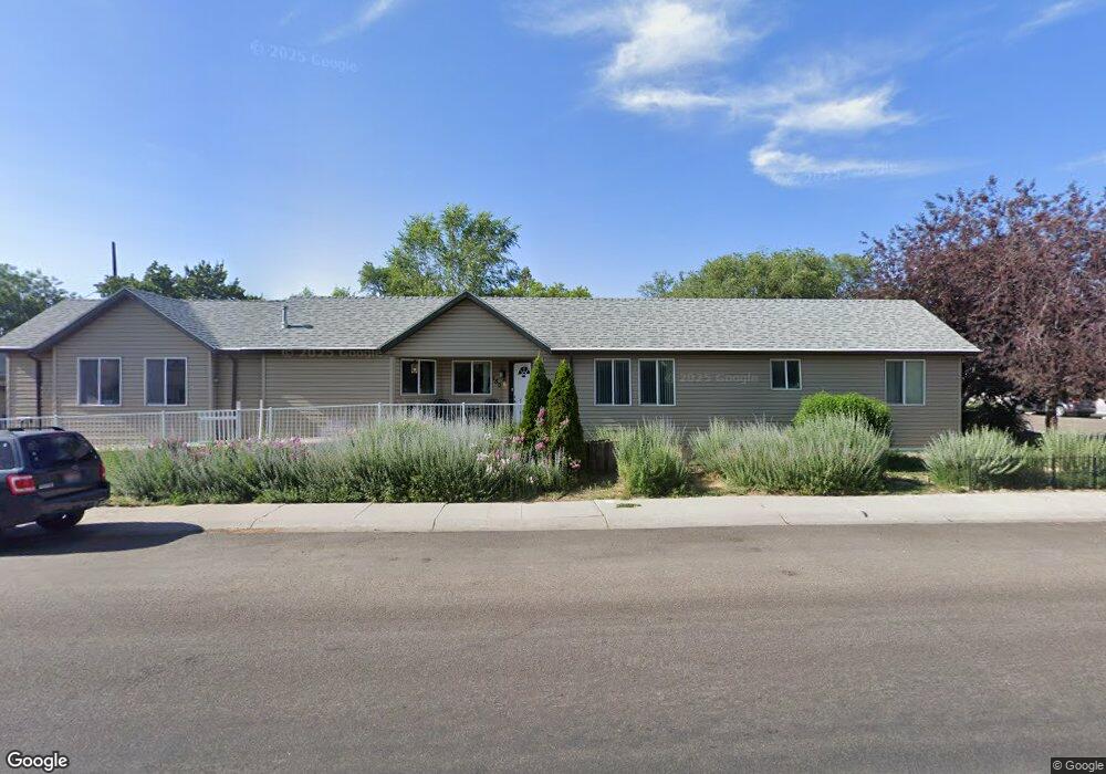
780 E Maple St Pocatello, ID 83201
Downtown Pocatello NeighborhoodEstimated Value: $244,000 - $284,000
1
Bed
4
Baths
1,177
Sq Ft
$227/Sq Ft
Est. Value
About This Home
This home is located at 780 E Maple St, Pocatello, ID 83201 and is currently estimated at $266,667, approximately $226 per square foot. 780 E Maple St is a home located in Bannock County with nearby schools including Lewis & Clark Elementary School, Kinport Academy, and Century High School.
Ownership History
Date
Name
Owned For
Owner Type
Purchase Details
Closed on
Apr 3, 2009
Sold by
Pocatello Neighborhod Housing Servicews
Bought by
Martin Tracy F
Current Estimated Value
Home Financials for this Owner
Home Financials are based on the most recent Mortgage that was taken out on this home.
Original Mortgage
$19,243
Outstanding Balance
$12,209
Interest Rate
5.17%
Mortgage Type
Unknown
Estimated Equity
$254,458
Purchase Details
Closed on
May 9, 2006
Sold by
Crook Wesley R and Crook Kira Harris
Bought by
Pocatello Neighborhood Housing Services
Create a Home Valuation Report for This Property
The Home Valuation Report is an in-depth analysis detailing your home's value as well as a comparison with similar homes in the area
Home Values in the Area
Average Home Value in this Area
Purchase History
| Date | Buyer | Sale Price | Title Company |
|---|---|---|---|
| Martin Tracy F | -- | Amerititle | |
| Pocatello Neighborhood Housing Services | -- | -- |
Source: Public Records
Mortgage History
| Date | Status | Borrower | Loan Amount |
|---|---|---|---|
| Open | Martin Tracy F | $19,243 | |
| Open | Martin Tracy F | $77,000 |
Source: Public Records
Tax History
| Year | Tax Paid | Tax Assessment Tax Assessment Total Assessment is a certain percentage of the fair market value that is determined by local assessors to be the total taxable value of land and additions on the property. | Land | Improvement |
|---|---|---|---|---|
| 2025 | $348 | $306,083 | $55,000 | $251,083 |
| 2024 | $651 | $271,988 | $55,000 | $216,988 |
| 2023 | $498 | $292,143 | $55,000 | $237,143 |
| 2022 | $498 | $213,316 | $21,746 | $191,570 |
| 2021 | $739 | $213,316 | $21,746 | $191,570 |
| 2020 | $712 | $153,691 | $18,122 | $135,569 |
| 2019 | $931 | $134,156 | $18,122 | $116,034 |
| 2018 | $852 | $109,827 | $13,132 | $96,695 |
| 2017 | $813 | $109,827 | $13,132 | $96,695 |
| 2016 | $773 | $109,827 | $13,132 | $96,695 |
| 2015 | $745 | $0 | $0 | $0 |
| 2012 | -- | $108,709 | $13,132 | $95,577 |
Source: Public Records
Map
Nearby Homes
- 238 Randolph Ave
- 855 E Walnut St
- TBD E Elm St
- Lot 19 Block 2 E Elm St
- 168 Park Ave
- 725 E Pine St
- 166 Washington Ave
- 335 Willard Ave
- 129 Wayne Ave
- 1110 E Elm St
- 436 Fairmont Ave
- 524 Euclid Ave
- 825 N 11th Ave
- 315 E Pine St
- 507 Willard Ave
- 0 Tbd W Buckskin Rd Unit 23971231
- 575 Euclid Ave
- 1028 N 9th Ave
- 946 N 9th Ave
- 215 Sorenson Ave
- 315 Randolph Ave
- 721 E Maple St
- 321 Randolph Ave
- 306 Randolph Ave
- 333 Randolph Ave
- 710 E Maple St
- 320 Park Ave
- 285 Randolph Ave
- 312 Park Ave
- 335 Randolph Ave
- 830 E Maple St
- 310 Randolph Ave
- 292 Randolph Ave
- 332 Randolph Ave
- 284 Randolph Ave
- 334 Randolph Ave
- 290 Park Ave
- 330 Park Ave
- 281 Randolph Ave
- 345 Randolph Ave
Your Personal Tour Guide
Ask me questions while you tour the home.