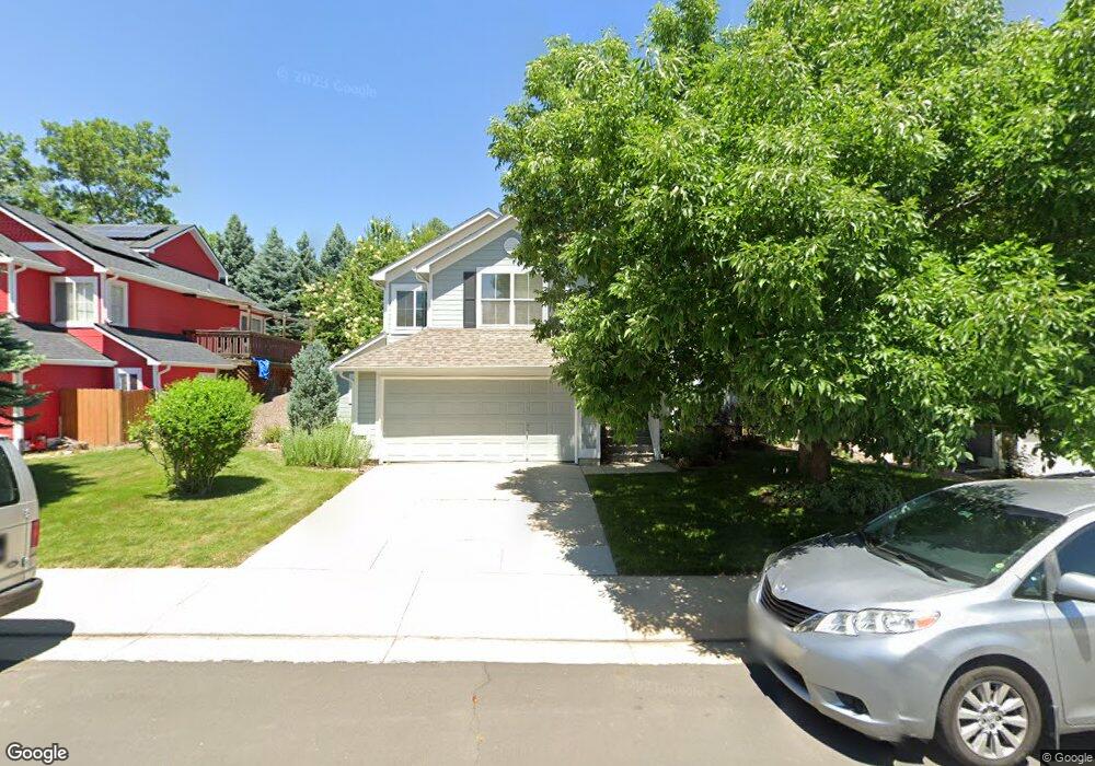
780 Nighthawk Cir Louisville, CO 80027
Estimated Value: $814,000 - $1,001,000
3
Beds
2
Baths
1,591
Sq Ft
$554/Sq Ft
Est. Value
About This Home
This home is located at 780 Nighthawk Cir, Louisville, CO 80027 and is currently estimated at $880,774, approximately $553 per square foot. 780 Nighthawk Cir is a home located in Boulder County with nearby schools including Fireside Elementary School, Monarch K-8 School, and Monarch High School.
Ownership History
Date
Name
Owned For
Owner Type
Purchase Details
Closed on
Nov 15, 1996
Sold by
Mcstain Enterprises Inc
Bought by
Keene Jane F
Current Estimated Value
Home Financials for this Owner
Home Financials are based on the most recent Mortgage that was taken out on this home.
Original Mortgage
$40,000
Outstanding Balance
$3,928
Interest Rate
8.05%
Estimated Equity
$876,846
Create a Home Valuation Report for This Property
The Home Valuation Report is an in-depth analysis detailing your home's value as well as a comparison with similar homes in the area
Home Values in the Area
Average Home Value in this Area
Purchase History
| Date | Buyer | Sale Price | Title Company |
|---|---|---|---|
| Keene Jane F | $190,364 | -- |
Source: Public Records
Mortgage History
| Date | Status | Borrower | Loan Amount |
|---|---|---|---|
| Open | Keene Jane F | $40,000 |
Source: Public Records
Tax History Compared to Growth
Tax History
| Year | Tax Paid | Tax Assessment Tax Assessment Total Assessment is a certain percentage of the fair market value that is determined by local assessors to be the total taxable value of land and additions on the property. | Land | Improvement |
|---|---|---|---|---|
| 2025 | $4,169 | $53,969 | $21,138 | $32,831 |
| 2024 | $4,169 | $53,969 | $21,138 | $32,831 |
| 2023 | $4,098 | $53,084 | $23,008 | $33,761 |
| 2022 | $3,245 | $40,671 | $17,048 | $23,623 |
| 2021 | $3,505 | $44,995 | $18,862 | $26,133 |
| 2020 | $3,011 | $39,326 | $15,945 | $23,381 |
| 2019 | $2,968 | $39,326 | $15,945 | $23,381 |
| 2018 | $2,509 | $35,280 | $7,992 | $27,288 |
| 2017 | $2,459 | $41,010 | $8,836 | $32,174 |
| 2016 | $2,164 | $32,556 | $11,940 | $20,616 |
| 2015 | $2,051 | $28,402 | $14,806 | $13,596 |
| 2014 | $1,748 | $28,402 | $14,806 | $13,596 |
Source: Public Records
Map
Nearby Homes
- 494 Owl Dr Unit 4
- 810 Trail Ridge Dr
- 823 Trail Ridge Dr
- 408 Fillmore Ct
- 593 Wildrose Way
- 118 S Tanager Ct
- 848 Trail Ridge Dr
- 812 W Mulberry St
- 592 Spruce Cir
- 900 Eldorado Ln
- 159 S Polk Ave
- 955 Arapahoe Cir
- 426 W Spruce Ln
- 641 W Dahlia St
- 1006 Honeysuckle Ln
- 958 Eldorado Ln
- 935 Eldorado Ln Unit A
- 935 Eldorado Ln
- 279 S Taft Ct Unit 53
- 291 W Sycamore Ln
- 776 Nighthawk Cir
- 784 Nighthawk Cir
- 788 Nighthawk Cir
- 772 Nighthawk Cir
- 779 Nighthawk Cir
- 767 Nighthawk Cir
- 783 Nighthawk Cir
- 768 Nighthawk Cir
- 790 Nighthawk Cir
- 787 Nighthawk Cir
- 755 Nighthawk Cir
- 764 Nighthawk Cir
- 789 Nighthawk Cir
- 792 Nighthawk Cir
- 737 Nighthawk Cir
- 733 Nighthawk Cir
- 739 Nighthawk Cir
- 731 Nighthawk Cir
- 760 Nighthawk Cir
- 791 Nighthawk Cir