Estimated Value: $127,405 - $155,000
2
Beds
1
Bath
1,240
Sq Ft
$113/Sq Ft
Est. Value
About This Home
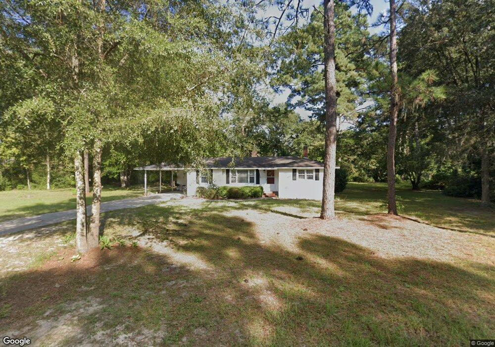
This home is located at 780 Riverside Dr, Jesup, GA 31545 and is currently estimated at $139,851, approximately $112 per square foot. 780 Riverside Dr is a home located in Wayne County with nearby schools including Jesup Elementary School, Arthur Williams Middle School, and Wayne County High School.
Ownership History
Date
Name
Owned For
Owner Type
Purchase Details
Closed on
Nov 13, 2020
Sold by
Evans Deborah
Bought by
Melton Tyler
Current Estimated Value
Home Financials for this Owner
Home Financials are based on the most recent Mortgage that was taken out on this home.
Original Mortgage
$79,797
Outstanding Balance
$70,598
Interest Rate
2.8%
Mortgage Type
New Conventional
Estimated Equity
$69,253
Purchase Details
Closed on
Sep 24, 2018
Sold by
Burch Lenell Hauss
Bought by
Evans Deborah
Purchase Details
Closed on
Aug 1, 1998
Bought by
Burch Lenell Hauss
Purchase Details
Closed on
Jan 1, 1989
Purchase Details
Closed on
Jul 1, 1983
Create a Home Valuation Report for This Property
The Home Valuation Report is an in-depth analysis detailing your home's value as well as a comparison with similar homes in the area
Home Values in the Area
Average Home Value in this Area
Purchase History
| Date | Buyer | Sale Price | Title Company |
|---|---|---|---|
| Melton Tyler | $79,000 | -- | |
| Evans Deborah | $50,000 | -- | |
| Burch Lenell Hauss | -- | -- | |
| -- | $28,000 | -- | |
| -- | -- | -- |
Source: Public Records
Mortgage History
| Date | Status | Borrower | Loan Amount |
|---|---|---|---|
| Open | Melton Tyler | $79,797 |
Source: Public Records
Tax History Compared to Growth
Tax History
| Year | Tax Paid | Tax Assessment Tax Assessment Total Assessment is a certain percentage of the fair market value that is determined by local assessors to be the total taxable value of land and additions on the property. | Land | Improvement |
|---|---|---|---|---|
| 2024 | $792 | $29,883 | $5,280 | $24,603 |
| 2023 | $804 | $26,815 | $5,280 | $21,535 |
| 2022 | $709 | $22,520 | $5,280 | $17,240 |
| 2021 | $625 | $18,548 | $5,280 | $13,268 |
| 2020 | $229 | $18,548 | $5,280 | $13,268 |
| 2019 | $243 | $18,548 | $5,280 | $13,268 |
| 2018 | $666 | $18,548 | $5,280 | $13,268 |
| 2017 | $574 | $18,548 | $5,280 | $13,268 |
| 2016 | $162 | $18,548 | $5,280 | $13,268 |
| 2014 | $161 | $18,548 | $5,280 | $13,268 |
| 2013 | -- | $18,547 | $5,280 | $13,267 |
Source: Public Records
Map
Nearby Homes
- 0 Golf Rd
- 0000 Lakeview Dr
- 00 Lakeview Dr
- 888 Altamaha Rd
- 2 Altamaha Rd
- 629 Sierra Rd
- 931 River Ridge Cir
- 0 Aspen Rd
- 149 Transit Rd
- 391 Rodman Rd
- 404 River Ridge Cir
- 106 Rodman Rd
- 290 Rodman Rd
- 1 Altamaha Rd
- 0 Shrine Club Rd Unit 163602
- 00 Dogwood Extension
- 195 Linden Dr
- 105 N Bay St
- 650 Linden Dr
- 24 Sangster Rd
- 854 Riverside Dr
- 99 Golf Rd
- 710 Riverside Dr
- 725 Riverside Dr
- 104 Golf Rd
- 690 Riverside Dr
- Lot 28 Riverside Dr NW
- 222 Beverly Ln
- 117 Sierra Rd
- 15 Street Exd
- 656 Riverside Dr
- 1069 Altamaha Rd
- 1069 Altamaha Rd Unit n
- 0 Sierra Rd Unit 7563239
- 0 Sierra Rd Unit 2685708
- 136 Golf Rd
- 616 Riverside Dr
- 633 Riverside Dr
- 73 Elizabeth Rd